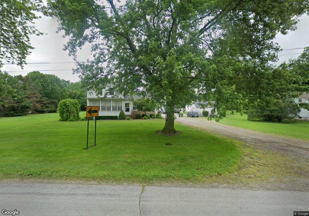
2096 Lasalle Rd Monroe, MI 48162
Estimated Value: $221,000 - $320,076
3
Beds
1
Bath
1,510
Sq Ft
$179/Sq Ft
Est. Value
About This Home
This home is located at 2096 Lasalle Rd, Monroe, MI 48162 and is currently estimated at $270,769, approximately $179 per square foot. 2096 Lasalle Rd is a home located in Monroe County with nearby schools including Monroe High School, Holy Ghost Lutheran School, and Zion Lutheran School.
Ownership History
Date
Name
Owned For
Owner Type
Purchase Details
Closed on
Feb 13, 2025
Sold by
Turner Keith Allen and Nichols-Turner Lorna L
Bought by
Nichols-Turner Lorna L and Barker Krista R
Current Estimated Value
Purchase Details
Closed on
Jul 12, 2002
Sold by
Est Christopher Cipolla
Bought by
Nichols-Turner Keith Turner Lorna
Home Financials for this Owner
Home Financials are based on the most recent Mortgage that was taken out on this home.
Original Mortgage
$65,000
Interest Rate
6.8%
Mortgage Type
New Conventional
Create a Home Valuation Report for This Property
The Home Valuation Report is an in-depth analysis detailing your home's value as well as a comparison with similar homes in the area
Home Values in the Area
Average Home Value in this Area
Purchase History
| Date | Buyer | Sale Price | Title Company |
|---|---|---|---|
| Nichols-Turner Lorna L | -- | None Listed On Document | |
| Nichols-Turner Keith Turner Lorna | $128,000 | -- |
Source: Public Records
Mortgage History
| Date | Status | Borrower | Loan Amount |
|---|---|---|---|
| Previous Owner | Nichols-Turner Keith Turner Lorna | $65,000 |
Source: Public Records
Tax History Compared to Growth
Tax History
| Year | Tax Paid | Tax Assessment Tax Assessment Total Assessment is a certain percentage of the fair market value that is determined by local assessors to be the total taxable value of land and additions on the property. | Land | Improvement |
|---|---|---|---|---|
| 2025 | $2,906 | $154,900 | $154,900 | $0 |
| 2024 | $982 | $148,400 | $0 | $0 |
| 2023 | $935 | $138,600 | $0 | $0 |
| 2022 | $2,722 | $138,600 | $0 | $0 |
| 2021 | $2,632 | $137,000 | $0 | $0 |
| 2020 | $2,553 | $98,600 | $0 | $0 |
| 2019 | $2,396 | $98,600 | $0 | $0 |
| 2018 | $3,139 | $78,400 | $0 | $0 |
| 2017 | $780 | $78,400 | $0 | $0 |
| 2016 | $3,072 | $71,600 | $0 | $0 |
| 2015 | $3,042 | $72,400 | $0 | $0 |
| 2014 | $3,081 | $72,400 | $0 | $0 |
| 2013 | -- | $71,800 | $0 | $0 |
Source: Public Records
Map
Nearby Homes
- 1969 Lasalle Rd
- 2496 Lasalle Rd
- ESSEX Plan at Forest Glen
- DUPONT Plan at Forest Glen
- 2255 Gunnison Ln
- 2250 Gunnison Ln
- 2248 Gunnison Ln
- 2243 Gunnison Ln
- 2236 Gunnison Ln
- 2231 Gunnison Ln
- 2205 Gunnison Ln
- 2198 Gunnison Ln
- 2181 Gunnison Ln
- 2025 Carson Ln
- 2397 N Telegraph Rd
- 2057 Danville Dr
- 2406 N Telegraph Rd
- 2015 Monohan Dr
- 2891 W Country Ln
- 420 Grassey Ln
- 2080 Lasalle Rd
- 2114 Lasalle Rd
- 1966 Lasalle Rd
- 1956 Lasalle Rd
- 2093 Lasalle Rd
- 1959 Lasalle Rd
- 1953 Lasalle Rd
- 2121 Lasalle Rd
- 1915 Lasalle Rd
- 1910 Lasalle Rd
- 2232 Lasalle Rd
- 1905 Lasalle Rd
- 2280 Lasalle Rd
- 2275 Lasalle Rd
- 2334 Lasalle Rd
- 2334 Lasalle Rd
- 2281 Lasalle Rd
- 2382 Lasalle Rd
- 2405 Lasalle Rd
- 2387 Lasalle Rd