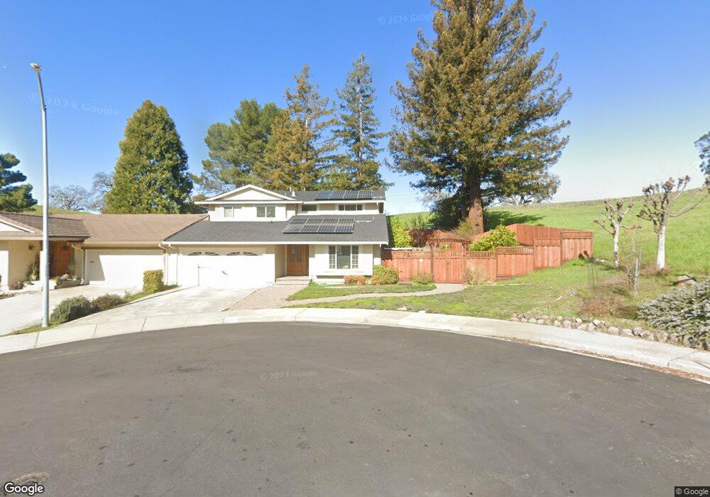
2096 Robb Rd Walnut Creek, CA 94596
Estimated Value: $976,000 - $1,224,000
3
Beds
3
Baths
2,114
Sq Ft
$543/Sq Ft
Est. Value
About This Home
This home is located at 2096 Robb Rd, Walnut Creek, CA 94596 and is currently estimated at $1,148,135, approximately $543 per square foot. 2096 Robb Rd is a home located in Contra Costa County with nearby schools including Murwood Elementary School, Walnut Creek Intermediate School, and Las Lomas High School.
Ownership History
Date
Name
Owned For
Owner Type
Purchase Details
Closed on
Jan 21, 2011
Sold by
Ramage Leslie I and Ramage Amelia
Bought by
Ramage Leslie I and Ramage Amelia
Current Estimated Value
Purchase Details
Closed on
May 5, 1998
Sold by
Crocker George G and Crocker Sandra
Bought by
Ramage Leslie I and Ramage Amelia
Home Financials for this Owner
Home Financials are based on the most recent Mortgage that was taken out on this home.
Original Mortgage
$259,200
Outstanding Balance
$50,778
Interest Rate
7.13%
Mortgage Type
Purchase Money Mortgage
Estimated Equity
$1,097,357
Create a Home Valuation Report for This Property
The Home Valuation Report is an in-depth analysis detailing your home's value as well as a comparison with similar homes in the area
Home Values in the Area
Average Home Value in this Area
Purchase History
| Date | Buyer | Sale Price | Title Company |
|---|---|---|---|
| Ramage Leslie I | -- | None Available | |
| Ramage Leslie I | $288,000 | Old Republic Title Company |
Source: Public Records
Mortgage History
| Date | Status | Borrower | Loan Amount |
|---|---|---|---|
| Open | Ramage Leslie I | $259,200 |
Source: Public Records
Tax History
| Year | Tax Paid | Tax Assessment Tax Assessment Total Assessment is a certain percentage of the fair market value that is determined by local assessors to be the total taxable value of land and additions on the property. | Land | Improvement |
|---|---|---|---|---|
| 2025 | $6,145 | $459,839 | $279,421 | $180,418 |
| 2024 | $5,907 | $450,824 | $273,943 | $176,881 |
| 2023 | $5,907 | $441,985 | $268,572 | $173,413 |
| 2022 | $5,787 | $433,319 | $263,306 | $170,013 |
| 2021 | $5,629 | $424,824 | $258,144 | $166,680 |
| 2019 | $5,490 | $412,226 | $250,489 | $161,737 |
| 2018 | $5,306 | $404,144 | $245,578 | $158,566 |
| 2017 | $5,197 | $396,220 | $240,763 | $155,457 |
| 2016 | $5,087 | $388,452 | $236,043 | $152,409 |
| 2015 | $4,965 | $382,618 | $232,498 | $150,120 |
| 2014 | $4,894 | $375,124 | $227,944 | $147,180 |
Source: Public Records
Map
Nearby Homes
- 1923 Whitecliff Way
- 1950 Whitecliff Ct
- 1109 Cardigan Dr
- 2257 Gladwin Dr
- 837 Rosewood Ct
- 44 Lariat Ct
- 321 Livorna Heights Rd
- 908 Gibson Ct
- 421 Twin Oaks Ln
- 320 Miranda Ln
- 21 Margaret Dr
- 2129 Youngs Valley Rd
- 209 Gerry Ct
- 930 Pinto Ct
- 401 Legacy Dr
- 125 Mystic Place
- 154 Rudgear Dr
- 2216 Blackwood Dr
- 218 Erselia Trail
- 137 Rudgear Dr
- 2094 Robb Rd
- 2090 Robb Rd
- 2088 Robb Rd
- 2095 Robb Rd
- 2097 Robb Rd
- 2093 Robb Rd
- 2099 Robb Rd
- 2091 Robb Rd
- 2089 Robb Rd
- 2087 Robb Rd
- 2162 Londonderry Ct
- 2176 Londonderry Ct
- 2160 Londonderry Ct
- 2178 Londonderry Ct
- 2085 Robb Rd
- 2148 Londonderry Ct
- 2146 Londonderry Ct
- 2180 Londonderry Ct
- 2132 Londonderry Ct
- 2130 Londonderry Ct
Your Personal Tour Guide
Ask me questions while you tour the home.