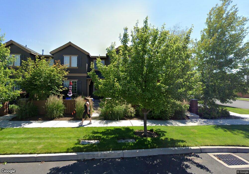
20968 High Desert Ln Unit Lot 1 Bend, OR 97701
Boyd Acres NeighborhoodEstimated Value: $480,000 - $491,000
3
Beds
3
Baths
1,450
Sq Ft
$334/Sq Ft
Est. Value
About This Home
This home is located at 20968 High Desert Ln Unit Lot 1, Bend, OR 97701 and is currently estimated at $484,513, approximately $334 per square foot. 20968 High Desert Ln Unit Lot 1 is a home located in Deschutes County with nearby schools including Lava Ridge Elementary School, Sky View Middle School, and Mountain View Senior High School.
Ownership History
Date
Name
Owned For
Owner Type
Purchase Details
Closed on
Nov 17, 2021
Sold by
Like Kimberly A
Bought by
Roe Alicia Maureen and Rudloff Dylan James
Current Estimated Value
Home Financials for this Owner
Home Financials are based on the most recent Mortgage that was taken out on this home.
Original Mortgage
$442,612
Outstanding Balance
$405,068
Interest Rate
3.05%
Mortgage Type
FHA
Estimated Equity
$79,445
Purchase Details
Closed on
Jan 19, 2010
Sold by
Pahlisch Homes Inc
Bought by
Wyman Kimberly H
Home Financials for this Owner
Home Financials are based on the most recent Mortgage that was taken out on this home.
Original Mortgage
$161,273
Interest Rate
4.78%
Mortgage Type
FHA
Create a Home Valuation Report for This Property
The Home Valuation Report is an in-depth analysis detailing your home's value as well as a comparison with similar homes in the area
Home Values in the Area
Average Home Value in this Area
Purchase History
| Date | Buyer | Sale Price | Title Company |
|---|---|---|---|
| Roe Alicia Maureen | $470,000 | First American Title | |
| Wyman Kimberly H | $173,500 | Amerititle |
Source: Public Records
Mortgage History
| Date | Status | Borrower | Loan Amount |
|---|---|---|---|
| Open | Roe Alicia Maureen | $442,612 | |
| Previous Owner | Wyman Kimberly H | $161,273 |
Source: Public Records
Tax History Compared to Growth
Tax History
| Year | Tax Paid | Tax Assessment Tax Assessment Total Assessment is a certain percentage of the fair market value that is determined by local assessors to be the total taxable value of land and additions on the property. | Land | Improvement |
|---|---|---|---|---|
| 2025 | $3,868 | $228,950 | -- | -- |
| 2024 | $3,722 | $222,290 | -- | -- |
| 2023 | $3,450 | $215,820 | $0 | $0 |
| 2022 | $3,219 | $203,440 | $0 | $0 |
| 2021 | $3,224 | $197,520 | $0 | $0 |
| 2020 | $3,059 | $197,520 | $0 | $0 |
| 2019 | $2,974 | $191,770 | $0 | $0 |
| 2018 | $2,890 | $186,190 | $0 | $0 |
| 2017 | $2,805 | $180,770 | $0 | $0 |
| 2016 | $2,675 | $175,510 | $0 | $0 |
| 2015 | $2,601 | $170,400 | $0 | $0 |
| 2014 | $2,524 | $165,440 | $0 | $0 |
Source: Public Records
Map
Nearby Homes
- 20751 Boulderfield Ave
- 21072 NE High Desert Ln
- 63103 Watercress Way
- 63157 Watercress Way
- 63150 Peale St
- 63190 Carly Ln
- 20663 NE Sierra Dr
- 20939 Blue Bush Ct
- 63091 Desert Sage St
- Avery Plan at Acadia Pointe
- Jade Plan at Acadia Pointe
- Hickory Plan at Acadia Pointe
- Larwood Plan at Acadia Pointe
- Magnolia Plan at Acadia Pointe
- Leverich Plan at Acadia Pointe
- Ashland Plan at Acadia Pointe
- Cypress Plan at Acadia Pointe
- 20676 Morningstar Dr
- 63210 Carly Ln
- 63218 Carly Ln
- 20968 High Desert Ln
- 20972 High Desert Ln
- 20972 High Desert Ln Unit Lot 2
- 20976 High Desert Ln
- 20980 High Desert Ln
- 20984 High Desert Ln
- 20980 NE High Desert Ln
- 20956 High Desert Ln
- 20988 High Desert Ln
- 20806 NE Sierra Dr
- 20992 High Desert Ln
- 20984 NE High Desert Ln
- 20952 High Desert Ln
- 20802 NE Sierra Dr
- 20996 High Desert Ln
- 20948 High Desert Ln
- 20948 NE High Desert Ln