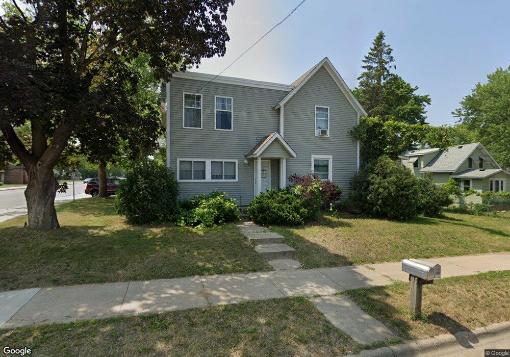
20985 Holt Ave Lakeville, MN 55044
Estimated Value: $285,000 - $346,362
5
Beds
2
Baths
2,061
Sq Ft
$159/Sq Ft
Est. Value
About This Home
This home is located at 20985 Holt Ave, Lakeville, MN 55044 and is currently estimated at $328,341, approximately $159 per square foot. 20985 Holt Ave is a home located in Dakota County with nearby schools including John F. Kennedy Elementary School, Mcguire Middle School, and Lakeville South High School.
Ownership History
Date
Name
Owned For
Owner Type
Purchase Details
Closed on
Oct 5, 2004
Sold by
Posante Thomas A and Posante Korenne K
Bought by
Koznick Jon and Panther Real Estate Llc
Current Estimated Value
Purchase Details
Closed on
Apr 30, 2002
Sold by
Zweber Michael P
Bought by
Posante Thomas A and Koristenson Koreene K
Purchase Details
Closed on
Sep 8, 1998
Sold by
Zweber Charles H and Zweber Delia E
Bought by
Zweber Michael P
Create a Home Valuation Report for This Property
The Home Valuation Report is an in-depth analysis detailing your home's value as well as a comparison with similar homes in the area
Home Values in the Area
Average Home Value in this Area
Purchase History
| Date | Buyer | Sale Price | Title Company |
|---|---|---|---|
| Koznick Jon | $210,000 | -- | |
| Posante Thomas A | $149,900 | -- | |
| Zweber Michael P | $60,000 | -- | |
| Zweber Michael P | $60,000 | -- |
Source: Public Records
Mortgage History
| Date | Status | Borrower | Loan Amount |
|---|---|---|---|
| Closed | Zweber Michael P | -- |
Source: Public Records
Tax History Compared to Growth
Tax History
| Year | Tax Paid | Tax Assessment Tax Assessment Total Assessment is a certain percentage of the fair market value that is determined by local assessors to be the total taxable value of land and additions on the property. | Land | Improvement |
|---|---|---|---|---|
| 2024 | $4,550 | $303,800 | $62,600 | $241,200 |
| 2023 | $4,550 | $351,400 | $62,400 | $289,000 |
| 2022 | $3,538 | $300,100 | $62,200 | $237,900 |
| 2021 | $3,240 | $251,300 | $54,100 | $197,200 |
| 2020 | $3,390 | $222,300 | $51,500 | $170,800 |
| 2019 | $3,298 | $221,200 | $49,000 | $172,200 |
| 2018 | $3,167 | $221,000 | $46,700 | $174,300 |
| 2017 | $2,943 | $208,100 | $44,400 | $163,700 |
| 2016 | $2,898 | $190,300 | $42,300 | $148,000 |
| 2015 | $2,644 | $178,400 | $41,100 | $137,300 |
| 2014 | -- | $169,300 | $40,000 | $129,300 |
| 2013 | -- | $157,000 | $36,600 | $120,400 |
Source: Public Records
Map
Nearby Homes
- 19820 Henning Ave
- 20685 Howland Ave W
- 21221 Hummingbird Ln
- 8210 208th St W
- 20724 Hurley Ave
- 20420 Hughes Ave W
- 21305 Hytrail Cir
- 21220 Ilavista Way
- 21316 Idaho Ave
- 20304 Hunter Ct
- 20450 Dodd Blvd
- 20771 Independence Ave
- 20508 Hartford Way
- 9508 211th St W
- 20576 Gunnison Dr
- 1-3XX Lakeville Blvd
- 20144 Holister Ln
- 20055 Heritage Dr
- 20060 Heritage Dr
- 20041 Heritage Dr
- 20971 Holt Ave
- 20970 Holyoke Ave
- 20955 Holt Ave
- 8710 210th St W
- 7344 183rd St W
- 7321 183rd St W
- 20950 Holt Ave
- 20945 Holt Ave
- 8770 210th St W
- 8685 Upper 209th St W
- 20925 Holt Ave
- 8774 210th St W
- 20924 Holt Ave
- 8645 Upper 209th St W
- 8782 210th St W
- 20915 Holt Ave
- 8610 210th St W
- 21060 Holyoke Ave
- 20916 Holt Ave
- 8625 Upper 209th St W