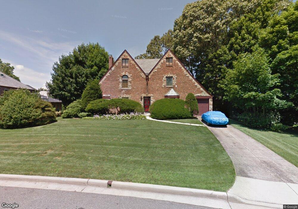
21 Blenheim Dr Manhasset, NY 11030
Estimated Value: $1,937,000 - $2,032,539
--
Bed
4
Baths
2,288
Sq Ft
$867/Sq Ft
Est. Value
About This Home
This home is located at 21 Blenheim Dr, Manhasset, NY 11030 and is currently estimated at $1,984,770, approximately $867 per square foot. 21 Blenheim Dr is a home located in Nassau County with nearby schools including Manhasset Secondary School, St Mary's Elementary School, and St. Mary's College Preparatory High School.
Ownership History
Date
Name
Owned For
Owner Type
Purchase Details
Closed on
May 27, 2004
Sold by
Kang John
Current Estimated Value
Purchase Details
Closed on
Jul 1, 1996
Sold by
Kennedy Dorothy
Bought by
Kang John
Home Financials for this Owner
Home Financials are based on the most recent Mortgage that was taken out on this home.
Original Mortgage
$440,000
Outstanding Balance
$31,076
Interest Rate
7.98%
Estimated Equity
$1,953,694
Purchase Details
Closed on
Feb 6, 1996
Sold by
Kennedy Norman and Kennedy Dorothy
Bought by
Kennedy Dorothy
Create a Home Valuation Report for This Property
The Home Valuation Report is an in-depth analysis detailing your home's value as well as a comparison with similar homes in the area
Home Values in the Area
Average Home Value in this Area
Purchase History
| Date | Buyer | Sale Price | Title Company |
|---|---|---|---|
| -- | $800,000 | -- | |
| Kang John | $550,000 | -- | |
| Kennedy Dorothy | -- | -- |
Source: Public Records
Mortgage History
| Date | Status | Borrower | Loan Amount |
|---|---|---|---|
| Open | Kang John | $440,000 |
Source: Public Records
Tax History Compared to Growth
Tax History
| Year | Tax Paid | Tax Assessment Tax Assessment Total Assessment is a certain percentage of the fair market value that is determined by local assessors to be the total taxable value of land and additions on the property. | Land | Improvement |
|---|---|---|---|---|
| 2025 | $25,505 | $1,575 | $845 | $730 |
| 2024 | $8,366 | $1,575 | $845 | $730 |
| 2023 | $24,173 | $1,575 | $845 | $730 |
| 2022 | $24,173 | $1,575 | $845 | $730 |
| 2021 | $23,882 | $1,573 | $844 | $729 |
| 2020 | $23,651 | $2,246 | $2,176 | $70 |
| 2019 | $22,247 | $2,246 | $2,176 | $70 |
| 2018 | $21,084 | $2,246 | $0 | $0 |
| 2017 | $12,287 | $2,246 | $2,176 | $70 |
| 2016 | $19,382 | $2,246 | $2,176 | $70 |
| 2015 | $6,768 | $2,246 | $2,176 | $70 |
| 2014 | $6,768 | $2,246 | $2,176 | $70 |
| 2013 | $6,438 | $2,246 | $2,176 | $70 |
Source: Public Records
Map
Nearby Homes
- 39 Bluebird Hill Ct
- 183 Mill Spring Rd
- 23 Estates Terrace N
- 20 Mill Spring Rd
- 112 Chapel Rd
- 45 Bristol Dr
- 207 Mill Spring Rd
- 43 Bristol Dr
- 10 Soundview Crest
- 117 Eagles Crescent
- 147 Darters Ln
- 21 the Glenada
- 25 The Oaks
- 1 Sequoia Cir
- 17 Evergreen Cir
- 12 Sequoia Cir
- 80 The Oaks
- 27 Sequoia Cir
- 26 Sequoia Cir
- 62 the Hemlocks