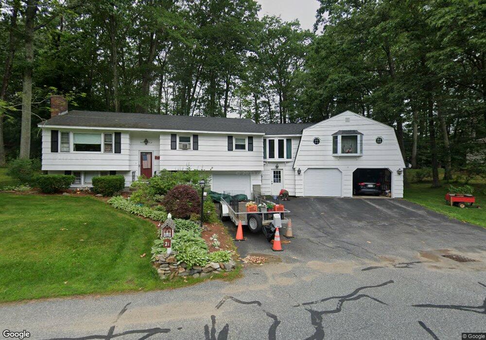
21 Braney Rd Millbury, MA 01527
Estimated Value: $546,000 - $655,000
4
Beds
2
Baths
2,189
Sq Ft
$272/Sq Ft
Est. Value
About This Home
This home is located at 21 Braney Rd, Millbury, MA 01527 and is currently estimated at $596,067, approximately $272 per square foot. 21 Braney Rd is a home located in Worcester County with nearby schools including Elmwood Street Elementary School, Raymond E. Shaw Elementary School, and Millbury Junior/Senior High School.
Ownership History
Date
Name
Owned For
Owner Type
Purchase Details
Closed on
Nov 15, 2018
Sold by
Higginbottom Kenneth W
Bought by
Higginbottom Ft and Higginbottom
Current Estimated Value
Purchase Details
Closed on
Apr 17, 2008
Sold by
Higginbottom Gail L and Higginbottom Kenneth W
Bought by
Higginbottom Kenneth W
Create a Home Valuation Report for This Property
The Home Valuation Report is an in-depth analysis detailing your home's value as well as a comparison with similar homes in the area
Home Values in the Area
Average Home Value in this Area
Purchase History
| Date | Buyer | Sale Price | Title Company |
|---|---|---|---|
| Higginbottom Ft | -- | -- | |
| Higginbottom Ft | -- | -- | |
| Higginbottom Kenneth W | -- | -- | |
| Higginbottom Kenneth W | -- | -- |
Source: Public Records
Mortgage History
| Date | Status | Borrower | Loan Amount |
|---|---|---|---|
| Previous Owner | Higginbottom Kenneth W | $50,000 | |
| Previous Owner | Higginbottom Kenneth W | $15,000 | |
| Previous Owner | Higginbottom Kenneth W | $35,000 |
Source: Public Records
Tax History Compared to Growth
Tax History
| Year | Tax Paid | Tax Assessment Tax Assessment Total Assessment is a certain percentage of the fair market value that is determined by local assessors to be the total taxable value of land and additions on the property. | Land | Improvement |
|---|---|---|---|---|
| 2025 | $5,972 | $446,000 | $117,600 | $328,400 |
| 2024 | $5,486 | $414,700 | $108,900 | $305,800 |
| 2023 | $4,969 | $343,900 | $76,500 | $267,400 |
| 2022 | $4,676 | $311,700 | $76,500 | $235,200 |
| 2021 | $4,604 | $298,400 | $76,500 | $221,900 |
| 2020 | $6,039 | $307,800 | $76,500 | $231,300 |
| 2019 | $4,482 | $282,800 | $76,100 | $206,700 |
| 2018 | $5,152 | $315,300 | $76,100 | $239,200 |
| 2017 | $4,640 | $282,400 | $79,400 | $203,000 |
| 2016 | $4,250 | $258,200 | $79,400 | $178,800 |
| 2015 | $4,224 | $256,600 | $84,400 | $172,200 |
| 2014 | $4,403 | $257,500 | $84,400 | $173,100 |
Source: Public Records
Map
Nearby Homes
- 20 Woodridge Rd
- 30 Lexington Rd
- 15 Rayburn Dr
- Lot 1 Cooper Rd
- 8 Autumn Gate Cir
- 123 Riverlin St
- 19 Rice Rd
- 64 Millbury Ave
- 4 Thomas Hill Rd
- 16 Jackie Dr
- 73 Potter Hill Rd
- 19 Cortland Way
- 81 Ariel Cir
- 17 Atwood Ave
- 90 Macarthur Dr
- 115 Ariel Cir
- 10 Leslie Ln
- 75 Potter Hill Rd
- 156 Brigham Hill Rd
- 5 Edward Dr