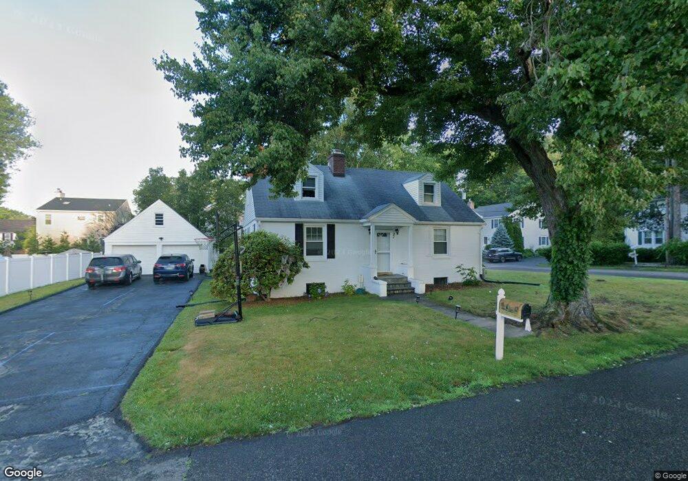
21 Charles St Darien, CT 06820
Estimated Value: $1,153,000 - $1,346,000
4
Beds
2
Baths
1,666
Sq Ft
$763/Sq Ft
Est. Value
About This Home
This home is located at 21 Charles St, Darien, CT 06820 and is currently estimated at $1,271,166, approximately $763 per square foot. 21 Charles St is a home located in Fairfield County with nearby schools including Holmes Elementary School, Middlesex Middle School, and Darien High School.
Ownership History
Date
Name
Owned For
Owner Type
Purchase Details
Closed on
Oct 14, 2020
Sold by
Keane Josephine S Est
Bought by
Shah Mahendrakumar-Shah A and Shah Neha A
Current Estimated Value
Home Financials for this Owner
Home Financials are based on the most recent Mortgage that was taken out on this home.
Original Mortgage
$592,000
Outstanding Balance
$526,552
Interest Rate
2.9%
Mortgage Type
New Conventional
Estimated Equity
$744,614
Create a Home Valuation Report for This Property
The Home Valuation Report is an in-depth analysis detailing your home's value as well as a comparison with similar homes in the area
Home Values in the Area
Average Home Value in this Area
Purchase History
| Date | Buyer | Sale Price | Title Company |
|---|---|---|---|
| Shah Mahendrakumar-Shah A | $740,000 | None Available | |
| Shah Mahendrakumar-Shah A | $740,000 | None Available |
Source: Public Records
Mortgage History
| Date | Status | Borrower | Loan Amount |
|---|---|---|---|
| Open | Shah Mahendrakumar-Shah A | $592,000 | |
| Closed | Shah Mahendrakumar-Shah A | $592,000 |
Source: Public Records
Tax History Compared to Growth
Tax History
| Year | Tax Paid | Tax Assessment Tax Assessment Total Assessment is a certain percentage of the fair market value that is determined by local assessors to be the total taxable value of land and additions on the property. | Land | Improvement |
|---|---|---|---|---|
| 2025 | $8,867 | $572,810 | $395,640 | $177,170 |
| 2024 | $8,415 | $572,810 | $395,640 | $177,170 |
| 2023 | $8,900 | $505,400 | $376,810 | $128,590 |
| 2022 | $8,708 | $505,400 | $376,810 | $128,590 |
| 2021 | $8,511 | $505,400 | $376,810 | $128,590 |
| 2020 | $8,268 | $505,400 | $376,810 | $128,590 |
| 2019 | $8,324 | $505,400 | $376,810 | $128,590 |
| 2018 | $7,253 | $451,080 | $311,150 | $139,930 |
| 2017 | $7,289 | $451,080 | $311,150 | $139,930 |
| 2016 | $7,114 | $451,080 | $311,150 | $139,930 |
| 2015 | $6,924 | $451,080 | $311,150 | $139,930 |
| 2014 | $6,771 | $451,080 | $311,150 | $139,930 |
Source: Public Records
Map
Nearby Homes
- 333 West Ave Unit 3
- 166 Hollow Tree Ridge Rd
- 77 Maple St
- 76 Deepwood Rd
- 88 Maple Tree Ave Unit G
- 47 Hollow Tree Ridge Rd
- 311 Noroton Ave
- 90 Courtland Hill St
- 69 Maple Tree Ave Unit 4
- 30 Lenox Ave
- 53 Noroton Ave
- 406 Courtland Ave Unit D
- 151 Courtland Ave Unit 6
- 151 Courtland Ave Unit 4
- 43 Crescent St Unit 11
- 34 Crescent St Unit 2D
- 16 Houston Terrace Unit 7
- 596 Glenbrook Rd Unit 36
- 45 Hecker Ave
- 130 West Ave