
Seller's Agent in 2025
Doreen Moran
RE/MAX
(410) 961-8686
8 in this area
43 Total Sales
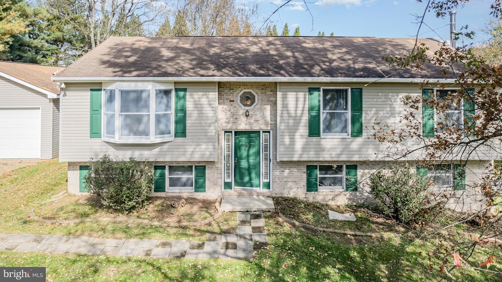
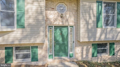
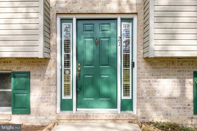
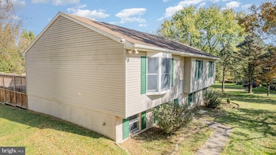
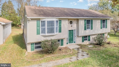
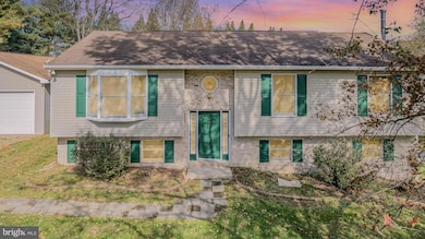
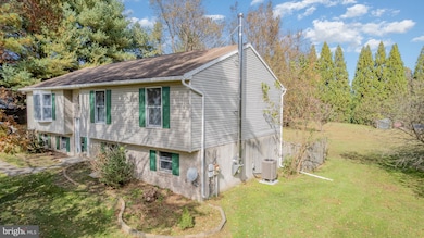
You Have Been Waiting for this one! Welcome to tranquility! This oversized bi-level home, situated on 1.66 acres in a picturesque countryside setting, offers a peaceful escape for its new owners. Featuring four bedrooms and two full bathrooms, this property boasts privacy, ample land, no HOA, and recently updated carpeting, paint, and flooring. Oh and there is a new HVAC system (2024). New Hot Water heater 2025, A substantial 24x40 garage provides generous storage and parking for up to four vehicles. The finished basement includes a wood stove, a full bath, a bedroom, and sliders that lead to the backyard. Notably, this home operates off-grid, powered by its own solar system, resulting in significant energy cost savings. Enjoy the natural beauty with multiple fruit trees, bushes, a small area suitable for goats or chickens, and a large deck off the Dining room. Prospective buyers are advised to conduct their own due diligence regarding the solar system. Appliances are as-is
Last Agent to Sell the Property
(410) 287-3629 Doreensells@gmail.com Remax Vision License #531905 Listed on: 10/09/2025
Last Buyer's Agent
(443) 512-0090 broker@americanpremierrealtymd.com American Premier Realty, LLC License #672853
| Date | Type | Sale Price | Title Company |
|---|---|---|---|
| Deed | $415,000 | Liberty Title | |
| Deed | $489,990 | Residential Title | |
| Deed | $489,990 | Residential Title | |
| Deed | -- | -- | |
| Deed | $98,000 | -- | |
| Deed | $27,000 | -- |
| Date | Status | Loan Amount | Loan Type |
|---|---|---|---|
| Open | $386,000 | New Conventional | |
| Previous Owner | $20,000 | No Value Available | |
| Closed | -- | No Value Available |
| Date | Event | Price | List to Sale | Price per Sq Ft |
|---|---|---|---|---|
| 12/12/2025 12/12/25 | Sold | $415,000 | -1.2% | $178 / Sq Ft |
| 10/31/2025 10/31/25 | Pending | -- | -- | -- |
| 10/09/2025 10/09/25 | For Sale | $420,000 | -- | $180 / Sq Ft |
| Year | Tax Paid | Tax Assessment Tax Assessment Total Assessment is a certain percentage of the fair market value that is determined by local assessors to be the total taxable value of land and additions on the property. | Land | Improvement |
|---|---|---|---|---|
| 2025 | $2,978 | $274,800 | $84,600 | $190,200 |
| 2024 | $2,513 | $261,933 | $0 | $0 |
| 2023 | $2,077 | $249,067 | $0 | $0 |
| 2022 | $2,720 | $236,200 | $84,600 | $151,600 |
| 2021 | $2,666 | $230,533 | $0 | $0 |
| 2020 | $2,654 | $224,867 | $0 | $0 |
| 2019 | $2,588 | $219,200 | $84,600 | $134,600 |
| 2018 | $2,547 | $215,600 | $0 | $0 |
| 2017 | $2,505 | $212,000 | $0 | $0 |
| 2016 | $2,358 | $208,400 | $0 | $0 |
| 2015 | $2,358 | $208,400 | $0 | $0 |
| 2014 | $2,197 | $208,400 | $0 | $0 |
Seller's Agent in 2025
Doreen Moran
RE/MAX
(410) 961-8686
8 in this area
43 Total Sales
Buyer's Agent in 2025
Leigh Kaminsky
American Premier Realty, LLC
(410) 877-4743
2 in this area
138 Total Sales
Source: Bright MLS
MLS Number: MDCC2019176
APN: 06-034691
Disclaimer: Certain information contained herein is derived from information provided by parties other than Homes.com. All information provided is deemed reliable, but is not guaranteed to be accurate and should be independently verified.
![]() The data relating to real estate for sale on this website appears in part through the BRIGHT Internet Data Exchange program, a voluntary cooperative exchange of property listing data between licensed real estate brokerage firms, and is provided by BRIGHT through a licensing agreement.
The data relating to real estate for sale on this website appears in part through the BRIGHT Internet Data Exchange program, a voluntary cooperative exchange of property listing data between licensed real estate brokerage firms, and is provided by BRIGHT through a licensing agreement.
Listing information is from various brokers who participate in the Bright MLS IDX program and not all listings may be visible on the site.
The property information being provided on or through the website is for the personal, non-commercial use of consumers and such information may not be used for any purpose other than to identify prospective properties consumers may be interested in purchasing.
Some properties which appear for sale on the website may no longer be available because they are for instance, under contract, sold or are no longer being offered for sale.
Property information displayed is deemed reliable but is not guaranteed.
Copyright 2026 Bright MLS, Inc.
Ask me questions while you tour the home.