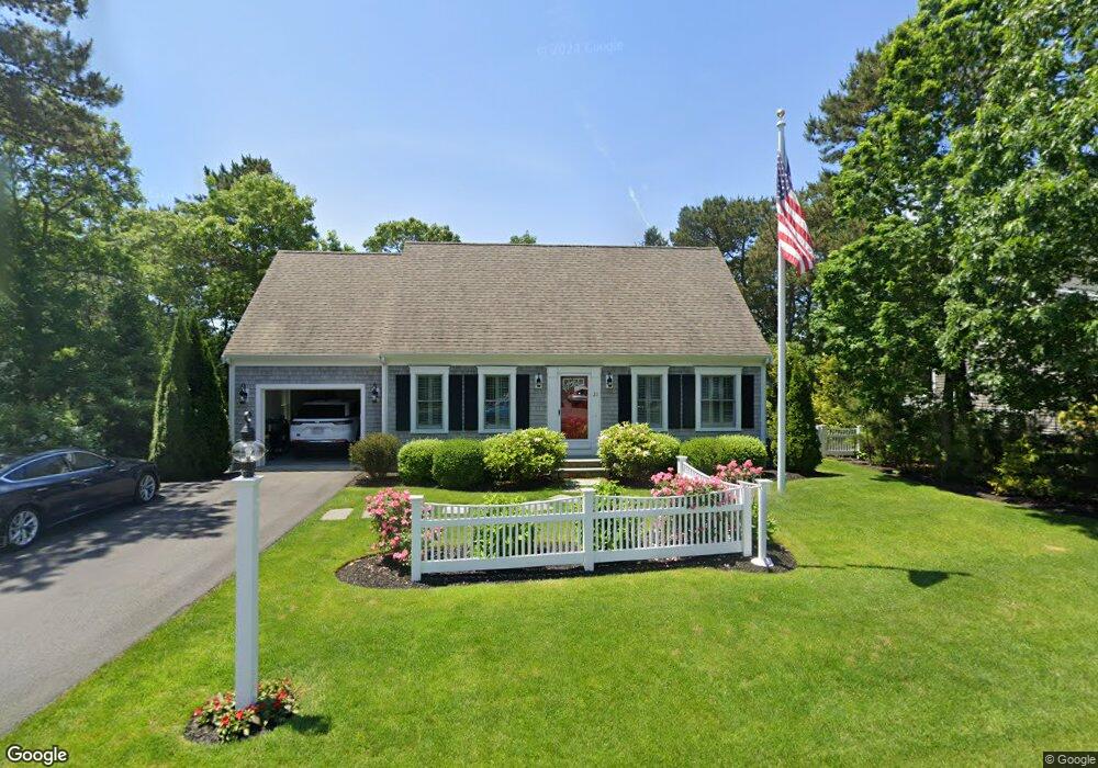
21 Dovetail Ln Cotuit, MA 2635
Cotuit NeighborhoodEstimated Value: $775,426 - $847,000
3
Beds
2
Baths
1,155
Sq Ft
$704/Sq Ft
Est. Value
About This Home
This home is located at 21 Dovetail Ln, Cotuit, MA 2635 and is currently estimated at $813,107, approximately $703 per square foot. 21 Dovetail Ln is a home located in Barnstable County with nearby schools including West Villages Elementary School, Barnstable United Elementary School, and Barnstable Intermediate School.
Ownership History
Date
Name
Owned For
Owner Type
Purchase Details
Closed on
Jul 21, 2023
Sold by
Pallotta Brian J and Pallotta Elizabeth A
Bought by
Brian J Pallotta T J and Brian Pallotta
Current Estimated Value
Create a Home Valuation Report for This Property
The Home Valuation Report is an in-depth analysis detailing your home's value as well as a comparison with similar homes in the area
Home Values in the Area
Average Home Value in this Area
Purchase History
| Date | Buyer | Sale Price | Title Company |
|---|---|---|---|
| Brian J Pallotta T J | -- | None Available |
Source: Public Records
Tax History Compared to Growth
Tax History
| Year | Tax Paid | Tax Assessment Tax Assessment Total Assessment is a certain percentage of the fair market value that is determined by local assessors to be the total taxable value of land and additions on the property. | Land | Improvement |
|---|---|---|---|---|
| 2025 | $5,521 | $661,200 | $247,400 | $413,800 |
| 2024 | $4,998 | $634,300 | $247,400 | $386,900 |
| 2023 | $4,951 | $591,500 | $244,700 | $346,800 |
| 2022 | $4,661 | $450,800 | $156,800 | $294,000 |
| 2021 | $4,636 | $419,900 | $166,600 | $253,300 |
| 2020 | $5,096 | $435,200 | $176,400 | $258,800 |
| 2019 | $4,967 | $418,100 | $186,200 | $231,900 |
| 2018 | $6,015 | $378,300 | $185,700 | $192,600 |
| 2017 | $4,417 | $374,300 | $190,800 | $183,500 |
| 2016 | $1,506 | $130,800 | $130,800 | $0 |
| 2015 | $1,432 | $124,300 | $124,300 | $0 |
Source: Public Records
Map
Nearby Homes
- 16 Spring Brook Ln
- 295 Pheasant Hill Cir
- 5 Darby Point Unit 5
- 195 Falmouth Rd Unit 10E
- 195 Falmouth Rd Unit 12F
- 195 Falmouth Rd Unit 3A
- 195 Falmouth Rd Unit 9D
- 195 Falmouth Rd Unit 7B
- 70 Cape Dr Unit 14D
- 70 Cape Dr Unit 11D
- 70 Cape Dr Unit 11D
- 4 Bishops Park
- 22 Stratford Ridge Unit 22
- 6 Mayfair Ct
- 6 Mayfair Ct Unit 6
- 220 Dunrobin Rd
- 226 Dunrobin Rd
- 30 Windsor Point
- 35 Claulise Ln
- 70 Simons Rd Unit E
- 21 Dovetail Ln
- 11 Dovetail Ln
- 31 Dovetail Ln
- 26 Dovetail Ln
- 16 Dovetail Ln
- 3 Dovetail Ln
- 3 Dovetail Ln
- 39 Dovetail Ln
- 29 Pheasant Hill Cir
- 40 Dovetail Ln
- 49 Dovetail Ln
- 32 Dovetail Ln
- 37 Pheasant Hill Cir
- 34 Dovetail Ln
- 22 Pheasant Hill Cir
- 50 Dovetail Ln
- 45 Pheasant Hill Cir
- 59 Dovetail Ln
- 59 Dovetail Ln
- 20 Eagle Ln