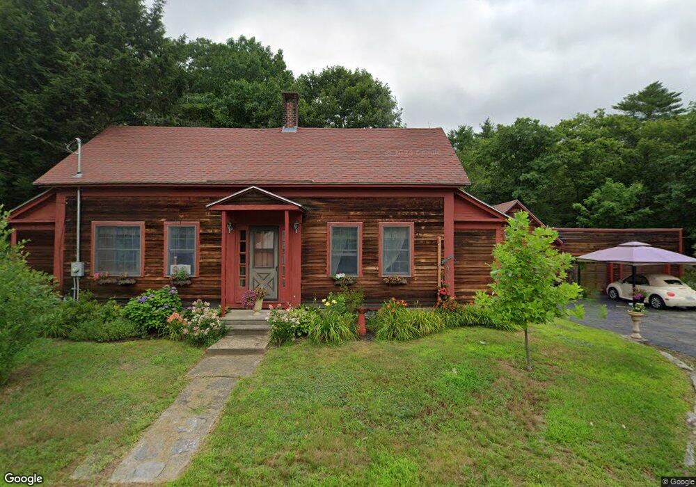
21 Drake Hill Rd Strafford, NH 03884
Estimated Value: $497,000 - $556,000
3
Beds
2
Baths
1,733
Sq Ft
$299/Sq Ft
Est. Value
About This Home
This home is located at 21 Drake Hill Rd, Strafford, NH 03884 and is currently estimated at $518,923, approximately $299 per square foot. 21 Drake Hill Rd is a home located in Strafford County with nearby schools including Strafford School and Coe-Brown Northwood Academy.
Ownership History
Date
Name
Owned For
Owner Type
Purchase Details
Closed on
Dec 31, 1998
Sold by
Vanbuskirk Arthur H and Vanbuskirk Van Buskirk
Bought by
Ryan Michael E and Ryan Nancy J
Current Estimated Value
Home Financials for this Owner
Home Financials are based on the most recent Mortgage that was taken out on this home.
Original Mortgage
$118,650
Outstanding Balance
$27,710
Interest Rate
6.84%
Estimated Equity
$491,213
Create a Home Valuation Report for This Property
The Home Valuation Report is an in-depth analysis detailing your home's value as well as a comparison with similar homes in the area
Home Values in the Area
Average Home Value in this Area
Purchase History
| Date | Buyer | Sale Price | Title Company |
|---|---|---|---|
| Ryan Michael E | $124,900 | -- |
Source: Public Records
Mortgage History
| Date | Status | Borrower | Loan Amount |
|---|---|---|---|
| Open | Ryan Michael E | $118,650 |
Source: Public Records
Tax History Compared to Growth
Tax History
| Year | Tax Paid | Tax Assessment Tax Assessment Total Assessment is a certain percentage of the fair market value that is determined by local assessors to be the total taxable value of land and additions on the property. | Land | Improvement |
|---|---|---|---|---|
| 2024 | $6,774 | $342,800 | $80,300 | $262,500 |
| 2023 | $6,386 | $342,600 | $80,300 | $262,300 |
| 2022 | $5,869 | $342,600 | $80,300 | $262,300 |
| 2021 | $6,324 | $342,600 | $80,300 | $262,300 |
| 2020 | $6,485 | $252,800 | $76,100 | $176,700 |
| 2019 | $5,919 | $252,200 | $76,100 | $176,100 |
| 2018 | $5,637 | $252,200 | $76,100 | $176,100 |
| 2016 | $5,359 | $252,200 | $76,100 | $176,100 |
| 2015 | $5,066 | $232,300 | $91,800 | $140,500 |
| 2014 | $5,380 | $232,300 | $91,800 | $140,500 |
| 2013 | $5,269 | $232,300 | $91,800 | $140,500 |
| 2012 | $5,232 | $233,800 | $91,800 | $142,000 |
Source: Public Records
Map
Nearby Homes
- 11 Drake Hill Rd
- Map 3 Lot 18-2b and 18-2c Water St
- M37 L40 Beaver Rd
- 268 Province Rd
- 133 & 137 Browns Pasture Rd
- 28-1 Range Rd
- 295 1st New Hampshire Turnpike
- 31 Green St
- 2184 Franklin Pierce Hwy
- 83 Sloper Rd
- Map 219 Lot 6-8 Ridge Rd
- 0 Sloper Rd Unit 6
- 150A 1st New Hampshire Turnpike
- 0 1st New Hampshire Turnpike Unit 5026030
- 0 1st New Hampshire Turnpike Unit 5013320
- 5 Liberty Ln
- 249 Cooper Hill Rd
- 142 Mountain Ave
- 108 Lucas Pond Rd
- 64 Kelsey Mill Rd
- 17 Drake Hill Rd
- 30 Drake Hill Rd
- 14 Drake Hill Rd
- 11 Drake Hill Rd Unit 4-41
- 31 Drake Hill Rd
- 34 Drake Hill Rd
- 537 Province Rd
- 6 Drake Hill Rd
- 6 Drake Hill Rd
- 1357 Whig Hill Rd
- 6 Drake Hill Rd Rt 202a Rd
- 527 Province Rd
- 39 Drake Hill Rd
- 553 Province Rd
- 550 Province Rd
- 1349 Old Whig Hill Rd
- 1349 Whig Hill Rd
- 555 Province Rd
- 554 Province Rd
- 51 Drake Hill Rd