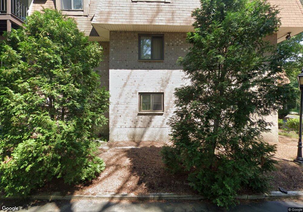
21 Erick Rd Unit 32 Mansfield, MA 02048
Estimated Value: $266,000 - $338,000
2
Beds
1
Bath
775
Sq Ft
$374/Sq Ft
Est. Value
About This Home
This home is located at 21 Erick Rd Unit 32, Mansfield, MA 02048 and is currently estimated at $289,618, approximately $373 per square foot. 21 Erick Rd Unit 32 is a home located in Bristol County with nearby schools including Jordan/Jackson Elementary School, Everett W. Robinson Elementary School, and Harold L. Qualters Middle School.
Ownership History
Date
Name
Owned For
Owner Type
Purchase Details
Closed on
Nov 30, 2007
Sold by
Frank Paul and Frank Sharon
Bought by
Kessler David A
Current Estimated Value
Home Financials for this Owner
Home Financials are based on the most recent Mortgage that was taken out on this home.
Original Mortgage
$115,116
Outstanding Balance
$73,539
Interest Rate
6.48%
Mortgage Type
Purchase Money Mortgage
Estimated Equity
$216,079
Purchase Details
Closed on
Jun 18, 1998
Sold by
Brandes William W and Brandes Lynne A
Bought by
Frank Paul and Frank Sharon
Home Financials for this Owner
Home Financials are based on the most recent Mortgage that was taken out on this home.
Original Mortgage
$40,100
Interest Rate
7.09%
Mortgage Type
Purchase Money Mortgage
Purchase Details
Closed on
Apr 23, 1987
Sold by
Allied Rlty Trust
Bought by
Brandes Wm W
Home Financials for this Owner
Home Financials are based on the most recent Mortgage that was taken out on this home.
Original Mortgage
$86,300
Interest Rate
8.97%
Mortgage Type
Purchase Money Mortgage
Create a Home Valuation Report for This Property
The Home Valuation Report is an in-depth analysis detailing your home's value as well as a comparison with similar homes in the area
Home Values in the Area
Average Home Value in this Area
Purchase History
| Date | Buyer | Sale Price | Title Company |
|---|---|---|---|
| Kessler David A | $143,895 | -- | |
| Frank Paul | $53,500 | -- | |
| Brandes Wm W | $99,800 | -- |
Source: Public Records
Mortgage History
| Date | Status | Borrower | Loan Amount |
|---|---|---|---|
| Open | Kessler David A | $115,116 | |
| Previous Owner | Brandes Wm W | $40,100 | |
| Previous Owner | Brandes Wm W | $86,300 |
Source: Public Records
Tax History Compared to Growth
Tax History
| Year | Tax Paid | Tax Assessment Tax Assessment Total Assessment is a certain percentage of the fair market value that is determined by local assessors to be the total taxable value of land and additions on the property. | Land | Improvement |
|---|---|---|---|---|
| 2025 | $3,152 | $239,300 | $0 | $239,300 |
| 2024 | $2,491 | $184,500 | $0 | $184,500 |
| 2023 | $2,287 | $162,300 | $0 | $162,300 |
| 2022 | $2,370 | $156,200 | $0 | $156,200 |
| 2021 | $2,161 | $140,700 | $0 | $140,700 |
| 2020 | $2,060 | $134,100 | $0 | $134,100 |
| 2019 | $1,881 | $123,600 | $0 | $123,600 |
| 2018 | $1,859 | $119,400 | $0 | $119,400 |
| 2017 | $1,640 | $109,200 | $0 | $109,200 |
| 2016 | $1,496 | $97,100 | $0 | $97,100 |
| 2015 | $1,593 | $102,800 | $0 | $102,800 |
Source: Public Records
Map
Nearby Homes
- 4 Shadybrook Ln
- 46 Kerry Dr
- 3 Cushing Ln
- 631 East St Unit H102
- 631 East St Unit B102
- 631 East St Unit E101
- 24 Corbane Dr
- 96 Kevins Way
- 55-57 Pine Needle Ln
- 25 Winter St
- 5 Ian Keats Dr
- 3 Coach Rd
- 20 Coach Rd
- 34 Kevins Way
- 43 Kathleen Grant Rd
- 29 Owl Ridge Rd
- 23 Estelle Marsan Dr
- 157 Highland St
- 1355-1357 East St
- 1360 East St
- 21 Erick Rd Unit 35
- 21 Erick Rd Unit 34
- 21 Erick Rd Unit 33
- 21 Erick Rd Unit 31
- 21 Erick Rd Unit 30
- 21 Erick Rd Unit 29
- 21 Erick Rd Unit 28
- 21 Erick Rd Unit 27
- 21 Erick Rd Unit 26
- 21 Erick Rd Unit 25
- 21 Erick Rd Unit 24
- 21 Erick Rd Unit 23
- 21 Erick Rd Unit 22
- 21 Erick Rd
- 21 Erick Rd Unit 20
- 21 Erick Rd Unit 19
- 21 Erick Rd Unit 18
- 21 Erick Rd Unit 15
- 21 Erick Rd Unit 14
- 21 Erick Rd Unit 12