S
Seller's Agent in 2025
Sestito Group
William Raveis R.E. & Home Services
(781) 383-0759
35 in this area
65 Total Sales
Estimated Value: $1,069,985 - $1,183,000
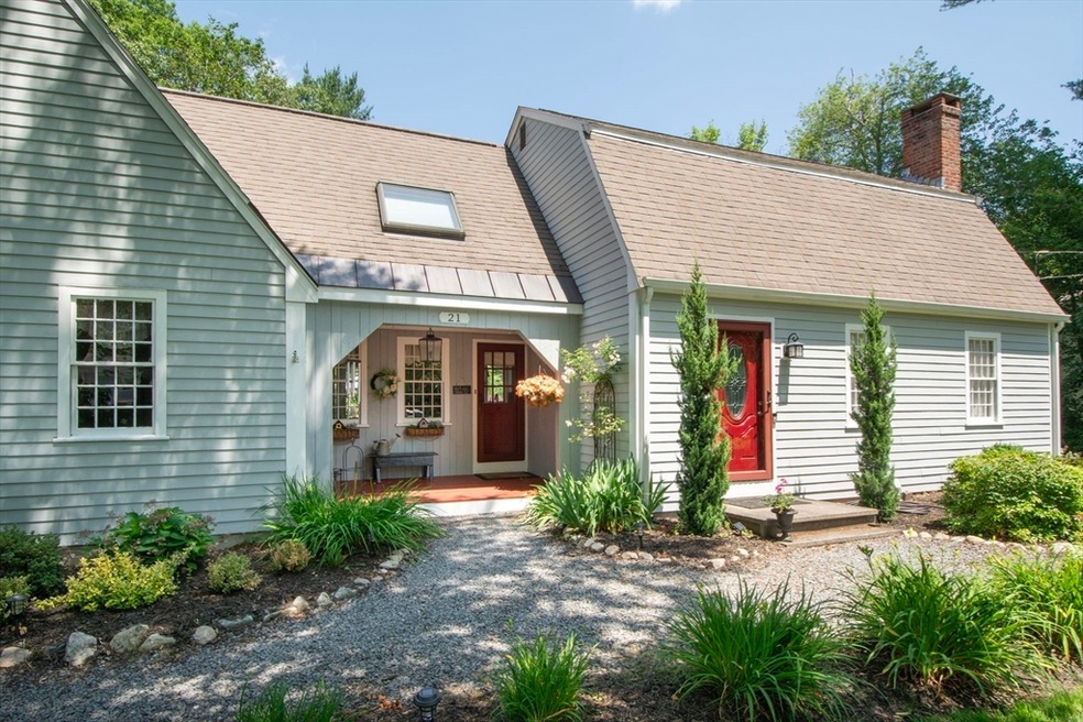
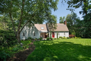
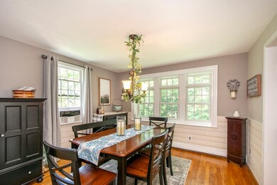
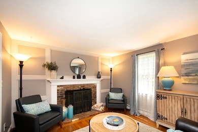
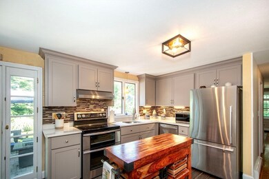
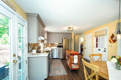
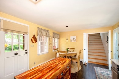
Tucked into a quiet cul-de-sac near Aaron River Reservoir, this charming 3-bed, 2-bath Gambrel sits on a beautifully landscaped half-acre in one of Cohasset’s most sought-after neighborhoods. A classic front porch welcomes you into the bright, eat-in kitchen with quartz counters, stainless appliances, and custom cabinetry. The well-designed layout features hardwood floors, a front living room with fireplace, dining room, and a cozy family room off the kitchen. Upstairs offers a spacious primary, two additional bedrooms, and a full bath. Enjoy a private backyard oasis with mature plantings, lush perennial gardens, and a peaceful patio. Includes a 2-car garage, generator, and ample storage. Just a short stroll to the soon-to-open Beechwood General, JJ’s Dairy Hut, ballpark, and playground. Minutes to Cohasset Village, Sandy Beach, commuter rail, and the harbor.
Last Agent to Sell the Property
William Raveis R.E. & Home Services Listed on: 06/25/2025

| Date | Buyer | Sale Price | Title Company |
|---|---|---|---|
| Rosso James J | $1,150,000 | -- | |
| Thompson Raymond J | $186,000 | -- | |
| Thompson Raymond J | $186,000 | -- |
| Date | Status | Borrower | Loan Amount |
|---|---|---|---|
| Open | Rosso James J | $920,000 | |
| Previous Owner | Thompson Raymond J | $385,100 | |
| Previous Owner | Thompson Raymond J | $45,000 |
| Date | Event | Price | List to Sale | Price per Sq Ft |
|---|---|---|---|---|
| 08/28/2025 08/28/25 | Sold | $1,150,000 | 0.0% | $545 / Sq Ft |
| 06/29/2025 06/29/25 | Pending | -- | -- | -- |
| 06/25/2025 06/25/25 | For Sale | $1,150,000 | -- | $545 / Sq Ft |
| Year | Tax Paid | Tax Assessment Tax Assessment Total Assessment is a certain percentage of the fair market value that is determined by local assessors to be the total taxable value of land and additions on the property. | Land | Improvement |
|---|---|---|---|---|
| 2025 | $8,991 | $776,400 | $446,200 | $330,200 |
| 2024 | $8,351 | $686,200 | $371,500 | $314,700 |
| 2023 | $7,931 | $672,100 | $357,400 | $314,700 |
| 2022 | $6,659 | $530,200 | $238,100 | $292,100 |
| 2021 | $6,639 | $509,100 | $238,100 | $271,000 |
| 2020 | $6,603 | $509,100 | $238,100 | $271,000 |
| 2019 | $6,567 | $509,100 | $238,100 | $271,000 |
| 2018 | $6,511 | $509,100 | $238,100 | $271,000 |
| 2017 | $6,151 | $471,000 | $226,700 | $244,300 |
| 2016 | $5,585 | $433,600 | $189,300 | $244,300 |
| 2015 | $5,511 | $433,600 | $189,300 | $244,300 |
| 2014 | $5,437 | $433,600 | $189,300 | $244,300 |
S
Seller's Agent in 2025
Sestito Group
William Raveis R.E. & Home Services
(781) 383-0759
35 in this area
65 Total Sales
Seller Co-Listing Agent in 2025
Lillian Sestito
William Raveis R.E. & Home Services
(781) 956-0070
11 in this area
19 Total Sales
Buyer's Agent in 2025
Colleen Fitzpatrick
Ray Lacouture & Associates
(617) 828-4133
1 in this area
108 Total Sales
Source: MLS Property Information Network (MLS PIN)
MLS Number: 73396718
APN: COHA-000011D-000055-000086
Disclaimer: Certain information contained herein is derived from information provided by parties other than Homes.com. All information provided is deemed reliable, but is not guaranteed to be accurate and should be independently verified.
![]() The property listing data and information, or the Images, set forth herein were provided to MLS Property Information Network, Inc. from third party sources, including sellers, lessors and public records, and were compiled by MLS Property Information Network, Inc. The property listing data and information, and the Images, are for the personal, non-commercial use of consumers having a good faith interest in purchasing or leasing listed properties of the type displayed to them and may not be used for any purpose other than to identify prospective properties which such consumers may have a good faith interest in purchasing or leasing. MLS Property Information Network, Inc. and its subscribers disclaim any and all representations and warranties as to the accuracy of the property listing data and information, or as to the accuracy of any of the Images, set forth herein.
The property listing data and information, or the Images, set forth herein were provided to MLS Property Information Network, Inc. from third party sources, including sellers, lessors and public records, and were compiled by MLS Property Information Network, Inc. The property listing data and information, and the Images, are for the personal, non-commercial use of consumers having a good faith interest in purchasing or leasing listed properties of the type displayed to them and may not be used for any purpose other than to identify prospective properties which such consumers may have a good faith interest in purchasing or leasing. MLS Property Information Network, Inc. and its subscribers disclaim any and all representations and warranties as to the accuracy of the property listing data and information, or as to the accuracy of any of the Images, set forth herein.