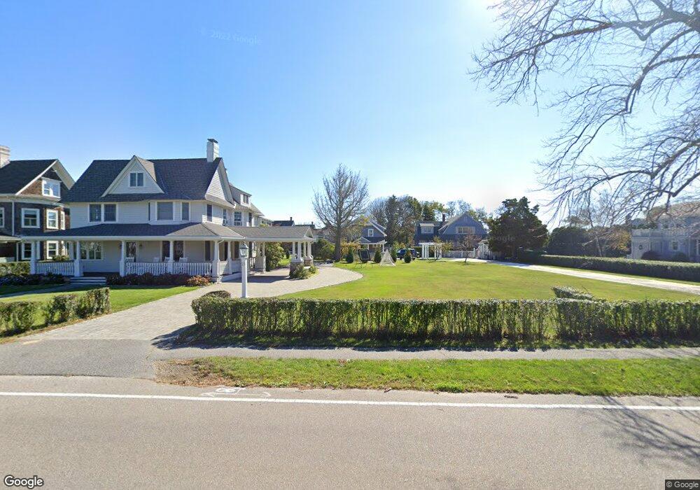
21 Gannett Rd Scituate, MA 02066
Estimated Value: $1,327,000 - $1,686,000
3
Beds
3
Baths
2,527
Sq Ft
$598/Sq Ft
Est. Value
About This Home
This home is located at 21 Gannett Rd, Scituate, MA 02066 and is currently estimated at $1,511,928, approximately $598 per square foot. 21 Gannett Rd is a home located in Plymouth County with nearby schools including Wampatuck Elementary School, Lester J. Gates Middle School, and Scituate High School.
Ownership History
Date
Name
Owned For
Owner Type
Purchase Details
Closed on
Jun 26, 1997
Sold by
Givan Thomas A and Givan Mollie S
Bought by
Tobin Edward B and Tobin Shannon L
Current Estimated Value
Purchase Details
Closed on
Oct 28, 1994
Sold by
Byrnes Rt and Frueauf Mary Lb
Bought by
Givan Thomas A and Morin Mollie S
Create a Home Valuation Report for This Property
The Home Valuation Report is an in-depth analysis detailing your home's value as well as a comparison with similar homes in the area
Home Values in the Area
Average Home Value in this Area
Purchase History
| Date | Buyer | Sale Price | Title Company |
|---|---|---|---|
| Tobin Edward B | $249,000 | -- | |
| Givan Thomas A | $205,000 | -- |
Source: Public Records
Mortgage History
| Date | Status | Borrower | Loan Amount |
|---|---|---|---|
| Open | Givan Thomas A | $573,750 | |
| Closed | Givan Thomas A | $20,000 |
Source: Public Records
Tax History Compared to Growth
Tax History
| Year | Tax Paid | Tax Assessment Tax Assessment Total Assessment is a certain percentage of the fair market value that is determined by local assessors to be the total taxable value of land and additions on the property. | Land | Improvement |
|---|---|---|---|---|
| 2025 | $11,822 | $1,183,400 | $624,500 | $558,900 |
| 2024 | $12,343 | $1,191,400 | $643,400 | $548,000 |
| 2023 | $12,638 | $1,073,100 | $584,900 | $488,200 |
| 2022 | $12,638 | $1,001,400 | $591,300 | $410,100 |
| 2021 | $11,872 | $890,600 | $563,200 | $327,400 |
| 2020 | $11,328 | $839,100 | $541,400 | $297,700 |
| 2019 | $11,154 | $811,800 | $530,800 | $281,000 |
| 2018 | $10,981 | $787,200 | $531,000 | $256,200 |
| 2017 | $10,469 | $743,000 | $486,800 | $256,200 |
| 2016 | $9,581 | $677,600 | $431,500 | $246,100 |
| 2015 | $8,115 | $619,500 | $409,300 | $210,200 |
Source: Public Records
Map
Nearby Homes
- 27 Cherry Ln
- 29 Country Club Cir
- 10 Baileys Causeway
- 6 Tilden Ave
- 7 Border St
- 24 Wood Island Rd
- 16 3 Ring Rd
- 112 Hollett St
- 26 Mordecai Lincoln Rd
- 378 Tilden Rd
- 59 Captain Peirce Rd
- 17 Bradford Ave
- 2 Windward Ln
- 70 Black Horse Ln
- 68 Black Horse Ln
- 100 Howard Gleason Rd
- 54 Woodland Rd
- 817 Country Way
- 104 Howard Gleason Rd
- 392 S Main St
- 12 Mitchell Ln
- 19 Gannett Rd
- 14 Mitchell Ln
- 14 Mitchell Ln Unit 1
- 14 Mitchell Ln Unit 14
- 17 Gannett Rd
- 25 Gannett Rd
- 18 Mitchell Ln
- 31 Gannett Rd
- 29 Gannett Rd
- 29 Gannett Rd Unit 1
- 2 Surfside Rd
- 12 Mitchell Ave
- 16 Mitchell Ave
- 20 Gannett Rd
- 18 A Mitchell Ave
- 18 Gannett Rd
- 9 Surfside Rd Unit 9
- 9 Surfside Rd
- 6 Mitchell Ave