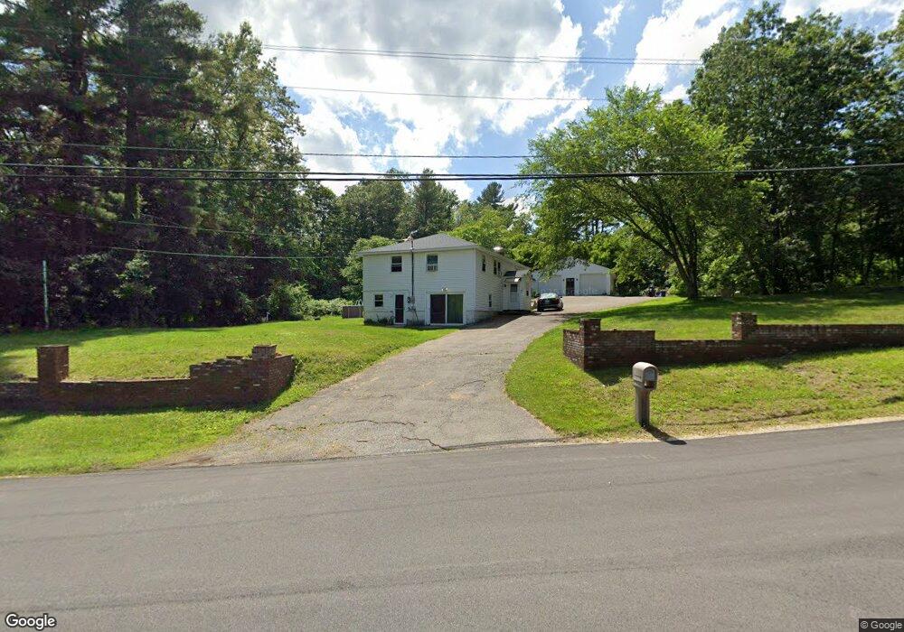
21 Garland Dr Pelham, NH 03076
Estimated Value: $647,086 - $802,000
4
Beds
2
Baths
3,052
Sq Ft
$230/Sq Ft
Est. Value
About This Home
This home is located at 21 Garland Dr, Pelham, NH 03076 and is currently estimated at $701,772, approximately $229 per square foot. 21 Garland Dr is a home located in Hillsborough County with nearby schools including Pelham Elementary School, Pelham Memorial School, and Pelham High School.
Ownership History
Date
Name
Owned For
Owner Type
Purchase Details
Closed on
May 8, 2015
Sold by
Constantino J D Sr Est
Bought by
Young Garth M and Young Lindsey
Current Estimated Value
Home Financials for this Owner
Home Financials are based on the most recent Mortgage that was taken out on this home.
Original Mortgage
$252,345
Outstanding Balance
$193,906
Interest Rate
3.69%
Mortgage Type
FHA
Estimated Equity
$507,866
Purchase Details
Closed on
Jul 22, 2005
Sold by
Woodview Dev Corp
Bought by
Cbc Contractors Llc
Create a Home Valuation Report for This Property
The Home Valuation Report is an in-depth analysis detailing your home's value as well as a comparison with similar homes in the area
Home Values in the Area
Average Home Value in this Area
Purchase History
| Date | Buyer | Sale Price | Title Company |
|---|---|---|---|
| Young Garth M | $257,000 | -- | |
| Cbc Contractors Llc | $215,000 | -- |
Source: Public Records
Mortgage History
| Date | Status | Borrower | Loan Amount |
|---|---|---|---|
| Open | Cbc Contractors Llc | $252,345 | |
| Previous Owner | Cbc Contractors Llc | $94,407 | |
| Previous Owner | Cbc Contractors Llc | $100,000 | |
| Previous Owner | Cbc Contractors Llc | $805,000 |
Source: Public Records
Tax History Compared to Growth
Tax History
| Year | Tax Paid | Tax Assessment Tax Assessment Total Assessment is a certain percentage of the fair market value that is determined by local assessors to be the total taxable value of land and additions on the property. | Land | Improvement |
|---|---|---|---|---|
| 2024 | $8,965 | $488,800 | $150,600 | $338,200 |
| 2023 | $8,018 | $440,800 | $150,600 | $290,200 |
| 2022 | $7,243 | $415,800 | $150,600 | $265,200 |
| 2021 | $6,636 | $415,800 | $150,600 | $265,200 |
| 2020 | $6,161 | $305,000 | $120,400 | $184,600 |
| 2019 | $5,917 | $305,000 | $120,400 | $184,600 |
| 2018 | $6,097 | $284,100 | $120,400 | $163,700 |
| 2017 | $6,152 | $286,800 | $120,400 | $166,400 |
| 2016 | $6,008 | $286,800 | $120,400 | $166,400 |
| 2015 | $5,978 | $257,000 | $114,300 | $142,700 |
| 2014 | $5,953 | $260,300 | $114,300 | $146,000 |
| 2013 | $5,953 | $260,300 | $114,300 | $146,000 |
Source: Public Records
Map
Nearby Homes
- 4 Melody Ln
- 2 Iris Ave
- 71 Deer Hill Cir
- 59 Thistlewood Dr Unit 47
- 34 Frontier Dr
- 50 Dutton Rd
- 67 Lincoln Ln
- 109 Meadow Creek Dr
- 99 Lincoln Ln
- 1 Currier Rd
- 2 S Shore Dr
- 19 Esther Way Unit Lot 10
- 321 Old Marsh Hill Rd
- 20 Esther Way Unit 11
- 10 Dutton Rd
- 167 Betty Ann Ln
- 7 Dadak Dr
- 6 Dadak Dr
- 121 Old Marsh Hill Rd
- 67 Foxhill Ln Unit 67