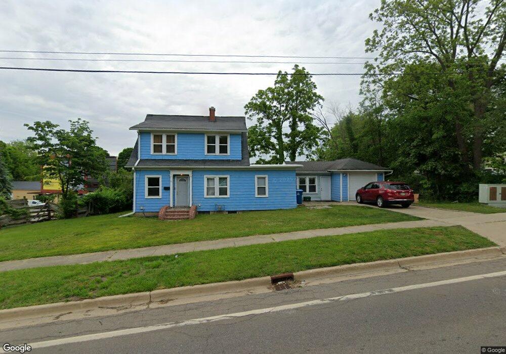
21 Goguac St E Battle Creek, MI 49015
Central Battle Creek NeighborhoodEstimated Value: $56,659 - $119,000
3
Beds
2
Baths
1,200
Sq Ft
$76/Sq Ft
Est. Value
About This Home
This home is located at 21 Goguac St E, Battle Creek, MI 49015 and is currently estimated at $90,665, approximately $75 per square foot. 21 Goguac St E is a home located in Calhoun County with nearby schools including Ann J. Kellogg School, Springfield Middle School, and Battle Creek Central High School.
Ownership History
Date
Name
Owned For
Owner Type
Purchase Details
Closed on
Oct 16, 2024
Sold by
P & H Investments Llc
Bought by
Asher Andrew
Current Estimated Value
Home Financials for this Owner
Home Financials are based on the most recent Mortgage that was taken out on this home.
Original Mortgage
$35,000
Outstanding Balance
$34,621
Interest Rate
6.2%
Mortgage Type
New Conventional
Estimated Equity
$56,044
Purchase Details
Closed on
Oct 5, 2005
Sold by
Praner David M and Praner Karen J
Bought by
P & H Investments Llc
Purchase Details
Closed on
Mar 26, 2004
Sold by
Rogers Silas
Bought by
Lasalle Bank Na and Afc Trust Series 2000-2
Purchase Details
Closed on
Mar 21, 1997
Sold by
Rogers Nadine M
Bought by
Rogers Silas
Create a Home Valuation Report for This Property
The Home Valuation Report is an in-depth analysis detailing your home's value as well as a comparison with similar homes in the area
Home Values in the Area
Average Home Value in this Area
Purchase History
| Date | Buyer | Sale Price | Title Company |
|---|---|---|---|
| Asher Andrew | $38,000 | Chicago Title | |
| P & H Investments Llc | -- | E Title Company | |
| Lasalle Bank Na | $25,563 | -- | |
| Rogers Silas | -- | -- |
Source: Public Records
Mortgage History
| Date | Status | Borrower | Loan Amount |
|---|---|---|---|
| Open | Asher Andrew | $35,000 |
Source: Public Records
Tax History Compared to Growth
Tax History
| Year | Tax Paid | Tax Assessment Tax Assessment Total Assessment is a certain percentage of the fair market value that is determined by local assessors to be the total taxable value of land and additions on the property. | Land | Improvement |
|---|---|---|---|---|
| 2025 | -- | $35,100 | $0 | $0 |
| 2024 | $786 | $29,395 | $0 | $0 |
| 2023 | $1,001 | $28,174 | $0 | $0 |
| 2022 | $711 | $21,329 | $0 | $0 |
| 2021 | $951 | $19,804 | $0 | $0 |
| 2020 | $940 | $18,261 | $0 | $0 |
| 2019 | $952 | $14,183 | $0 | $0 |
| 2018 | $952 | $14,458 | $511 | $13,947 |
| 2017 | $1,090 | $15,386 | $0 | $0 |
| 2016 | $1,129 | $17,548 | $0 | $0 |
| 2015 | $1,345 | $19,680 | $1,638 | $18,042 |
| 2014 | $1,345 | $20,937 | $1,638 | $19,299 |
Source: Public Records
Map
Nearby Homes
- 66 Cleveland St
- 17 Tennyson Ave
- 96 Battle Creek Ave
- 57 Boulder St
- 21 Spring St
- 171 Goguac St W
- 210 Battle Creek Ave
- 71 Burnham St W
- 35 Eldred St
- 212 Goguac St W
- 30 Harris St
- 296 Meachem Ave
- 180 Upton Ave
- 178 Webber St
- 111 Burnham St W
- 39 Harris St
- 207 Upton Ave Unit V/L
- 211 Upton Ave Unit V/L
- 100 Eldred St
- 131 Spring St