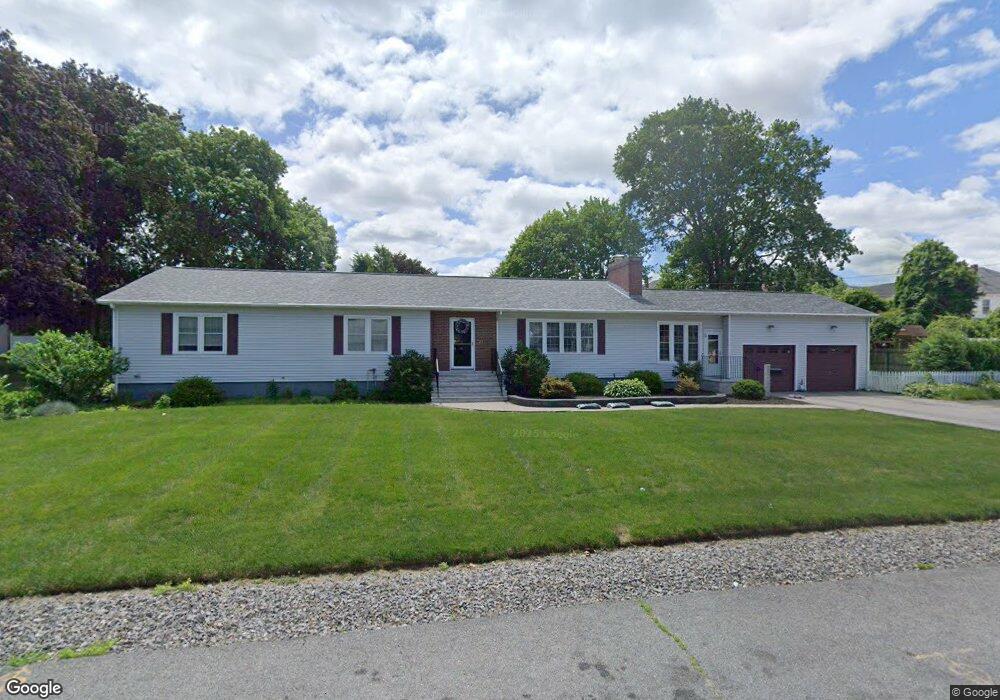
21 Henry Ave Lowell, MA 01850
Centralville NeighborhoodEstimated Value: $581,000 - $719,632
3
Beds
3
Baths
2,242
Sq Ft
$298/Sq Ft
Est. Value
About This Home
This home is located at 21 Henry Ave, Lowell, MA 01850 and is currently estimated at $667,908, approximately $297 per square foot. 21 Henry Ave is a home located in Middlesex County with nearby schools including Greenhalge Elementary School, S. Christa McAuliffe Elementary School, and Moody Elementary School.
Ownership History
Date
Name
Owned For
Owner Type
Purchase Details
Closed on
Oct 13, 2006
Sold by
Lacourse Andrew J
Bought by
Ozella Bruce T and Ozella Debra M
Current Estimated Value
Home Financials for this Owner
Home Financials are based on the most recent Mortgage that was taken out on this home.
Original Mortgage
$315,000
Outstanding Balance
$188,071
Interest Rate
6.47%
Mortgage Type
Purchase Money Mortgage
Estimated Equity
$479,837
Purchase Details
Closed on
Nov 12, 1996
Sold by
Sheehan Gloria T
Bought by
Lacourse Andrew J
Create a Home Valuation Report for This Property
The Home Valuation Report is an in-depth analysis detailing your home's value as well as a comparison with similar homes in the area
Home Values in the Area
Average Home Value in this Area
Purchase History
| Date | Buyer | Sale Price | Title Company |
|---|---|---|---|
| Ozella Bruce T | $395,000 | -- | |
| Ozella Bruce T | $395,000 | -- | |
| Lacourse Andrew J | $150,000 | -- | |
| Lacourse Andrew J | $150,000 | -- |
Source: Public Records
Mortgage History
| Date | Status | Borrower | Loan Amount |
|---|---|---|---|
| Open | Ozella Bruce T | $315,000 | |
| Closed | Lacourse Andrew J | $315,000 | |
| Previous Owner | Lacourse Andrew J | $50,000 |
Source: Public Records
Tax History Compared to Growth
Tax History
| Year | Tax Paid | Tax Assessment Tax Assessment Total Assessment is a certain percentage of the fair market value that is determined by local assessors to be the total taxable value of land and additions on the property. | Land | Improvement |
|---|---|---|---|---|
| 2025 | $8,259 | $719,400 | $175,100 | $544,300 |
| 2024 | $7,665 | $643,600 | $156,500 | $487,100 |
| 2023 | $7,277 | $585,900 | $126,600 | $459,300 |
| 2022 | $6,806 | $536,300 | $109,500 | $426,800 |
| 2021 | $6,703 | $498,000 | $95,300 | $402,700 |
| 2020 | $6,271 | $469,400 | $111,500 | $357,900 |
| 2019 | $6,579 | $468,600 | $93,000 | $375,600 |
| 2018 | $6,234 | $433,200 | $88,600 | $344,600 |
| 2017 | $5,834 | $391,000 | $73,600 | $317,400 |
| 2016 | $5,691 | $375,400 | $68,200 | $307,200 |
| 2015 | $5,687 | $367,400 | $68,200 | $299,200 |
| 2013 | $4,815 | $320,800 | $78,700 | $242,100 |
Source: Public Records
Map
Nearby Homes
- 20 Dean Ave
- 363 Hildreth St Unit 11
- 349 Hildreth St Unit 16
- 345 Hildreth St Unit 14
- 37 Beaudry St
- 74 Aiken Ave
- 195 Ludlam St
- 2 Sutherland St
- 108 Billings St
- 3 Hamel Place
- 87 Lilley Ave
- 49 Sparks St
- 81 Spring Park Ave
- 18 Stone St
- 44 19th St
- 100 Cass Ave Unit A13
- 39 Phoebe Ave
- 575 Beacon St
- 28 May St
- 41 W L St
- 122 Orleans St
- 110 Orleans St
- 37 Henry Ave
- 20 Henry Ave
- 7 Henry Ave
- 7 Henry Ave
- 124 Orleans St Unit 3
- 124 Orleans St Unit 2
- 124 Orleans St Unit 1
- 102 Orleans St
- 7 Osgood Ave
- 35 Osgood Ave
- 11 Osgood Ave
- 3 Osgood Ave
- 35 Osgood Ave
- 98 Orleans St
- 136 Orleans St
- 119 Orleans St
- 43 Osgood Ave
- 96 Orleans St