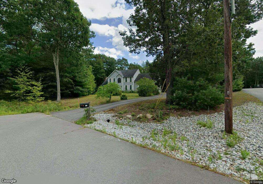
21 High View Dr Brookline, NH 03033
Estimated Value: $771,000 - $815,000
4
Beds
3
Baths
3,097
Sq Ft
$254/Sq Ft
Est. Value
About This Home
This home is located at 21 High View Dr, Brookline, NH 03033 and is currently estimated at $785,920, approximately $253 per square foot. 21 High View Dr is a home with nearby schools including Richard Maghakian Memorial School, Captain Samuel Douglass Academy, and Hollis-Brookline Middle School.
Ownership History
Date
Name
Owned For
Owner Type
Purchase Details
Closed on
Aug 24, 2007
Sold by
Edwards David
Bought by
Costa Albert J and Costa Alicia
Current Estimated Value
Purchase Details
Closed on
Nov 4, 2005
Sold by
Glendale Homes Inc
Bought by
Edwards David
Create a Home Valuation Report for This Property
The Home Valuation Report is an in-depth analysis detailing your home's value as well as a comparison with similar homes in the area
Home Values in the Area
Average Home Value in this Area
Purchase History
| Date | Buyer | Sale Price | Title Company |
|---|---|---|---|
| Costa Albert J | $425,000 | -- | |
| Edwards David | $428,000 | -- |
Source: Public Records
Mortgage History
| Date | Status | Borrower | Loan Amount |
|---|---|---|---|
| Open | Edwards David | $250,000 | |
| Closed | Edwards David | $280,000 | |
| Closed | Edwards David | $295,000 | |
| Closed | Edwards David | $301,000 |
Source: Public Records
Tax History Compared to Growth
Tax History
| Year | Tax Paid | Tax Assessment Tax Assessment Total Assessment is a certain percentage of the fair market value that is determined by local assessors to be the total taxable value of land and additions on the property. | Land | Improvement |
|---|---|---|---|---|
| 2024 | $15,913 | $703,800 | $270,800 | $433,000 |
| 2023 | $14,625 | $703,800 | $270,800 | $433,000 |
| 2022 | $12,774 | $429,800 | $157,200 | $272,600 |
| 2021 | $12,284 | $429,800 | $157,200 | $272,600 |
| 2020 | $11,948 | $429,800 | $157,200 | $272,600 |
| 2019 | $12,838 | $429,800 | $157,200 | $272,600 |
| 2018 | $12,705 | $429,800 | $157,200 | $272,600 |
| 2017 | $11,881 | $360,700 | $129,600 | $231,100 |
| 2016 | $11,744 | $360,700 | $129,600 | $231,100 |
| 2015 | $11,200 | $360,700 | $129,600 | $231,100 |
| 2014 | $11,849 | $360,700 | $129,600 | $231,100 |
| 2013 | $11,409 | $360,700 | $129,600 | $231,100 |
Source: Public Records
Map
Nearby Homes
- 9 Marjorie Dr
- 59 Cleveland Hill Rd
- 2 Corey Hill Rd
- 6 Laurelcrest Dr
- 12 Old Milford Rd
- 42 Pepperell Rd
- 47 Pepperell Rd
- 22 Hobart Hill Rd
- 18 Sawtelle Rd
- 55 Oak Hill Rd
- 6 Flint Meadow Dr
- 25 Rocky Pond Rd
- 15 N End Rd
- 5 Carons Way
- 6 High Oaks Path
- 0 Brookline St
- 52 W Hollis Rd
- 26 Ben Farnsworth Rd
- 28 N Mason Rd
- 1235 Townsend Rd