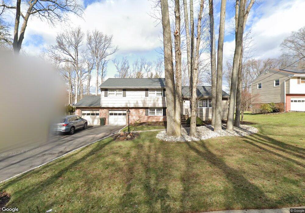
21 Huntington Rd Edison, NJ 08820
Estimated Value: $830,709 - $1,040,000
3
Beds
3
Baths
1,812
Sq Ft
$513/Sq Ft
Est. Value
About This Home
This home is located at 21 Huntington Rd, Edison, NJ 08820 and is currently estimated at $930,177, approximately $513 per square foot. 21 Huntington Rd is a home located in Middlesex County with nearby schools including Menlo Park Elementary School, Woodrow Wilson Middle School, and J.P. Stevens High School.
Ownership History
Date
Name
Owned For
Owner Type
Purchase Details
Closed on
Sep 6, 2017
Sold by
Thomson Mary L
Bought by
Sekar Murugesan
Current Estimated Value
Home Financials for this Owner
Home Financials are based on the most recent Mortgage that was taken out on this home.
Original Mortgage
$424,000
Outstanding Balance
$343,825
Interest Rate
2.87%
Mortgage Type
Adjustable Rate Mortgage/ARM
Estimated Equity
$586,352
Create a Home Valuation Report for This Property
The Home Valuation Report is an in-depth analysis detailing your home's value as well as a comparison with similar homes in the area
Home Values in the Area
Average Home Value in this Area
Purchase History
| Date | Buyer | Sale Price | Title Company |
|---|---|---|---|
| Sekar Murugesan | $540,000 | Elite Tieam Title Llc |
Source: Public Records
Mortgage History
| Date | Status | Borrower | Loan Amount |
|---|---|---|---|
| Open | Sekar Murugesan | $424,000 |
Source: Public Records
Tax History Compared to Growth
Tax History
| Year | Tax Paid | Tax Assessment Tax Assessment Total Assessment is a certain percentage of the fair market value that is determined by local assessors to be the total taxable value of land and additions on the property. | Land | Improvement |
|---|---|---|---|---|
| 2025 | $13,549 | $227,600 | $120,500 | $107,100 |
| 2024 | $13,476 | $227,600 | $120,500 | $107,100 |
| 2023 | $13,476 | $227,600 | $120,500 | $107,100 |
| 2022 | $13,481 | $227,600 | $120,500 | $107,100 |
| 2021 | $12,935 | $227,600 | $120,500 | $107,100 |
| 2020 | $13,312 | $227,600 | $120,500 | $107,100 |
| 2019 | $12,057 | $227,600 | $120,500 | $107,100 |
| 2018 | $11,735 | $227,600 | $120,500 | $107,100 |
| 2017 | $11,735 | $227,600 | $120,500 | $107,100 |
| 2016 | $11,507 | $227,600 | $120,500 | $107,100 |
| 2015 | $11,070 | $227,600 | $120,500 | $107,100 |
| 2014 | $10,756 | $227,600 | $120,500 | $107,100 |
Source: Public Records
Map
Nearby Homes
- 19 Huntington Rd
- 23 Huntington Rd
- 17 Huntington Rd
- 20 Huntington Rd
- 22 Huntington Rd
- 96 Stephenville Pkwy
- 25 Huntington Rd
- 18 Huntington Rd
- 92 Stephenville Pkwy
- 94 Stephenville Pkwy
- 92 Stephenville Pw
- 15 Huntington Rd
- 90 Stephenville Pkwy
- 16 Huntington Rd
- 27 Huntington Rd
- 26 Huntington Rd
- 98 Stephenville Pkwy
- 13 Huntington Rd
- 88 Stephenville Pkwy
- 14 Huntington Rd