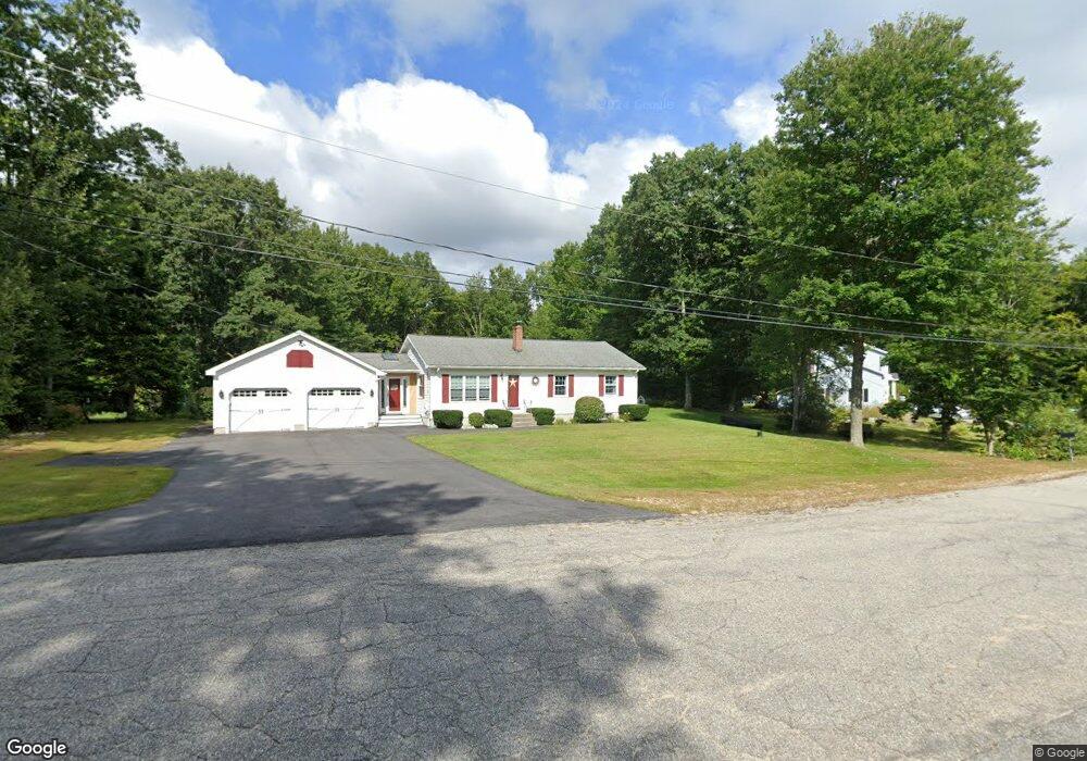
21 Kevin Cir Buxton, ME 04093
Estimated Value: $421,760 - $488,000
3
Beds
1
Bath
1,272
Sq Ft
$363/Sq Ft
Est. Value
About This Home
This home is located at 21 Kevin Cir, Buxton, ME 04093 and is currently estimated at $461,440, approximately $362 per square foot. 21 Kevin Cir is a home with nearby schools including Bonny Eagle High School.
Create a Home Valuation Report for This Property
The Home Valuation Report is an in-depth analysis detailing your home's value as well as a comparison with similar homes in the area
Home Values in the Area
Average Home Value in this Area
Tax History Compared to Growth
Tax History
| Year | Tax Paid | Tax Assessment Tax Assessment Total Assessment is a certain percentage of the fair market value that is determined by local assessors to be the total taxable value of land and additions on the property. | Land | Improvement |
|---|---|---|---|---|
| 2024 | $3,606 | $328,100 | $106,000 | $222,100 |
| 2023 | $3,422 | $328,100 | $106,000 | $222,100 |
| 2022 | $3,360 | $328,100 | $106,000 | $222,100 |
| 2021 | $3,009 | $208,109 | $65,700 | $142,409 |
| 2020 | $3,034 | $208,109 | $65,700 | $142,409 |
| 2019 | $2,761 | $186,300 | $65,700 | $120,600 |
| 2018 | $2,634 | $186,300 | $65,700 | $120,600 |
| 2017 | $2,534 | $186,300 | $65,700 | $120,600 |
| 2016 | $2,431 | $186,300 | $65,700 | $120,600 |
| 2015 | $2,413 | $186,300 | $65,700 | $120,600 |
| 2014 | $2,366 | $186,300 | $65,700 | $120,600 |
| 2013 | $2,329 | $186,300 | $65,700 | $120,600 |
Source: Public Records
Map
Nearby Homes
- 125 Old Thompson Rd
- 866 Parker Farm Rd Unit A
- 866 Parker Farm Rd Unit B
- 30 Joan Dixon Way
- 14 Patrick Dr
- Lot 2 Commerce Way
- 47 Proprietors Rd
- 580 Bonny Eagle Rd
- 22 Finn Parker Rd
- 17 Fox Track
- 95 Skip Rd
- 62 Emery Cir
- 6 Sunrise St
- 00 Ossipee Trail E
- 21 Alexander Dr
- 135 Buck St
- 8 Cortland Place Unit 5
- 116 Dingley Spring Rd
- 183 Buck St
- 6 Cortland Place Unit 4