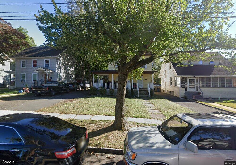
21 Laramie Rd Unit 23 Plainfield, NJ 07060
Estimated Value: $435,240 - $521,000
--
Bed
--
Bath
1,495
Sq Ft
$325/Sq Ft
Est. Value
About This Home
This home is located at 21 Laramie Rd Unit 23, Plainfield, NJ 07060 and is currently estimated at $486,310, approximately $325 per square foot. 21 Laramie Rd Unit 23 is a home located in Union County with nearby schools including Cedarbrook K-8 Center, Hubbard Middle School, and Plainfield High School.
Ownership History
Date
Name
Owned For
Owner Type
Purchase Details
Closed on
Sep 19, 2012
Sold by
Pastilha Mario V
Bought by
Burrell Alvin and Anckle Simone
Current Estimated Value
Home Financials for this Owner
Home Financials are based on the most recent Mortgage that was taken out on this home.
Original Mortgage
$186,558
Outstanding Balance
$129,090
Interest Rate
3.57%
Mortgage Type
FHA
Estimated Equity
$357,220
Purchase Details
Closed on
Nov 2, 2011
Sold by
Damon Ida
Bought by
Pastilha Mario
Create a Home Valuation Report for This Property
The Home Valuation Report is an in-depth analysis detailing your home's value as well as a comparison with similar homes in the area
Home Values in the Area
Average Home Value in this Area
Purchase History
| Date | Buyer | Sale Price | Title Company |
|---|---|---|---|
| Burrell Alvin | $190,000 | None Available | |
| Pastilha Mario | $55,000 | -- |
Source: Public Records
Mortgage History
| Date | Status | Borrower | Loan Amount |
|---|---|---|---|
| Open | Burrell Alvin | $186,558 |
Source: Public Records
Tax History Compared to Growth
Tax History
| Year | Tax Paid | Tax Assessment Tax Assessment Total Assessment is a certain percentage of the fair market value that is determined by local assessors to be the total taxable value of land and additions on the property. | Land | Improvement |
|---|---|---|---|---|
| 2025 | $6,986 | $80,000 | $40,000 | $40,000 |
| 2024 | $6,917 | $80,000 | $40,000 | $40,000 |
| 2023 | $6,917 | $80,000 | $40,000 | $40,000 |
| 2022 | $6,767 | $80,000 | $40,000 | $40,000 |
| 2021 | $6,708 | $80,000 | $40,000 | $40,000 |
| 2020 | $6,689 | $80,000 | $40,000 | $40,000 |
| 2019 | $6,689 | $80,000 | $40,000 | $40,000 |
| 2018 | $6,549 | $80,000 | $40,000 | $40,000 |
| 2017 | $6,389 | $80,000 | $40,000 | $40,000 |
| 2016 | $8,488 | $108,500 | $40,000 | $68,500 |
| 2015 | $8,237 | $108,500 | $40,000 | $68,500 |
| 2014 | -- | $108,500 | $40,000 | $68,500 |
Source: Public Records
Map
Nearby Homes
- 1208 Moffett Ave Unit 12
- 1339 Park Ave Unit 41
- 1349 Park Ave Unit 53
- 115 Ellsworth Ct Unit 17
- 1143 Stilford Ave Unit 45
- 1143-45 Stilford Ave
- 77 Parkside Rd Unit 89
- 132 Parkside Rd
- 1360 Belleview Ave Unit 64
- 1066 Allenwood Dr
- 1388 Belleview Ave Unit 90
- 1358 Marlborough Ave Unit 60
- 1454 S End Pkwy Unit 56
- 1354 Chetwynd Ave Unit 58
- 117 Golf Ave E
- 127 Remington Ave Unit 31
- 1028 Evergreen Ave
- 1400 Kenyon Ave
- 221 Golf Ave E
- 125 Redding Ave
- 21-23 Laramie Rd
- 25-27 Laramie Rd
- 25 Laramie Rd Unit 27
- 17 Laramie Rd Unit 19
- 29 Laramie Rd Unit 31
- 13 Laramie Rd Unit 15
- 33 Laramie Rd Unit 35
- 1272 Park Ave
- 37 Laramie Rd
- 1264 Park Ave Unit 72
- 1264 Park Ave Unit 72
- 1243 Lenox Ave Unit 45
- 39 Laramie Rd Unit 41
- 1258 Park Ave Unit 62
- 1239 Lenox Ave Unit 41
- 43 Laramie Rd
- 1246 Lenox Ave Unit 48
- 1248 Lenox Ave
- 45 Laramie Rd Unit 47
- 1242-44 Lenox Ave