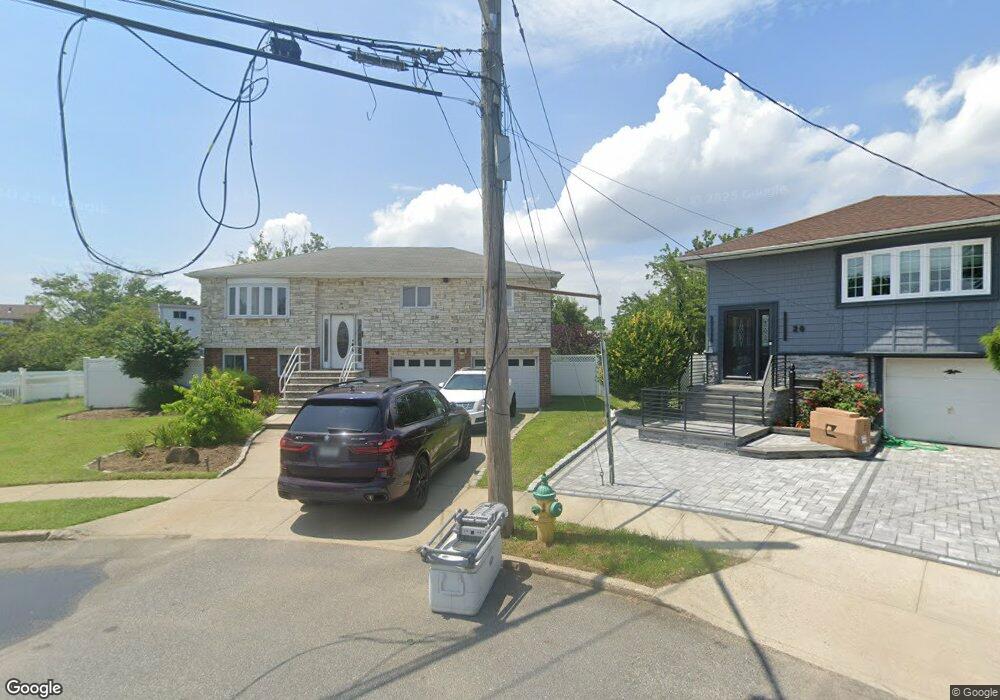
21 Laurel Rd Freeport, NY 11520
Estimated Value: $733,210 - $808,000
3
Beds
2
Baths
1,081
Sq Ft
$713/Sq Ft
Est. Value
About This Home
This home is located at 21 Laurel Rd, Freeport, NY 11520 and is currently estimated at $770,605, approximately $712 per square foot. 21 Laurel Rd is a home located in Nassau County with nearby schools including Columbus Avenue School, Caroline G. Atkinson Intermediate School, and John W Dodd Middle School.
Ownership History
Date
Name
Owned For
Owner Type
Purchase Details
Closed on
Dec 18, 2020
Sold by
Steady Enterprises Inc
Bought by
Andujar Amanda M and Andujar Roxanne M
Current Estimated Value
Home Financials for this Owner
Home Financials are based on the most recent Mortgage that was taken out on this home.
Original Mortgage
$517,454
Outstanding Balance
$456,425
Interest Rate
2.7%
Mortgage Type
FHA
Estimated Equity
$314,180
Purchase Details
Closed on
May 2, 2019
Sold by
Jenkins Aaron C
Bought by
Steady Enterprises Inc
Home Financials for this Owner
Home Financials are based on the most recent Mortgage that was taken out on this home.
Original Mortgage
$38,000
Interest Rate
4%
Mortgage Type
Commercial
Purchase Details
Closed on
Jan 22, 1999
Purchase Details
Closed on
May 16, 1997
Create a Home Valuation Report for This Property
The Home Valuation Report is an in-depth analysis detailing your home's value as well as a comparison with similar homes in the area
Home Values in the Area
Average Home Value in this Area
Purchase History
| Date | Buyer | Sale Price | Title Company |
|---|---|---|---|
| Andujar Amanda M | $527,000 | First American Title | |
| Steady Enterprises Inc | $317,000 | None Available | |
| -- | -- | -- | |
| -- | $160,000 | -- |
Source: Public Records
Mortgage History
| Date | Status | Borrower | Loan Amount |
|---|---|---|---|
| Open | Andujar Amanda M | $517,454 | |
| Previous Owner | Steady Enterprises Inc | $38,000 | |
| Previous Owner | Steady Enterprises Inc | $297,000 |
Source: Public Records
Tax History
| Year | Tax Paid | Tax Assessment Tax Assessment Total Assessment is a certain percentage of the fair market value that is determined by local assessors to be the total taxable value of land and additions on the property. | Land | Improvement |
|---|---|---|---|---|
| 2025 | $8,862 | $411 | $173 | $238 |
| 2024 | $942 | $411 | $173 | $238 |
| 2023 | $9,474 | $411 | $173 | $238 |
| 2022 | $9,474 | $411 | $173 | $238 |
| 2021 | $14,635 | $394 | $166 | $228 |
| 2020 | $9,419 | $731 | $466 | $265 |
| 2019 | $1,213 | $731 | $466 | $265 |
| 2018 | $5,024 | $731 | $0 | $0 |
| 2017 | $7,397 | $731 | $466 | $265 |
| 2016 | $8,494 | $731 | $466 | $265 |
| 2015 | $1,056 | $731 | $466 | $265 |
| 2014 | $1,056 | $731 | $466 | $265 |
| 2013 | $998 | $731 | $466 | $265 |
Source: Public Records
Map
Nearby Homes
- 308 Bedell St
- 130 Gordon Place
- 62 W 1st St
- 121 Garfield St
- 51 Atlantic Ave
- 54 W 2nd St
- 21 Stillwell Place
- 176 Gordon Place
- 251 Arthur St
- 271 Arthur St
- 254 Arthur St
- 51 E 2nd St
- 251 Garfield St
- 120 Sportsmans Ave
- 208 Sportsmans Ave
- 268 Gordon Place
- 335 Arthur St
- 4 Laurette Ln
- 3 Archer St
- 22 Wilshire Ct
Your Personal Tour Guide
Ask me questions while you tour the home.