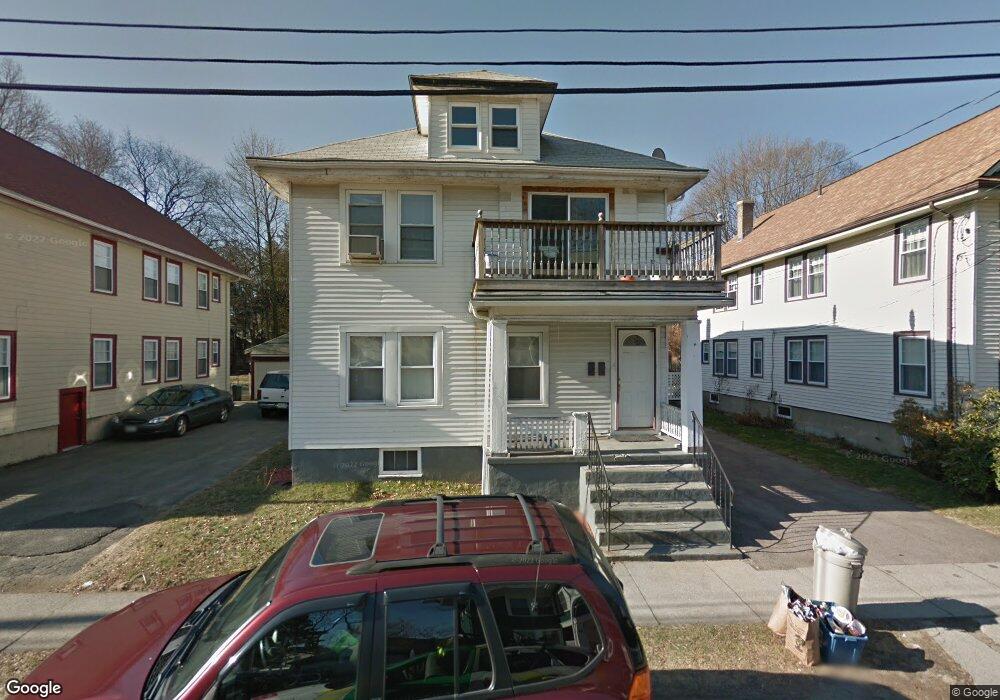
21 Laurel Rd Milton, MA 02186
Milton Center NeighborhoodEstimated Value: $883,000 - $1,013,000
4
Beds
2
Baths
2,340
Sq Ft
$408/Sq Ft
Est. Value
About This Home
This home is located at 21 Laurel Rd, Milton, MA 02186 and is currently estimated at $954,450, approximately $407 per square foot. 21 Laurel Rd is a home located in Norfolk County with nearby schools including Milton High School, KIPP Academy Boston Charter School, and St. Mary of the Hills School.
Ownership History
Date
Name
Owned For
Owner Type
Purchase Details
Closed on
Sep 30, 2025
Sold by
Arthur L & C Phillips Ret and Phillips
Bought by
Phillips Carolyne
Current Estimated Value
Purchase Details
Closed on
Sep 16, 2021
Sold by
Phillips Arthur L
Bought by
A L & C Phillips Ret and Phillips
Purchase Details
Closed on
Sep 21, 2006
Sold by
Phillips Arthur L and Green Pamela P
Bought by
Phillips Arthur L and Phillips Pamela
Create a Home Valuation Report for This Property
The Home Valuation Report is an in-depth analysis detailing your home's value as well as a comparison with similar homes in the area
Home Values in the Area
Average Home Value in this Area
Purchase History
| Date | Buyer | Sale Price | Title Company |
|---|---|---|---|
| Phillips Carolyne | -- | -- | |
| A L & C Phillips Ret | -- | None Available | |
| Phillips Arthur L | -- | -- | |
| Phillips Arthur L | -- | -- |
Source: Public Records
Mortgage History
| Date | Status | Borrower | Loan Amount |
|---|---|---|---|
| Previous Owner | Phillips Arthur L | $32,500 | |
| Previous Owner | Phillips Arthur L | $170,000 | |
| Previous Owner | Phillips Arthur L | $180,000 |
Source: Public Records
Tax History
| Year | Tax Paid | Tax Assessment Tax Assessment Total Assessment is a certain percentage of the fair market value that is determined by local assessors to be the total taxable value of land and additions on the property. | Land | Improvement |
|---|---|---|---|---|
| 2025 | $8,818 | $795,100 | $367,500 | $427,600 |
| 2024 | $8,583 | $786,000 | $350,000 | $436,000 |
| 2023 | $8,159 | $715,700 | $311,200 | $404,500 |
| 2022 | $8,214 | $658,700 | $311,200 | $347,500 |
| 2021 | $8,146 | $620,400 | $289,500 | $330,900 |
| 2020 | $7,387 | $563,000 | $267,700 | $295,300 |
| 2019 | $6,842 | $519,100 | $259,900 | $259,200 |
| 2018 | $6,535 | $473,200 | $215,500 | $257,700 |
| 2017 | $5,960 | $439,500 | $205,200 | $234,300 |
| 2016 | $5,512 | $408,300 | $192,400 | $215,900 |
| 2015 | $5,303 | $380,400 | $177,000 | $203,400 |
Source: Public Records
Map
Nearby Homes
- 168 Brook Rd
- 214 Brook Rd
- 29/31 Belvoir Rd
- 82 Blue Hill Ave
- 137 Thacher St Unit 137
- 16 Blue Hill Ave
- 80 Blue Hills Pkwy
- 46 Audubon Rd
- 16 Concord Ave Unit 1
- 640 River St
- 73 Hudson St
- 30 Massasoit St
- 645 River St
- 424 Brook Rd
- 7 Parkway Crescent
- 23 Caton St
- 44 Allen Cir
- 853 Cummins Hwy
- 72 Columbine Rd
- 259 Central Ave
- 17 Laurel Rd
- 23 Laurel Rd Unit 25
- 25 Laurel Rd Unit 2
- 29 Laurel Rd
- 29 Laurel Rd
- 29 Laurel Rd Unit 1
- 15 Laurel Rd Unit 1
- 13-15 Laurel Rd
- 13 Laurel Rd Unit 15
- 20 Laurel Rd
- 20 Laurel Rd Unit 2
- 20 Laurel Rd Unit 1
- 11 West St
- 12 Laurel Rd Unit 16
- 24 Laurel Rd
- 33 Laurel Rd
- 9 Laurel Rd
- 7 West St
- 28 Laurel Rd
- 34 Laurel Rd
Your Personal Tour Guide
Ask me questions while you tour the home.