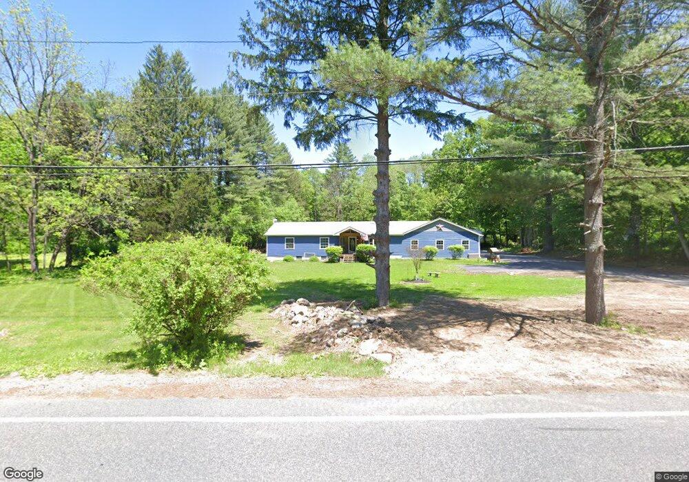
21 Lertora Rd Sandyston, NJ 07826
Estimated Value: $422,066 - $466,000
--
Bed
--
Bath
1,456
Sq Ft
$304/Sq Ft
Est. Value
About This Home
This home is located at 21 Lertora Rd, Sandyston, NJ 07826 and is currently estimated at $442,767, approximately $304 per square foot. 21 Lertora Rd is a home located in Sussex County with nearby schools including Sandyston-Walpack Consolidated School and Kittatinny Regional High School.
Ownership History
Date
Name
Owned For
Owner Type
Purchase Details
Closed on
Jul 14, 2016
Sold by
Eaton Patricia L and Eaton Arthur R
Bought by
Eaton Timothy
Current Estimated Value
Purchase Details
Closed on
Jul 22, 1987
Bought by
Eaton Arthur R and Eaton Patricia L
Create a Home Valuation Report for This Property
The Home Valuation Report is an in-depth analysis detailing your home's value as well as a comparison with similar homes in the area
Home Values in the Area
Average Home Value in this Area
Purchase History
| Date | Buyer | Sale Price | Title Company |
|---|---|---|---|
| Eaton Timothy | $155,000 | -- | |
| Eaton Arthur R | $45,000 | -- |
Source: Public Records
Tax History Compared to Growth
Tax History
| Year | Tax Paid | Tax Assessment Tax Assessment Total Assessment is a certain percentage of the fair market value that is determined by local assessors to be the total taxable value of land and additions on the property. | Land | Improvement |
|---|---|---|---|---|
| 2025 | $7,654 | $242,200 | $69,200 | $173,000 |
| 2024 | $6,787 | $242,200 | $69,200 | $173,000 |
| 2023 | $6,787 | $221,500 | $69,200 | $152,300 |
| 2022 | $6,486 | $221,500 | $69,200 | $152,300 |
| 2021 | $6,284 | $221,500 | $69,200 | $152,300 |
| 2020 | $6,023 | $221,500 | $69,200 | $152,300 |
| 2019 | $5,761 | $221,500 | $69,200 | $152,300 |
| 2018 | $5,726 | $221,500 | $69,200 | $152,300 |
| 2017 | $5,628 | $221,500 | $69,200 | $152,300 |
| 2016 | $5,655 | $221,500 | $69,200 | $152,300 |
| 2015 | $5,460 | $221,500 | $69,200 | $152,300 |
| 2014 | $5,052 | $246,100 | $113,600 | $132,500 |
Source: Public Records
Map
Nearby Homes
- 4 Butternut Ln
- 113 Rt560
- 113 County Road 560
- 119 Rte 560
- 155 Route560
- 12 Old Dingman Rd
- 11 Hirams Grove Rd
- 13 Sunrise Trail
- 111 County Road 645
- 00 Devita Rd
- 161A County Road 645
- 163 County Road 645
- 43 Meyers Rd
- 8 Ayers Rd
- 174 County Road 645
- 3 Volker Ln
- 9 Woods Rd
- 0 Lot85a Unit 755921
- 4 Lake Path 1
- 13 U S 206