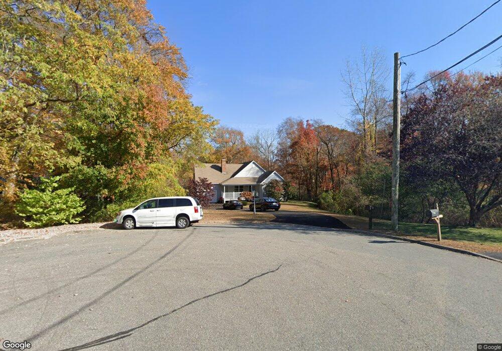
21 Longview Ave Waterford, CT 06385
Estimated Value: $408,000 - $548,000
3
Beds
2
Baths
1,738
Sq Ft
$282/Sq Ft
Est. Value
About This Home
This home is located at 21 Longview Ave, Waterford, CT 06385 and is currently estimated at $490,686, approximately $282 per square foot. 21 Longview Ave is a home located in New London County with nearby schools including Clark Lane Middle School, Waterford High School, and Lighthouse Vocation Education Center.
Ownership History
Date
Name
Owned For
Owner Type
Purchase Details
Closed on
Jan 24, 2018
Sold by
Bronson Louise T Est and Bronson
Bought by
Sanders Ryan W
Current Estimated Value
Home Financials for this Owner
Home Financials are based on the most recent Mortgage that was taken out on this home.
Original Mortgage
$157,140
Outstanding Balance
$132,882
Interest Rate
3.93%
Mortgage Type
Credit Line Revolving
Estimated Equity
$357,804
Purchase Details
Closed on
Jul 16, 1990
Sold by
Bandos Douglas
Bought by
Carr Robert
Home Financials for this Owner
Home Financials are based on the most recent Mortgage that was taken out on this home.
Original Mortgage
$140,000
Interest Rate
10.17%
Create a Home Valuation Report for This Property
The Home Valuation Report is an in-depth analysis detailing your home's value as well as a comparison with similar homes in the area
Home Values in the Area
Average Home Value in this Area
Purchase History
| Date | Buyer | Sale Price | Title Company |
|---|---|---|---|
| Carr Robert | $177,000 | -- | |
| Sanders Ryan W | $81,500 | -- |
Source: Public Records
Mortgage History
| Date | Status | Borrower | Loan Amount |
|---|---|---|---|
| Open | Carr Robert | $157,140 | |
| Previous Owner | Carr Robert | $140,000 | |
| Previous Owner | Carr Robert | $80,000 |
Source: Public Records
Tax History Compared to Growth
Tax History
| Year | Tax Paid | Tax Assessment Tax Assessment Total Assessment is a certain percentage of the fair market value that is determined by local assessors to be the total taxable value of land and additions on the property. | Land | Improvement |
|---|---|---|---|---|
| 2025 | $6,916 | $296,070 | $107,580 | $188,490 |
| 2024 | $6,602 | $296,070 | $107,580 | $188,490 |
| 2023 | $6,277 | $296,070 | $107,580 | $188,490 |
| 2022 | $6,192 | $224,690 | $74,420 | $150,270 |
| 2021 | $6,210 | $224,690 | $74,420 | $150,270 |
| 2020 | $6,262 | $224,690 | $74,420 | $150,270 |
| 2019 | $6,287 | $224,690 | $74,420 | $150,270 |
| 2018 | $6,161 | $224,690 | $74,420 | $150,270 |
| 2017 | $5,627 | $208,180 | $76,560 | $131,620 |
| 2016 | $5,575 | $208,180 | $76,560 | $131,620 |
| 2015 | $5,377 | $208,180 | $76,560 | $131,620 |
| 2014 | $5,377 | $208,180 | $76,560 | $131,620 |
Source: Public Records
Map
Nearby Homes
- 27 Mullen Hill Rd
- 270 Boston Post Rd Unit 22
- 310 Boston Post Rd Unit 86
- 267 Boston Post Rd
- 164 Stoneheights Dr Unit 164
- 37 Spithead Rd
- 84 Stoneheights Dr
- 213 Boston Post Rd
- 54 Rope Ferry Rd Unit H133
- 24 Stoneheights Dr
- 127 Spithead Rd
- 7 Robin St
- 9 Rock Ridge Rd
- 23 Whaling Dr
- 398 & 402 Boston Post Rd
- 398 Boston Post Rd
- 26 Fulmore Dr
- 9 Arrowhead Trail
- 18 Whaling Dr
- 6 Fulmore Dr