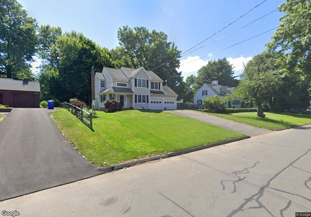
21 Longvue Dr Wethersfield, CT 06109
Estimated Value: $448,000 - $501,920
3
Beds
3
Baths
1,588
Sq Ft
$295/Sq Ft
Est. Value
About This Home
This home is located at 21 Longvue Dr, Wethersfield, CT 06109 and is currently estimated at $467,980, approximately $294 per square foot. 21 Longvue Dr is a home located in Hartford County with nearby schools including Alfred W. Hanmer School, Silas Deane Middle School, and Wethersfield High School.
Ownership History
Date
Name
Owned For
Owner Type
Purchase Details
Closed on
Oct 25, 2005
Sold by
Scanlon Nancy G
Bought by
Cavaliere Diane E
Current Estimated Value
Home Financials for this Owner
Home Financials are based on the most recent Mortgage that was taken out on this home.
Original Mortgage
$239,100
Outstanding Balance
$128,433
Interest Rate
5.72%
Estimated Equity
$339,547
Purchase Details
Closed on
Sep 17, 2001
Sold by
Cardaropoli Vincent R and Demas Stephanie
Bought by
Scanlon Nancy G
Purchase Details
Closed on
Jul 2, 1998
Sold by
Beaudoin Kevin and Beaudoin Joann M
Bought by
Cardaropoli Vincent R and Demas Stephanie
Create a Home Valuation Report for This Property
The Home Valuation Report is an in-depth analysis detailing your home's value as well as a comparison with similar homes in the area
Home Values in the Area
Average Home Value in this Area
Purchase History
| Date | Buyer | Sale Price | Title Company |
|---|---|---|---|
| Cavaliere Diane E | $298,900 | -- | |
| Scanlon Nancy G | $215,000 | -- | |
| Cardaropoli Vincent R | $177,000 | -- |
Source: Public Records
Mortgage History
| Date | Status | Borrower | Loan Amount |
|---|---|---|---|
| Open | Cardaropoli Vincent R | $239,100 | |
| Previous Owner | Cardaropoli Vincent R | $37,000 | |
| Previous Owner | Cardaropoli Vincent R | $15,000 | |
| Previous Owner | Cardaropoli Vincent R | $170,750 |
Source: Public Records
Tax History Compared to Growth
Tax History
| Year | Tax Paid | Tax Assessment Tax Assessment Total Assessment is a certain percentage of the fair market value that is determined by local assessors to be the total taxable value of land and additions on the property. | Land | Improvement |
|---|---|---|---|---|
| 2025 | $12,486 | $302,900 | $93,800 | $209,100 |
| 2024 | $8,538 | $197,540 | $65,100 | $132,440 |
| 2023 | $8,253 | $197,540 | $65,100 | $132,440 |
| 2022 | $8,115 | $197,540 | $65,100 | $132,440 |
| 2021 | $8,034 | $197,540 | $65,100 | $132,440 |
| 2020 | $8,038 | $197,540 | $65,100 | $132,440 |
| 2019 | $8,048 | $197,540 | $65,100 | $132,440 |
| 2018 | $7,891 | $193,500 | $63,600 | $129,900 |
| 2017 | $7,695 | $193,500 | $63,600 | $129,900 |
| 2016 | $7,457 | $193,500 | $63,600 | $129,900 |
| 2015 | $7,390 | $193,500 | $63,600 | $129,900 |
| 2014 | $7,109 | $193,500 | $63,600 | $129,900 |
Source: Public Records
Map
Nearby Homes
- 27 Longvue Dr
- 15 Longvue Dr
- 33 Longvue Dr
- 540 Wolcott Hill Rd
- 534 Wolcott Hill Rd
- 528 Wolcott Hill Rd
- 550 Wolcott Hill Rd
- 18 Longvue Dr
- 26 Longvue Dr
- 146 Wells Rd
- 41 Longvue Dr
- 32 Longvue Dr
- 522 Wolcott Hill Rd
- 140 Wells Rd
- 560 Wolcott Hill Rd
- 38 Longvue Dr
- 134 Wells Rd
- 127 Stillwold Dr
- 46 Longvue Dr
- 123 Stillwold Dr