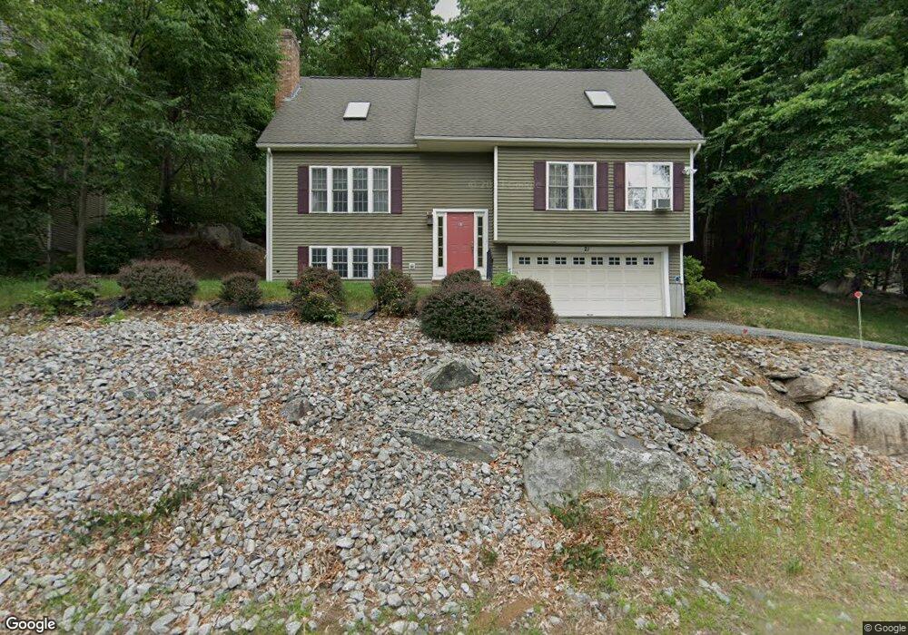
21 Macarthur Dr Millbury, MA 01527
Estimated Value: $610,363 - $772,000
3
Beds
3
Baths
2,042
Sq Ft
$342/Sq Ft
Est. Value
About This Home
This home is located at 21 Macarthur Dr, Millbury, MA 01527 and is currently estimated at $698,841, approximately $342 per square foot. 21 Macarthur Dr is a home located in Worcester County with nearby schools including Elmwood Street Elementary School, Raymond E. Shaw Elementary School, and Millbury Junior/Senior High School.
Ownership History
Date
Name
Owned For
Owner Type
Purchase Details
Closed on
Jun 30, 1999
Sold by
Colman Construction
Bought by
Barbara Malkowski P and Barbara Lisa
Current Estimated Value
Home Financials for this Owner
Home Financials are based on the most recent Mortgage that was taken out on this home.
Original Mortgage
$208,300
Outstanding Balance
$56,643
Interest Rate
7.19%
Mortgage Type
Purchase Money Mortgage
Estimated Equity
$642,198
Create a Home Valuation Report for This Property
The Home Valuation Report is an in-depth analysis detailing your home's value as well as a comparison with similar homes in the area
Home Values in the Area
Average Home Value in this Area
Purchase History
| Date | Buyer | Sale Price | Title Company |
|---|---|---|---|
| Barbara Malkowski P | $260,432 | -- | |
| Barbara Malkowski P | $260,432 | -- |
Source: Public Records
Mortgage History
| Date | Status | Borrower | Loan Amount |
|---|---|---|---|
| Open | Barbara Malkowski P | $208,300 | |
| Closed | Barbara Malkowski P | $208,300 |
Source: Public Records
Tax History
| Year | Tax Paid | Tax Assessment Tax Assessment Total Assessment is a certain percentage of the fair market value that is determined by local assessors to be the total taxable value of land and additions on the property. | Land | Improvement |
|---|---|---|---|---|
| 2025 | $7,277 | $543,500 | $108,000 | $435,500 |
| 2024 | $6,680 | $504,900 | $100,000 | $404,900 |
| 2023 | $5,747 | $397,700 | $70,200 | $327,500 |
| 2022 | $5,702 | $380,100 | $70,200 | $309,900 |
| 2021 | $5,276 | $341,900 | $70,200 | $271,700 |
| 2020 | $5,436 | $354,600 | $70,200 | $284,400 |
| 2019 | $5,490 | $346,400 | $63,700 | $282,700 |
| 2018 | $5,353 | $327,600 | $63,700 | $263,900 |
| 2017 | $4,722 | $287,400 | $63,700 | $223,700 |
| 2016 | $4,665 | $283,400 | $63,700 | $219,700 |
| 2015 | $4,640 | $281,900 | $67,800 | $214,100 |
| 2014 | $4,258 | $249,000 | $67,800 | $181,200 |
Source: Public Records
Map
Nearby Homes
- 2 Diane St
- 12 Irene Ct
- 25 Upton St
- 300 Millbury Ave
- 2 Wilson Rd Unit B
- 2 Wilson Rd Unit A
- 11 Maplewood Rd
- 1459 Grafton Rd
- 4 John Dr
- 5 Ann Dr Unit 5
- 2 Riverlin Pkwy
- 5 Lincoln Ln Unit 5
- 6 Nathaniel St
- 1260 Grafton St
- 7 Clarissa St
- 9 Marissa Cir
- 1195 Grafton St Unit 29
- 1195 Grafton St Unit 19
- 1195 Grafton St Unit 39
- 12 Bruce St
- 19 Macarthur Dr
- 23 Macarthur Dr
- 17 Macarthur Dr Unit A
- 1 Rollie Shepard Dr
- 48 Tiffany Cir
- 47 Tiffany Cir
- 46 Tiffany Cir
- 47 Tiffany Cir Unit 47
- 44 Tiffany Cir
- 43 Tiffany Cir
- 42 Tiffany Cir
- 41 Tiffany Cir
- 42 Tiffany Cir Unit M-42
- 41 Tiffany Cir Unit 41
- 3 Rollie Shepard Dr
- 52 Tiffany Cir
- 51 Tiffany Cir
- 50 Tiffany Cir
- 49 Tiffany Cir
- 15 Macarthur Dr
Your Personal Tour Guide
Ask me questions while you tour the home.