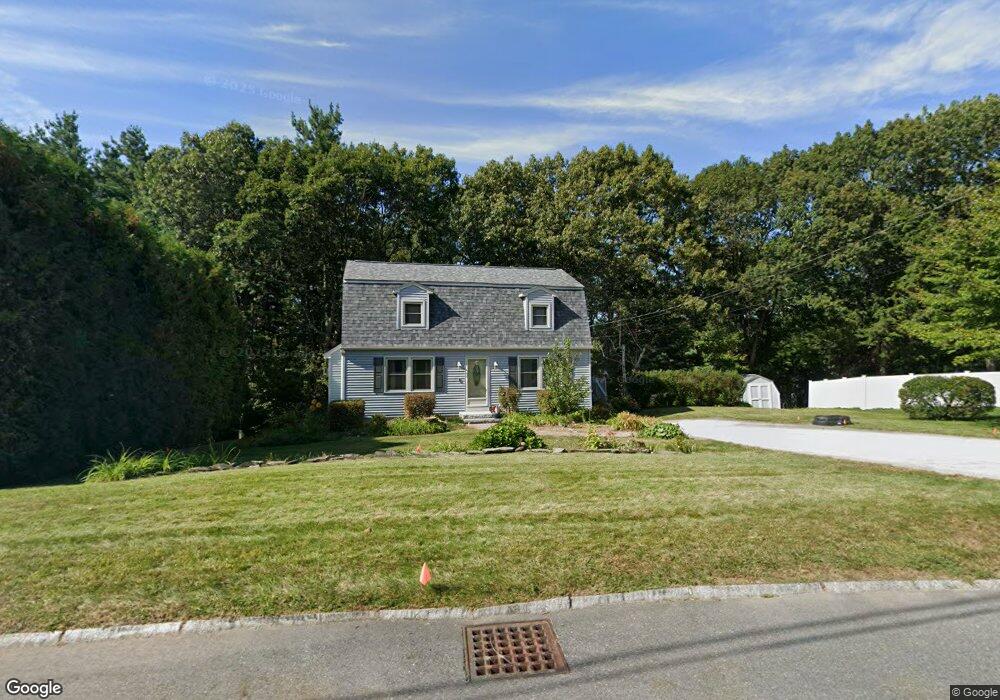
21 Macdonald Dr Nashua, NH 03062
Southwest Nashua NeighborhoodEstimated Value: $542,000 - $624,000
4
Beds
2
Baths
1,632
Sq Ft
$354/Sq Ft
Est. Value
About This Home
This home is located at 21 Macdonald Dr, Nashua, NH 03062 and is currently estimated at $577,918, approximately $354 per square foot. 21 Macdonald Dr is a home located in Hillsborough County with nearby schools including Main Dunstable School, Elm Street Middle School, and Nashua High School South.
Ownership History
Date
Name
Owned For
Owner Type
Purchase Details
Closed on
Jan 9, 2001
Sold by
Christine S Andon T
Bought by
Bender John E and Bender Christian G
Current Estimated Value
Home Financials for this Owner
Home Financials are based on the most recent Mortgage that was taken out on this home.
Original Mortgage
$143,920
Outstanding Balance
$53,679
Interest Rate
7.69%
Mortgage Type
Purchase Money Mortgage
Estimated Equity
$524,239
Create a Home Valuation Report for This Property
The Home Valuation Report is an in-depth analysis detailing your home's value as well as a comparison with similar homes in the area
Home Values in the Area
Average Home Value in this Area
Purchase History
| Date | Buyer | Sale Price | Title Company |
|---|---|---|---|
| Bender John E | $179,900 | -- |
Source: Public Records
Mortgage History
| Date | Status | Borrower | Loan Amount |
|---|---|---|---|
| Open | Bender John E | $42,000 | |
| Open | Bender John E | $143,920 |
Source: Public Records
Tax History
| Year | Tax Paid | Tax Assessment Tax Assessment Total Assessment is a certain percentage of the fair market value that is determined by local assessors to be the total taxable value of land and additions on the property. | Land | Improvement |
|---|---|---|---|---|
| 2024 | $7,686 | $483,400 | $163,100 | $320,300 |
| 2023 | $7,485 | $410,600 | $130,500 | $280,100 |
| 2022 | $7,420 | $410,600 | $130,500 | $280,100 |
| 2021 | $6,659 | $286,800 | $91,300 | $195,500 |
| 2020 | $6,356 | $281,100 | $91,300 | $189,800 |
| 2019 | $6,117 | $281,100 | $91,300 | $189,800 |
| 2018 | $5,962 | $281,100 | $91,300 | $189,800 |
| 2017 | $5,947 | $230,600 | $69,600 | $161,000 |
| 2016 | $5,781 | $230,600 | $69,600 | $161,000 |
| 2015 | $5,657 | $230,600 | $69,600 | $161,000 |
| 2014 | $5,546 | $230,600 | $69,600 | $161,000 |
Source: Public Records
Map
Nearby Homes
- 17 Twilight Dr
- 244 Harris Rd
- 64 Mckenna Dr
- 5 Wilderness Dr
- 10 Houston Dr
- 25 Silverton Dr Unit U73
- 154 Westwood Dr
- 26 Old Coach Rd
- 4 Henry David Dr Unit 203
- 4 Henry David Dr Unit 202
- 10 Woodfield St
- 130 Westwood Dr
- 4 Heather Ct Unit U34
- 288 Main Dunstable Rd
- 29 Nottingham Dr
- 47 Dogwood Dr Unit U205
- 47 Dogwood Dr Unit U202
- 30 Ledgewood Hills Dr Unit 104
- 14 Millbrook Dr
- 4 Portchester Dr
- 23 Macdonald Dr
- 19 Macdonald Dr
- 16 Macdonald Dr
- 25 Macdonald Dr
- 17 Macdonald Dr
- 18 Macdonald Dr
- 14 Macdonald Dr
- 16 Sagamore Rd
- 20 Macdonald Dr
- 27 Macdonald Dr
- 15 Macdonald Dr
- 60 Seneca Dr Unit 28
- 14 Sagamore Rd
- 20 Sagamore Rd
- 12 Macdonald Dr
- 22 Sagamore Rd
- 12 Sagamore Rd
- 29 Macdonald Dr
- 22 Macdonald Dr
- 5 Scotia Way
Your Personal Tour Guide
Ask me questions while you tour the home.