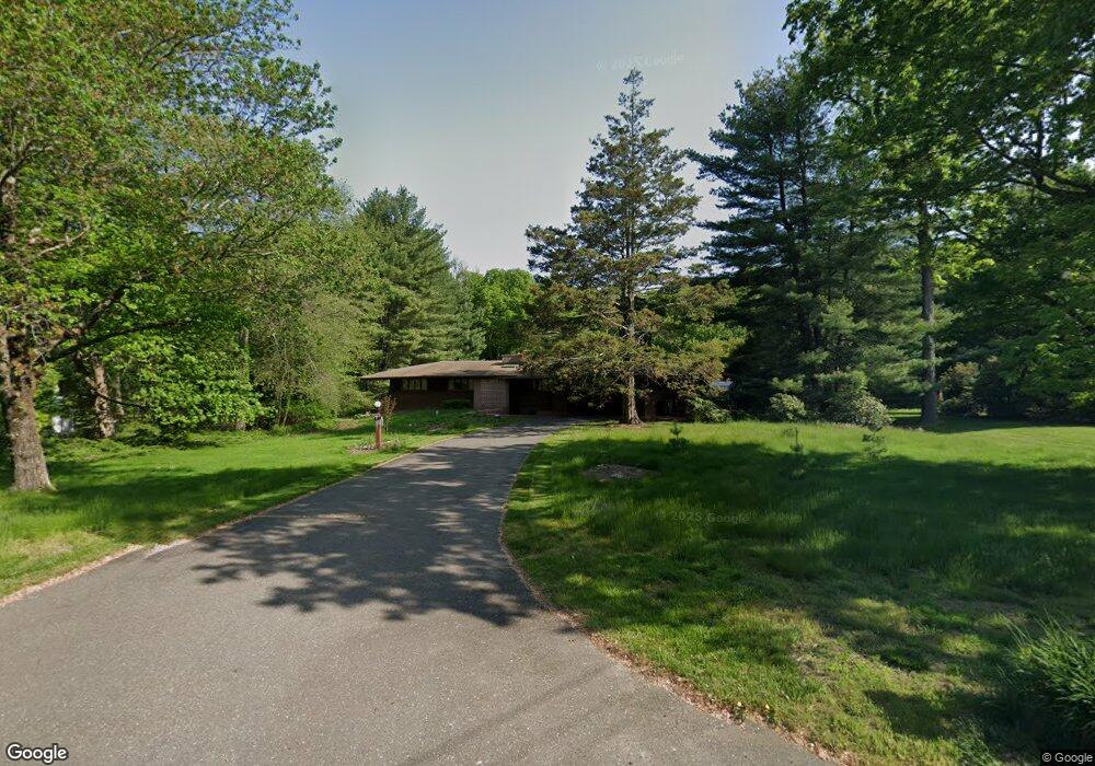
21 Macdonald Rd Trumbull, CT 06611
Nichols NeighborhoodEstimated Value: $705,000 - $787,939
4
Beds
4
Baths
1,626
Sq Ft
$456/Sq Ft
Est. Value
About This Home
This home is located at 21 Macdonald Rd, Trumbull, CT 06611 and is currently estimated at $741,735, approximately $456 per square foot. 21 Macdonald Rd is a home located in Fairfield County with nearby schools including Booth Hill School, Hillcrest Middle School, and Trumbull High School.
Ownership History
Date
Name
Owned For
Owner Type
Purchase Details
Closed on
Jul 17, 2007
Sold by
Warner Edward L and Warner Susan W
Bought by
Lavalle Thomas A and Lavalle Debra K
Current Estimated Value
Home Financials for this Owner
Home Financials are based on the most recent Mortgage that was taken out on this home.
Original Mortgage
$210,000
Outstanding Balance
$131,120
Interest Rate
6.48%
Estimated Equity
$610,615
Purchase Details
Closed on
May 1, 1997
Sold by
Szymanski Alfred L and Szymanski Shirley M
Bought by
Warner Susan W
Home Financials for this Owner
Home Financials are based on the most recent Mortgage that was taken out on this home.
Original Mortgage
$165,000
Interest Rate
7.85%
Mortgage Type
Unknown
Create a Home Valuation Report for This Property
The Home Valuation Report is an in-depth analysis detailing your home's value as well as a comparison with similar homes in the area
Home Values in the Area
Average Home Value in this Area
Purchase History
| Date | Buyer | Sale Price | Title Company |
|---|---|---|---|
| Lavalle Thomas A | $515,000 | -- | |
| Warner Susan W | $280,000 | -- |
Source: Public Records
Mortgage History
| Date | Status | Borrower | Loan Amount |
|---|---|---|---|
| Open | Warner Susan W | $210,000 | |
| Previous Owner | Warner Susan W | $350,000 | |
| Previous Owner | Warner Susan W | $212,750 | |
| Previous Owner | Warner Susan W | $165,000 |
Source: Public Records
Tax History
| Year | Tax Paid | Tax Assessment Tax Assessment Total Assessment is a certain percentage of the fair market value that is determined by local assessors to be the total taxable value of land and additions on the property. | Land | Improvement |
|---|---|---|---|---|
| 2025 | $11,935 | $322,910 | $154,210 | $168,700 |
| 2024 | $11,592 | $322,910 | $154,210 | $168,700 |
| 2023 | $11,415 | $322,910 | $154,210 | $168,700 |
| 2022 | $11,239 | $322,910 | $154,210 | $168,700 |
| 2021 | $127 | $264,600 | $140,840 | $123,760 |
| 2020 | $127 | $264,600 | $140,840 | $123,760 |
| 2018 | $9,306 | $264,600 | $140,840 | $123,760 |
| 2017 | $9,129 | $264,600 | $140,840 | $123,760 |
| 2016 | $8,958 | $264,600 | $140,840 | $123,760 |
| 2015 | $8,978 | $266,400 | $140,900 | $125,500 |
| 2014 | $8,786 | $266,400 | $140,900 | $125,500 |
Source: Public Records
Map
Nearby Homes
- 38 Macdonald Rd
- 2449 Huntington Turnpike
- 0 Pinewood Trail
- 7 Hemlock Trail
- 244 Strobel Rd
- 35 Greenfield Dr
- 10 Foxwood Rd
- 176 Strobel Rd
- 43 Woodmere Dr
- 0 Lot #4 & Lot #5 W Mischa Rd Unit 24138429
- 2 Doe Hollow Dr
- 23 Rolling Brook Ln
- 7 E Lake Rd
- 101 Golden Hill St
- 22 Beverly Rd
- 181 Isinglass Rd
- 40 Puritan Rd
- 3 Wheeler Dr
- 256 Nichols Ave
- 699 Daniels Farm Rd
- 15 Macdonald Rd
- 25 Macdonald Rd
- 9 Macdonald Rd
- 590 Booth Hill Rd
- 35 Macdonald Rd
- 24 Macdonald Rd
- 20 Macdonald Rd
- 37 Macdonald Rd
- 30 Macdonald Rd
- 596 Booth Hill Rd
- 22 Shadowood Ln
- 604 Booth Hill Rd
- 14 Macdonald Rd
- 34 Macdonald Rd
- 10 Macdonald Rd
- 2453 Huntington Turnpike
- 570 Booth Hill Rd
- 16 Shadowood Ln
- 36 Macdonald Rd
- 2459 Huntington Turnpike
Your Personal Tour Guide
Ask me questions while you tour the home.