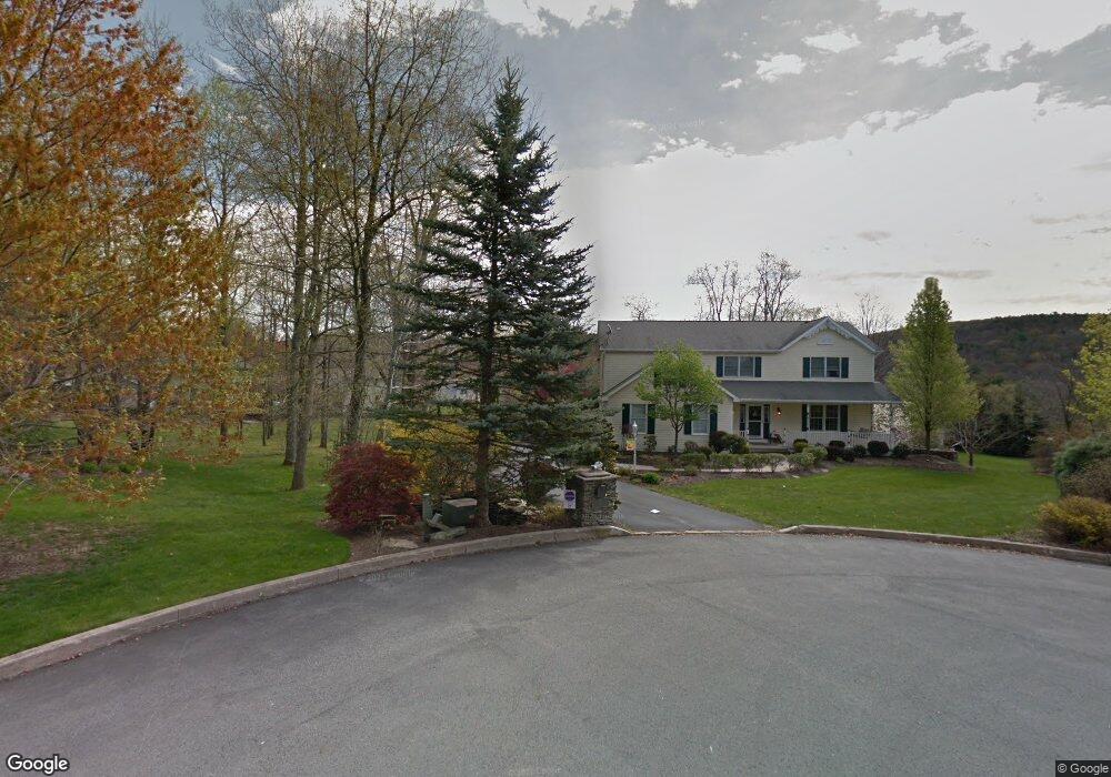
21 Maple Leaf Rd Shavertown, PA 18708
Estimated Value: $457,552 - $558,000
4
Beds
3
Baths
2,544
Sq Ft
$202/Sq Ft
Est. Value
About This Home
This home is located at 21 Maple Leaf Rd, Shavertown, PA 18708 and is currently estimated at $513,388, approximately $201 per square foot. 21 Maple Leaf Rd is a home located in Luzerne County with nearby schools including Dallas Senior High School.
Ownership History
Date
Name
Owned For
Owner Type
Purchase Details
Closed on
Jul 6, 2012
Sold by
White Jonathan J and White Nicole L
Bought by
Jacobs Tina M
Current Estimated Value
Home Financials for this Owner
Home Financials are based on the most recent Mortgage that was taken out on this home.
Original Mortgage
$263,920
Outstanding Balance
$179,157
Interest Rate
3.7%
Mortgage Type
New Conventional
Estimated Equity
$334,231
Create a Home Valuation Report for This Property
The Home Valuation Report is an in-depth analysis detailing your home's value as well as a comparison with similar homes in the area
Home Values in the Area
Average Home Value in this Area
Purchase History
| Date | Buyer | Sale Price | Title Company |
|---|---|---|---|
| Jacobs Tina M | $329,900 | None Available |
Source: Public Records
Mortgage History
| Date | Status | Borrower | Loan Amount |
|---|---|---|---|
| Open | Jacobs Tina M | $263,920 |
Source: Public Records
Tax History
| Year | Tax Paid | Tax Assessment Tax Assessment Total Assessment is a certain percentage of the fair market value that is determined by local assessors to be the total taxable value of land and additions on the property. | Land | Improvement |
|---|---|---|---|---|
| 2026 | $6,870 | $299,500 | $53,200 | $246,300 |
| 2025 | $6,486 | $299,500 | $53,200 | $246,300 |
| 2024 | $6,286 | $299,500 | $53,200 | $246,300 |
| 2023 | $6,286 | $299,500 | $53,200 | $246,300 |
| 2022 | $6,231 | $299,500 | $53,200 | $246,300 |
| 2021 | $6,231 | $299,500 | $53,200 | $246,300 |
| 2020 | $6,231 | $299,500 | $53,200 | $246,300 |
| 2019 | $6,172 | $299,500 | $53,200 | $246,300 |
| 2018 | $6,112 | $299,500 | $53,200 | $246,300 |
| 2017 | $6,024 | $299,500 | $53,200 | $246,300 |
| 2016 | -- | $299,500 | $53,200 | $246,300 |
| 2015 | -- | $289,500 | $53,200 | $236,300 |
| 2014 | -- | $289,500 | $53,200 | $236,300 |
Source: Public Records
Map
Nearby Homes
- 315 Echo Valley Dr
- 39 Cardinal Dr
- 665 Sparrow Dr
- 235 E Center St
- 3 N Pioneer Ave
- Lot # 4 Pioneer Ave
- 1021 Lower Demunds Rd
- 1004 Lower Demunds Rd
- 695 Main St
- 1000 Lower Demunds Rd
- 680 Main Rd
- 1074 Lower Demunds Rd
- 1259 Lower Demunds Rd
- 175 N Pioneer Ave
- 179 N Pioneer Ave
- 0 Lt Michael Cleary Dr
- 256 Kelly St
- 217 Parrish St
- 0 Route 309
- 0 Grandview Ave
Your Personal Tour Guide
Ask me questions while you tour the home.