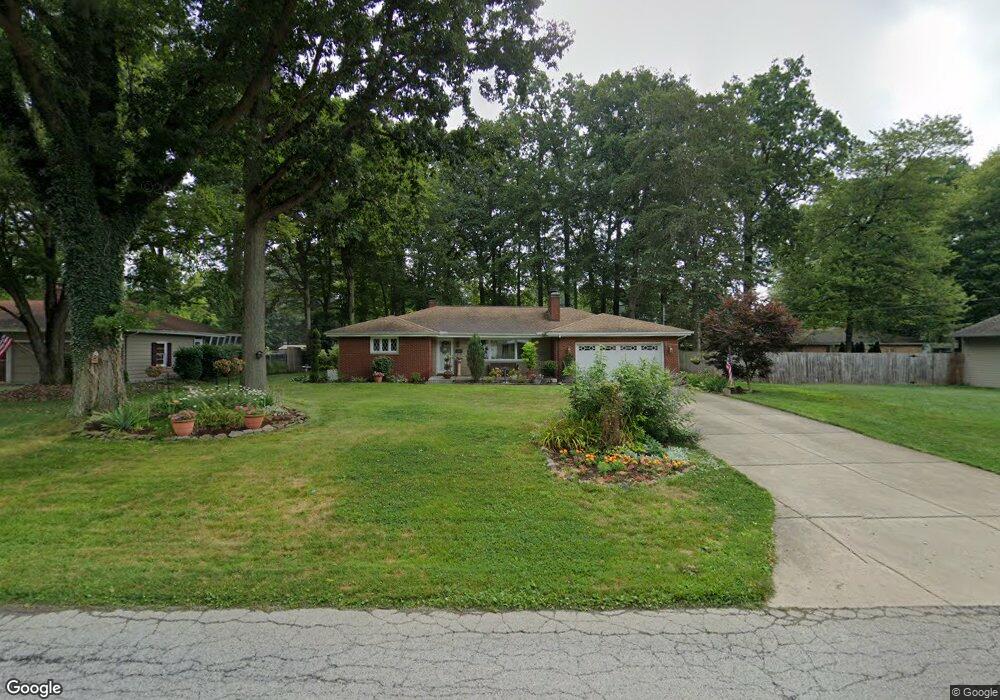
21 Mill Trace Rd Youngstown, OH 44511
Estimated Value: $196,000 - $228,000
3
Beds
2
Baths
1,667
Sq Ft
$127/Sq Ft
Est. Value
About This Home
This home is located at 21 Mill Trace Rd, Youngstown, OH 44511 and is currently estimated at $212,265, approximately $127 per square foot. 21 Mill Trace Rd is a home located in Mahoning County with nearby schools including West Boulevard Elementary School, Boardman Center Middle School, and Boardman High School.
Ownership History
Date
Name
Owned For
Owner Type
Purchase Details
Closed on
Apr 1, 1996
Sold by
Est Pauline D Hutch
Bought by
George Kevin P and George Sandra L
Current Estimated Value
Home Financials for this Owner
Home Financials are based on the most recent Mortgage that was taken out on this home.
Original Mortgage
$64,950
Interest Rate
6.49%
Mortgage Type
New Conventional
Purchase Details
Closed on
Jan 29, 1986
Bought by
Hutch Pauline D
Create a Home Valuation Report for This Property
The Home Valuation Report is an in-depth analysis detailing your home's value as well as a comparison with similar homes in the area
Home Values in the Area
Average Home Value in this Area
Purchase History
| Date | Buyer | Sale Price | Title Company |
|---|---|---|---|
| George Kevin P | $97,950 | -- | |
| Hutch Pauline D | -- | -- |
Source: Public Records
Mortgage History
| Date | Status | Borrower | Loan Amount |
|---|---|---|---|
| Closed | George Kevin P | $64,950 |
Source: Public Records
Tax History Compared to Growth
Tax History
| Year | Tax Paid | Tax Assessment Tax Assessment Total Assessment is a certain percentage of the fair market value that is determined by local assessors to be the total taxable value of land and additions on the property. | Land | Improvement |
|---|---|---|---|---|
| 2024 | $2,930 | $57,270 | $7,380 | $49,890 |
| 2023 | $2,891 | $57,270 | $7,380 | $49,890 |
| 2022 | $2,684 | $40,610 | $6,380 | $34,230 |
| 2021 | $2,684 | $40,610 | $6,380 | $34,230 |
| 2020 | $2,132 | $40,610 | $6,380 | $34,230 |
| 2019 | $1,929 | $33,840 | $5,310 | $28,530 |
| 2018 | $2,201 | $33,840 | $5,310 | $28,530 |
| 2017 | $1,317 | $33,840 | $5,310 | $28,530 |
| 2016 | $2,319 | $35,840 | $5,310 | $30,530 |
| 2015 | $2,273 | $35,840 | $5,310 | $30,530 |
| 2014 | $2,280 | $35,840 | $5,310 | $30,530 |
| 2013 | $2,251 | $35,840 | $5,310 | $30,530 |
Source: Public Records
Map
Nearby Homes
- 29 Gillian Ln
- 21.19 acres Truesdale and Lockwood Rd
- 990 Westport Dr
- 537 W Glen Dr
- 950 Donmar Ln
- 3927 Hopkins Rd
- 5200 West Blvd Unit 505
- 4478 Devonshire Dr Unit 1B
- 4042 Baymar Dr
- 272 Shields Rd
- 4225 Stratford Rd
- 5020 Friendship Ave
- 3726 Glenwood Ave
- 4141 Windsor Rd
- 2002 Canfield Rd
- 117 Overhill Rd
- 4250 Oak Knoll Dr
- 2981 Louise Rita Ct
- 2127 Hermosa Dr
- 3296 Cricket Dr
- 15 Mill Trace Rd
- 54 Gillian Ln
- 46 Gillian Ln
- 40 Gillian Ln
- 9 Mill Trace Rd
- 22 Mill Trace Rd
- 28 Mill Trace Rd
- 10 Mill Trace Rd
- 4485 Lockwood Blvd
- 57 Gillian Ln
- 4477 Lockwood Blvd
- 22 Gillian Ln
- 51 Gillian Ln
- 4 Mill Trace Rd
- 34 Mill Trace Rd
- 40 Mill Trace Rd
- 19 Lake Shore Dr
- 16 Gillian Ln
- 15 Lake Shore Dr
- 45 Gillian Ln