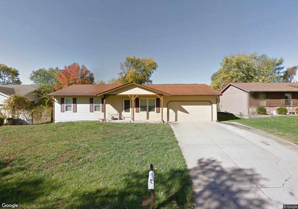
21 N Lang Dr O Fallon, MO 63366
Estimated Value: $272,000 - $292,000
3
Beds
2
Baths
1,200
Sq Ft
$234/Sq Ft
Est. Value
About This Home
This home is located at 21 N Lang Dr, O Fallon, MO 63366 and is currently estimated at $280,736, approximately $233 per square foot. 21 N Lang Dr is a home located in St. Charles County with nearby schools including Green Tree Elementary School, Wentzville South Middle School, and Timberland High School.
Ownership History
Date
Name
Owned For
Owner Type
Purchase Details
Closed on
Aug 24, 2005
Sold by
Clean As A Whistle Ltd
Bought by
Anderson Nancy S
Current Estimated Value
Home Financials for this Owner
Home Financials are based on the most recent Mortgage that was taken out on this home.
Original Mortgage
$115,200
Outstanding Balance
$59,912
Interest Rate
5.8%
Mortgage Type
Fannie Mae Freddie Mac
Estimated Equity
$220,824
Purchase Details
Closed on
Apr 19, 2005
Sold by
Halterman Jason
Bought by
Clean As A Whistle Ltd
Purchase Details
Closed on
Jul 7, 2000
Sold by
Karla K Santa Maria Michael J and Santa Maria
Bought by
Halterman Jason R
Home Financials for this Owner
Home Financials are based on the most recent Mortgage that was taken out on this home.
Original Mortgage
$95,450
Interest Rate
8.56%
Mortgage Type
FHA
Create a Home Valuation Report for This Property
The Home Valuation Report is an in-depth analysis detailing your home's value as well as a comparison with similar homes in the area
Home Values in the Area
Average Home Value in this Area
Purchase History
| Date | Buyer | Sale Price | Title Company |
|---|---|---|---|
| Anderson Nancy S | $144,000 | -- | |
| Clean As A Whistle Ltd | -- | -- | |
| Halterman Jason R | -- | -- |
Source: Public Records
Mortgage History
| Date | Status | Borrower | Loan Amount |
|---|---|---|---|
| Open | Anderson Nancy S | $115,200 | |
| Previous Owner | Halterman Jason R | $95,450 |
Source: Public Records
Tax History
| Year | Tax Paid | Tax Assessment Tax Assessment Total Assessment is a certain percentage of the fair market value that is determined by local assessors to be the total taxable value of land and additions on the property. | Land | Improvement |
|---|---|---|---|---|
| 2025 | $2,700 | $44,414 | -- | -- |
| 2023 | $2,698 | $40,960 | $0 | $0 |
| 2022 | $2,360 | $33,295 | $0 | $0 |
| 2021 | $2,359 | $33,295 | $0 | $0 |
| 2020 | $2,177 | $29,945 | $0 | $0 |
| 2019 | $2,021 | $29,945 | $0 | $0 |
| 2018 | $1,817 | $25,600 | $0 | $0 |
| 2017 | $1,808 | $25,600 | $0 | $0 |
| 2016 | $1,744 | $24,533 | $0 | $0 |
| 2015 | $1,712 | $24,533 | $0 | $0 |
| 2014 | $1,527 | $22,404 | $0 | $0 |
Source: Public Records
Map
Nearby Homes
- 7 King Cir
- 263 Tyndale Dr
- 1012 Delmar Dr
- 2 Royal Dr
- 856 Brookmead Dr
- 1382 Apple Valley Dr
- 703 Norwood Terrace
- 680 Lakewood Dr
- 1373 Sunburst Dr
- 219 Place
- 136 Columbia Meadows Ln
- 655 Lakewood Dr
- 1 Grand Columbia @ Columbia Meadows
- 1 Columbia @ Columbia Meadows
- 1 Grand Columbia II @ Columbia Meadows
- 220 Discovery Meadows Place
- 127 Columbia Meadows Ln
- 4 Challenger Ct
- 105 Columbia Meadows Ln
- 116 Columbia Meadows Ln
Your Personal Tour Guide
Ask me questions while you tour the home.