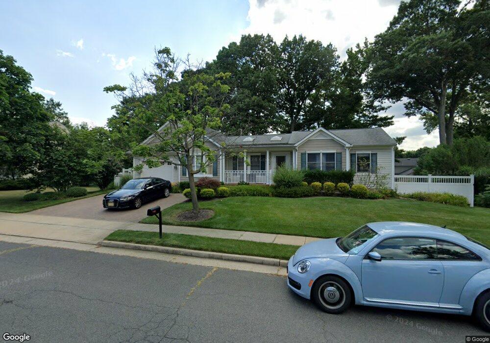
21 Netherwood Cir Edison, NJ 08820
Estimated Value: $737,243 - $928,000
--
Bed
--
Bath
1,764
Sq Ft
$466/Sq Ft
Est. Value
About This Home
This home is located at 21 Netherwood Cir, Edison, NJ 08820 and is currently estimated at $821,311, approximately $465 per square foot. 21 Netherwood Cir is a home located in Middlesex County with nearby schools including James Madison Primary School, James Madison Intermediate School, and John Adams Middle School.
Ownership History
Date
Name
Owned For
Owner Type
Purchase Details
Closed on
May 25, 2000
Sold by
Mintzer Gertrude
Bought by
Kausch Paul and Kausch Barbara
Current Estimated Value
Home Financials for this Owner
Home Financials are based on the most recent Mortgage that was taken out on this home.
Original Mortgage
$190,800
Outstanding Balance
$65,821
Interest Rate
8.12%
Estimated Equity
$755,490
Create a Home Valuation Report for This Property
The Home Valuation Report is an in-depth analysis detailing your home's value as well as a comparison with similar homes in the area
Home Values in the Area
Average Home Value in this Area
Purchase History
| Date | Buyer | Sale Price | Title Company |
|---|---|---|---|
| Kausch Paul | $212,000 | -- |
Source: Public Records
Mortgage History
| Date | Status | Borrower | Loan Amount |
|---|---|---|---|
| Open | Kausch Paul | $190,800 |
Source: Public Records
Tax History Compared to Growth
Tax History
| Year | Tax Paid | Tax Assessment Tax Assessment Total Assessment is a certain percentage of the fair market value that is determined by local assessors to be the total taxable value of land and additions on the property. | Land | Improvement |
|---|---|---|---|---|
| 2025 | $13,769 | $231,300 | $101,600 | $129,700 |
| 2024 | $13,695 | $231,300 | $101,600 | $129,700 |
| 2023 | $13,695 | $231,300 | $101,600 | $129,700 |
| 2022 | $13,700 | $231,300 | $101,600 | $129,700 |
| 2021 | $13,145 | $231,300 | $101,600 | $129,700 |
| 2020 | $13,529 | $231,300 | $101,600 | $129,700 |
| 2019 | $12,253 | $231,300 | $101,600 | $129,700 |
| 2018 | $12,030 | $231,300 | $101,600 | $129,700 |
| 2017 | $11,914 | $231,300 | $101,600 | $129,700 |
| 2016 | $11,695 | $231,300 | $101,600 | $129,700 |
| 2015 | $11,250 | $231,300 | $101,600 | $129,700 |
| 2014 | $10,931 | $231,300 | $101,600 | $129,700 |
Source: Public Records
Map
Nearby Homes
- 9A Wakefield Dr
- 9 Wakefield Dr
- 975 Inman Ave
- 990 Inman Ave
- 6 Quaker St
- 6 Wintergreen Ave E
- 9 Vallata Place
- 24 Sandalwood Dr
- 984 Feather Bed Ln
- 1505 Maplecrest Rd
- 6 Tulip Ct
- 868 Inman Ave
- 11 Bernice St
- 35 Revere Blvd
- 87 Ellmyer Rd
- 3606 Spring Brook Dr
- 5104 Stonehedge Rd
- 4807 Stonehedge Rd
- 38 Revere Blvd
- 3606 Springbrook Dr
- 61 Netherwood Cir
- 23 Netherwood Cir
- 19 Netherwood Cir
- 67 Netherwood Cir
- 59 Netherwood Cir
- 22 Netherwood Cir
- 24 Netherwood Cir
- 25 Netherwood Cir
- 20 Netherwood Cir
- 57 Netherwood Cir
- 26 Netherwood Cir
- 13 Netherwood Cir
- 18 Netherwood Cir
- 20 Sinclair Rd
- 62 Netherwood Cir
- 22 Sinclair Rd
- 72 Netherwood Cir
- 27 Netherwood Cir
- 55 Netherwood Cir
- 28 Netherwood Cir