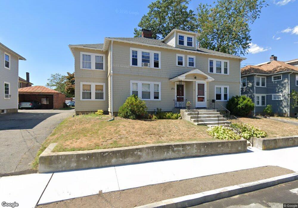
21 Noble St Unit 23 West Newton, MA 02465
West Newton NeighborhoodEstimated Value: $1,277,000 - $1,365,909
4
Beds
2
Baths
2,664
Sq Ft
$496/Sq Ft
Est. Value
About This Home
This home is located at 21 Noble St Unit 23, West Newton, MA 02465 and is currently estimated at $1,320,977, approximately $495 per square foot. 21 Noble St Unit 23 is a home located in Middlesex County with nearby schools including Franklin Elementary School, F.A. Day Middle School, and Newton North High School.
Ownership History
Date
Name
Owned For
Owner Type
Purchase Details
Closed on
Mar 25, 2021
Sold by
Colangione Lynn and Baskin Lauren
Bought by
21-23 Noble Street Rt
Current Estimated Value
Purchase Details
Closed on
Jul 31, 2018
Sold by
Lim Epstein Nt
Bought by
Baskin Lauren and Colangione Lynn
Home Financials for this Owner
Home Financials are based on the most recent Mortgage that was taken out on this home.
Original Mortgage
$535,000
Interest Rate
4.6%
Mortgage Type
New Conventional
Create a Home Valuation Report for This Property
The Home Valuation Report is an in-depth analysis detailing your home's value as well as a comparison with similar homes in the area
Home Values in the Area
Average Home Value in this Area
Purchase History
| Date | Buyer | Sale Price | Title Company |
|---|---|---|---|
| 21-23 Noble Street Rt | -- | None Available | |
| Baskin Lauren | $835,000 | -- |
Source: Public Records
Mortgage History
| Date | Status | Borrower | Loan Amount |
|---|---|---|---|
| Previous Owner | Baskin Lauren | $535,000 |
Source: Public Records
Tax History Compared to Growth
Tax History
| Year | Tax Paid | Tax Assessment Tax Assessment Total Assessment is a certain percentage of the fair market value that is determined by local assessors to be the total taxable value of land and additions on the property. | Land | Improvement |
|---|---|---|---|---|
| 2025 | $9,898 | $1,010,000 | $664,700 | $345,300 |
| 2024 | $9,571 | $980,600 | $645,300 | $335,300 |
| 2023 | $8,990 | $883,100 | $513,300 | $369,800 |
| 2022 | $8,602 | $817,700 | $475,300 | $342,400 |
| 2021 | $8,072 | $750,200 | $436,100 | $314,100 |
| 2020 | $7,832 | $750,200 | $436,100 | $314,100 |
| 2019 | $6,819 | $652,500 | $407,600 | $244,900 |
| 2018 | $6,760 | $624,800 | $385,000 | $239,800 |
| 2017 | $6,374 | $573,200 | $353,200 | $220,000 |
| 2016 | $5,985 | $525,900 | $324,000 | $201,900 |
| 2015 | $5,706 | $491,500 | $302,800 | $188,700 |
Source: Public Records
Map
Nearby Homes
- 24 Tolman St Unit A
- 31-37 Washington Ave
- 11 Derby St
- 75 Cherry St
- 138 Myrtle St Unit 2
- 162 Myrtle St Unit 1
- 265-267 River St Unit 267
- 265-267 River St Unit 265
- 56 Dearborn St
- 81 Alder St
- 47 Alder St Unit 6
- 40 Myrtle St Unit 9
- 312 Newton St Unit 1A
- 73 Orange St Unit 2
- 44 Westland Ave
- 308 Newton St Unit 1
- 42 Alder St
- 15 Alder St Unit 1
- 101-103 Lexington St
- 76 Taft Ave Unit 1
- 27 Noble St Unit 1
- 27 Noble St Unit 29
- 27 Noble St Unit 27
- 17 Noble St
- 15 Noble St
- 15 Noble St Unit 15
- 15 Noble St Unit 2
- 17 Noble St Unit 17
- 17 Noble St Unit 1
- 29 Noble St Unit 1
- 29 Noble St Unit 29
- 22 Milo St Unit 24
- 22 Milo St Unit 24
- 22 Milo St Unit 2
- 22 Milo St Unit 22
- 16-18 Milo St
- 16 Milo St Unit 18
- 16 Milo St
- 18 Milo St
- 18 Milo St