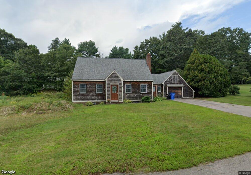
21 Phillips Ln Wrentham, MA 02093
Estimated Value: $370,000 - $566,132
2
Beds
1
Bath
864
Sq Ft
$572/Sq Ft
Est. Value
About This Home
This home is located at 21 Phillips Ln, Wrentham, MA 02093 and is currently estimated at $494,033, approximately $571 per square foot. 21 Phillips Ln is a home located in Norfolk County with nearby schools including Delaney Elementary School and Charles E Roderick.
Ownership History
Date
Name
Owned For
Owner Type
Purchase Details
Closed on
Oct 25, 2018
Sold by
Washer Jason H and Washer Barbara H
Bought by
Slade Rebecca J and Curley Sharan L
Current Estimated Value
Purchase Details
Closed on
Dec 16, 1965
Bought by
Washer Jason H and Washer Barbara H
Create a Home Valuation Report for This Property
The Home Valuation Report is an in-depth analysis detailing your home's value as well as a comparison with similar homes in the area
Home Values in the Area
Average Home Value in this Area
Purchase History
| Date | Buyer | Sale Price | Title Company |
|---|---|---|---|
| Slade Rebecca J | -- | -- | |
| Washer Jason H | -- | -- |
Source: Public Records
Mortgage History
| Date | Status | Borrower | Loan Amount |
|---|---|---|---|
| Previous Owner | Washer Jason H | $75,000 |
Source: Public Records
Tax History Compared to Growth
Tax History
| Year | Tax Paid | Tax Assessment Tax Assessment Total Assessment is a certain percentage of the fair market value that is determined by local assessors to be the total taxable value of land and additions on the property. | Land | Improvement |
|---|---|---|---|---|
| 2025 | $5,834 | $503,400 | $289,200 | $214,200 |
| 2024 | $5,855 | $487,900 | $289,200 | $198,700 |
| 2023 | $5,582 | $442,300 | $263,000 | $179,300 |
| 2022 | $5,390 | $394,300 | $245,400 | $148,900 |
| 2021 | $5,006 | $355,800 | $214,200 | $141,600 |
| 2020 | $4,980 | $349,500 | $190,500 | $159,000 |
| 2019 | $4,821 | $341,400 | $190,500 | $150,900 |
| 2018 | $4,513 | $316,900 | $190,600 | $126,300 |
| 2017 | $4,321 | $303,200 | $186,900 | $116,300 |
| 2016 | $4,244 | $297,200 | $181,500 | $115,700 |
| 2015 | $4,158 | $277,600 | $174,500 | $103,100 |
| 2014 | $4,111 | $268,500 | $167,800 | $100,700 |
Source: Public Records
Map
Nearby Homes
- 570 Franklin St
- 10 Nature View Dr
- 15 Nature View Dr
- 270 Dedham St
- 246 Forest Grove Ave
- 50 Reed Fulton Ave Unit Lot 61
- 1 Lorraine Metcalf Dr
- 131 Creek St Unit 7
- 45 Joshua Rd
- 3 Oak Rd
- 11 Earle Stewart Ln
- Lot 3 - 14 Earle Stewart Ln
- Lot 1 - Blueberry 2 Car Plan at King Philip Estates
- Lot 8 - Blueberry 2 Car Plan at King Philip Estates
- Lot 5 - Hughes 2 car Plan at King Philip Estates
- Lot 6 - Blueberry 3 Car Plan at King Philip Estates
- Lot 2 - Camden 2 Car Plan at King Philip Estates
- Lot 7 - Cedar Plan at King Philip Estates
- Lot 4 - Hemingway 2 Car Plan at King Philip Estates
- Lot 3 - Blueberry 2 Car Plan at King Philip Estates