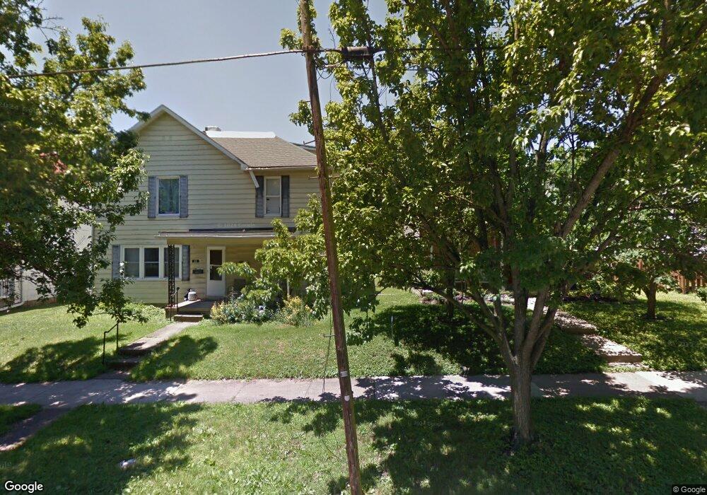
21 Raymond Dr Athens, OH 45701
Estimated Value: $144,000 - $243,000
3
Beds
3
Baths
1,622
Sq Ft
$107/Sq Ft
Est. Value
About This Home
This home is located at 21 Raymond Dr, Athens, OH 45701 and is currently estimated at $173,672, approximately $107 per square foot. 21 Raymond Dr is a home located in Athens County with nearby schools including West Elementary School, Athens Middle School, and Athens High School.
Ownership History
Date
Name
Owned For
Owner Type
Purchase Details
Closed on
Jan 22, 2014
Sold by
Ragg Steven J and Kronberg Christy M
Bought by
Blue Shoe Equity Llc
Current Estimated Value
Purchase Details
Closed on
Jun 16, 2003
Sold by
Conrath Larry F and Conrath Shelley R
Bought by
Shelton Randall W
Purchase Details
Closed on
Jan 3, 2001
Sold by
Lewis Rita A
Bought by
Conrath Larry F and Conrath Shelley R
Purchase Details
Closed on
May 16, 2000
Sold by
Lewis L Franklin
Bought by
Lewis Rita A
Create a Home Valuation Report for This Property
The Home Valuation Report is an in-depth analysis detailing your home's value as well as a comparison with similar homes in the area
Home Values in the Area
Average Home Value in this Area
Purchase History
| Date | Buyer | Sale Price | Title Company |
|---|---|---|---|
| Blue Shoe Equity Llc | -- | Attorney | |
| Shelton Randall W | $59,500 | -- | |
| Conrath Larry F | $39,500 | -- | |
| Lewis Rita A | -- | -- |
Source: Public Records
Tax History Compared to Growth
Tax History
| Year | Tax Paid | Tax Assessment Tax Assessment Total Assessment is a certain percentage of the fair market value that is determined by local assessors to be the total taxable value of land and additions on the property. | Land | Improvement |
|---|---|---|---|---|
| 2024 | $2,323 | $42,520 | $5,970 | $36,550 |
| 2023 | $2,150 | $42,520 | $5,970 | $36,550 |
| 2022 | $1,827 | $34,520 | $5,970 | $28,550 |
| 2021 | $1,835 | $34,520 | $5,970 | $28,550 |
| 2020 | $1,780 | $34,520 | $5,970 | $28,550 |
| 2019 | $1,727 | $33,050 | $5,360 | $27,690 |
| 2018 | $1,705 | $33,050 | $5,360 | $27,690 |
| 2017 | $2,944 | $33,050 | $5,360 | $27,690 |
| 2016 | $1,473 | $29,510 | $5,100 | $24,410 |
| 2015 | $2,695 | $29,510 | $5,100 | $24,410 |
| 2014 | $2,695 | $29,510 | $5,100 | $24,410 |
| 2013 | $2,718 | $30,580 | $5,100 | $25,480 |
Source: Public Records
Map
Nearby Homes
- 87 Central Ave
- 18 Clarke St
- 98 Central Ave
- 6980 Salem St
- 56.15/15.5 Central & Clark
- 13 Hanlin Ave
- 10 1st St
- 29 Hanlin Ave
- 15 S Shafer St Unit 201
- 15 S Shafer St Unit 1701
- 31 1st St
- 7 Elizabeth Dr
- 12 Walker St
- 41 N Lancaster St
- 0 Roberts St
- 2 & 2.5 Columbia
- 31 Blick Ave
- 71 W Washington St
- 550 W Union St
- 88 University Estates Blvd