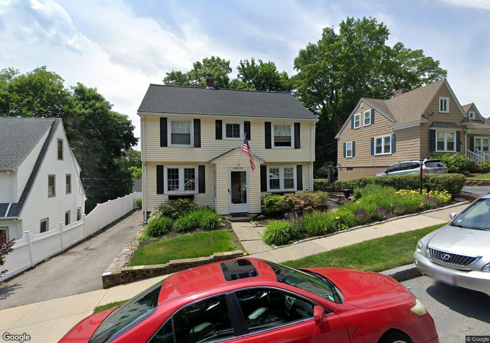
21 Rob Roy Rd Worcester, MA 01602
Newton Square NeighborhoodEstimated Value: $417,000 - $538,000
3
Beds
2
Baths
2,061
Sq Ft
$239/Sq Ft
Est. Value
About This Home
This home is located at 21 Rob Roy Rd, Worcester, MA 01602 and is currently estimated at $492,890, approximately $239 per square foot. 21 Rob Roy Rd is a home located in Worcester County with nearby schools including Chandler Magnet, Jacob Hiatt Magnet School, and May Street Elementary School.
Ownership History
Date
Name
Owned For
Owner Type
Purchase Details
Closed on
Jun 23, 2022
Sold by
Lacouture Patricia A
Bought by
Lacouture Ft
Current Estimated Value
Purchase Details
Closed on
Feb 20, 1992
Sold by
Delaney William R and Delaney Paula
Bought by
Malatesta Patricia
Create a Home Valuation Report for This Property
The Home Valuation Report is an in-depth analysis detailing your home's value as well as a comparison with similar homes in the area
Home Values in the Area
Average Home Value in this Area
Purchase History
| Date | Buyer | Sale Price | Title Company |
|---|---|---|---|
| Lacouture Ft | -- | None Available | |
| Malatesta Patricia | $128,000 | -- |
Source: Public Records
Mortgage History
| Date | Status | Borrower | Loan Amount |
|---|---|---|---|
| Previous Owner | Malatesta Patricia | $53,800 | |
| Previous Owner | Malatesta Patricia | $130,000 |
Source: Public Records
Tax History
| Year | Tax Paid | Tax Assessment Tax Assessment Total Assessment is a certain percentage of the fair market value that is determined by local assessors to be the total taxable value of land and additions on the property. | Land | Improvement |
|---|---|---|---|---|
| 2025 | $6,183 | $468,800 | $113,700 | $355,100 |
| 2024 | $6,032 | $438,700 | $113,700 | $325,000 |
| 2023 | $5,809 | $405,100 | $98,900 | $306,200 |
| 2022 | $5,374 | $353,300 | $79,100 | $274,200 |
| 2021 | $5,322 | $326,900 | $63,300 | $263,600 |
| 2020 | $5,132 | $301,900 | $63,300 | $238,600 |
| 2019 | $5,132 | $285,100 | $56,900 | $228,200 |
| 2018 | $5,068 | $268,000 | $56,900 | $211,100 |
| 2017 | $4,849 | $252,300 | $56,900 | $195,400 |
| 2016 | $4,883 | $236,900 | $42,000 | $194,900 |
| 2015 | $4,399 | $219,200 | $42,000 | $177,200 |
| 2014 | $4,271 | $218,600 | $42,000 | $176,600 |
Source: Public Records
Map
Nearby Homes
- 24 Hadwen Rd
- 16 Sherwood Rd
- 18 Hadwen Ln
- 33 Carlisle St
- 60 June St
- 108 Longfellow Rd
- 32 Zenith Dr
- 15 Longfellow Rd
- 19 Kenilworth Rd
- 3A Chalmers Rd
- 6 Newton Ave
- 19 Highland Terrace
- 3 Suburban Rd
- 6 Ludington Rd
- 34 Rosslare Dr Unit 108
- 31 Lenox St
- 7 Longworth Rd
- 47R Yarnie Unit 3A
- 47R Yarnie Unit 1B
- 47R Yarnie Unit 2B
Your Personal Tour Guide
Ask me questions while you tour the home.