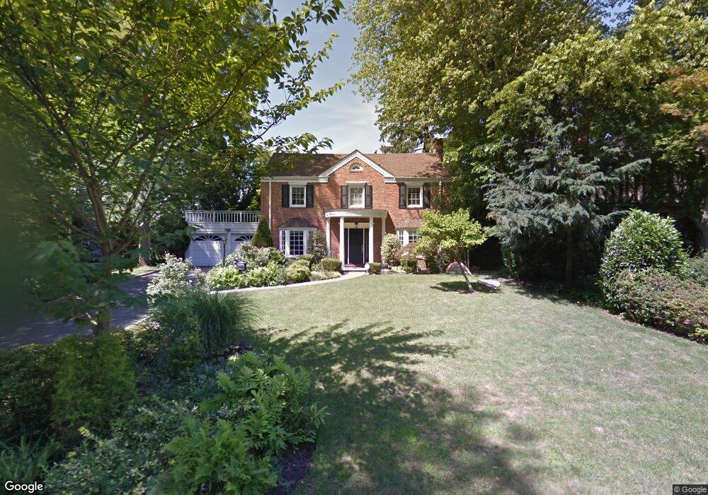
21 Rockcrest Rd Manhasset, NY 11030
Estimated Value: $2,030,000 - $2,072,523
4
Beds
3
Baths
2,295
Sq Ft
$894/Sq Ft
Est. Value
About This Home
This home is located at 21 Rockcrest Rd, Manhasset, NY 11030 and is currently estimated at $2,051,262, approximately $893 per square foot. 21 Rockcrest Rd is a home located in Nassau County with nearby schools including Manhasset Secondary School, St Mary's Elementary School, and Our Lady of Grace Montessori School.
Ownership History
Date
Name
Owned For
Owner Type
Purchase Details
Closed on
Jan 7, 2021
Sold by
Kang David and Kang Yoonsun
Bought by
Kang Yoonsun
Current Estimated Value
Purchase Details
Closed on
Sep 23, 2014
Sold by
Dalessio Richard M and Dalessio Alecia Fox
Bought by
Dalessio Richard and Richard Dalessio Trust
Purchase Details
Closed on
Jun 30, 2010
Sold by
Meyer Louise R
Bought by
Dalessio Richard M and Fox-Dalessio Alecia
Home Financials for this Owner
Home Financials are based on the most recent Mortgage that was taken out on this home.
Original Mortgage
$50,250
Outstanding Balance
$33,558
Interest Rate
4.82%
Mortgage Type
Credit Line Revolving
Estimated Equity
$2,017,704
Purchase Details
Closed on
Jan 15, 2002
Create a Home Valuation Report for This Property
The Home Valuation Report is an in-depth analysis detailing your home's value as well as a comparison with similar homes in the area
Home Values in the Area
Average Home Value in this Area
Purchase History
| Date | Buyer | Sale Price | Title Company |
|---|---|---|---|
| Kang Yoonsun | -- | Chicago Title | |
| Dalessio Richard | -- | None Available | |
| Dalessio Richard M | $975,000 | -- | |
| -- | -- | -- |
Source: Public Records
Mortgage History
| Date | Status | Borrower | Loan Amount |
|---|---|---|---|
| Open | Dalessio Richard M | $50,250 |
Source: Public Records
Tax History
| Year | Tax Paid | Tax Assessment Tax Assessment Total Assessment is a certain percentage of the fair market value that is determined by local assessors to be the total taxable value of land and additions on the property. | Land | Improvement |
|---|---|---|---|---|
| 2025 | $22,193 | $1,369 | $801 | $568 |
| 2024 | $7,215 | $1,369 | $801 | $568 |
Source: Public Records
Map
Nearby Homes
- 15 Hilltop Dr
- 183 Mill Spring Rd
- 207 Mill Spring Rd
- 65 Old Mill Rd
- 96 Quaker Ridge Rd
- 10 Soundview Crest
- 409 Abbey Rd
- 25 Shelter Rock Rd
- 448 Abbey Rd N
- 304 Aerie Ct
- 44 Old ox Rd
- 32 Barnard Place
- 26 the Hemlocks
- 67 Knollwood Rd
- 45 Bristol Dr
- 126 Northwoods Rd
- 23 Estates Terrace N
- 305 Nassau Ave
- 43 Bristol Dr
- 38 Mason Dr
Your Personal Tour Guide
Ask me questions while you tour the home.