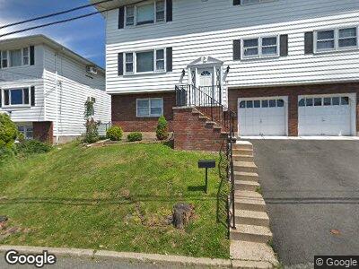
21 Rockland Ave Unit 2 Woodland Park, NJ 07424
Estimated Value: $646,000 - $775,000
3
Beds
1
Bath
3,152
Sq Ft
$219/Sq Ft
Est. Value
About This Home
This home is located at 21 Rockland Ave Unit 2, Woodland Park, NJ 07424 and is currently estimated at $688,826, approximately $218 per square foot. 21 Rockland Ave Unit 2 is a home located in Passaic County with nearby schools including Charles Olbon School, Beatrice Gilmore Elementary School, and Memorial Middle School.
Ownership History
Date
Name
Owned For
Owner Type
Purchase Details
Closed on
Mar 24, 2022
Sold by
John Nolfo
Bought by
Perez Madayi
Current Estimated Value
Home Financials for this Owner
Home Financials are based on the most recent Mortgage that was taken out on this home.
Original Mortgage
$472,500
Outstanding Balance
$449,678
Interest Rate
4.42%
Mortgage Type
New Conventional
Estimated Equity
$261,484
Purchase Details
Closed on
Mar 30, 2007
Sold by
Nolfo Josephine M L
Bought by
Nolfo Salvatore
Home Financials for this Owner
Home Financials are based on the most recent Mortgage that was taken out on this home.
Original Mortgage
$300,000
Interest Rate
6.21%
Mortgage Type
New Conventional
Create a Home Valuation Report for This Property
The Home Valuation Report is an in-depth analysis detailing your home's value as well as a comparison with similar homes in the area
Home Values in the Area
Average Home Value in this Area
Purchase History
| Date | Buyer | Sale Price | Title Company |
|---|---|---|---|
| Perez Madayi | $648,500 | New Title Company Name | |
| Nolfo Salvatore | $240,000 | -- |
Source: Public Records
Mortgage History
| Date | Status | Borrower | Loan Amount |
|---|---|---|---|
| Open | Perez Madayi | $472,500 | |
| Previous Owner | Nolfo Salavatore | $269,800 | |
| Previous Owner | Nolfo Salvatore | $300,000 |
Source: Public Records
Tax History Compared to Growth
Tax History
| Year | Tax Paid | Tax Assessment Tax Assessment Total Assessment is a certain percentage of the fair market value that is determined by local assessors to be the total taxable value of land and additions on the property. | Land | Improvement |
|---|---|---|---|---|
| 2024 | $10,995 | $334,900 | $138,400 | $196,500 |
| 2022 | $11,012 | $334,900 | $138,400 | $196,500 |
| 2021 | $10,868 | $334,900 | $138,400 | $196,500 |
| 2020 | $10,670 | $334,900 | $138,400 | $196,500 |
| 2019 | $10,432 | $334,900 | $138,400 | $196,500 |
| 2018 | $10,586 | $334,900 | $138,400 | $196,500 |
| 2017 | $10,312 | $334,900 | $138,400 | $196,500 |
| 2016 | $10,147 | $334,900 | $138,400 | $196,500 |
| 2015 | $9,926 | $334,900 | $138,400 | $196,500 |
| 2014 | $9,585 | $354,600 | $153,400 | $201,200 |
Source: Public Records
Map
Nearby Homes
- 230 Salomone Ave
- 40 Ridgeview Dr
- 19 Borrego Dr
- 1 Taft Ave
- 181 Squirrelwood Rd
- 37 Highview Dr
- 80-84 Cedarhurst Ave
- 18 Cedarhurst Ave
- 113 Hillcrest Ave
- 3 Parkside Terrace Unit 2D
- 56 Newby Ave
- 40 Meriline Ave
- 13 Hillery St
- 12 Meriline Ave
- 375 Rifle Camp Rd
- 375 Rifle Camp Rd Unit 106
- 512 Mcbride Ave
- 12 Borkowski Place
- 94 Quartz Ln
- 36-60 Mountain Ave