Estimated Value: $294,321 - $508,000
4
Beds
3
Baths
1,820
Sq Ft
$204/Sq Ft
Est. Value
About This Home
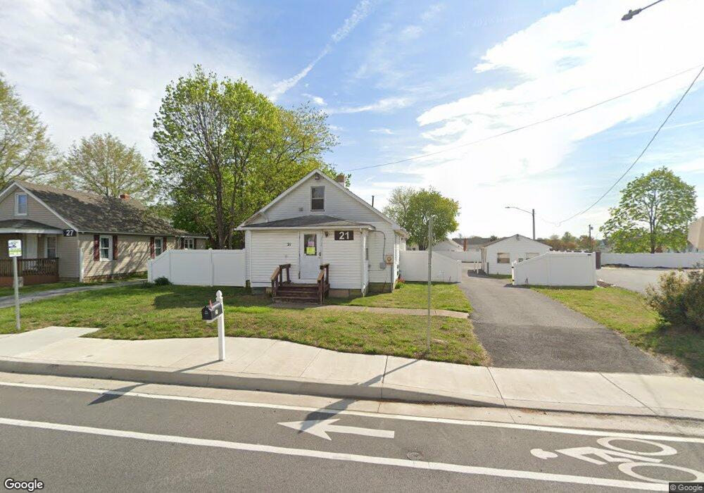
This home is located at 21 Saulsbury Rd, Dover, DE 19904 and is currently estimated at $370,830, approximately $203 per square foot. 21 Saulsbury Rd is a home located in Kent County with nearby schools including Booker T. Washington Elementary School, William Henry Middle School, and Central Middle School.
Ownership History
Date
Name
Owned For
Owner Type
Purchase Details
Closed on
Apr 29, 2009
Sold by
Anderson Tolano D and Anderson Cathy
Bought by
Faithwork Llc
Current Estimated Value
Purchase Details
Closed on
Feb 2, 2006
Sold by
Harvest Years Senior Center Inc
Bought by
Anderson Tolano B and Anderson Cathy
Home Financials for this Owner
Home Financials are based on the most recent Mortgage that was taken out on this home.
Original Mortgage
$264,000
Interest Rate
6.23%
Mortgage Type
Future Advance Clause Open End Mortgage
Create a Home Valuation Report for This Property
The Home Valuation Report is an in-depth analysis detailing your home's value as well as a comparison with similar homes in the area
Home Values in the Area
Average Home Value in this Area
Purchase History
| Date | Buyer | Sale Price | Title Company |
|---|---|---|---|
| Faithwork Llc | -- | None Available | |
| Anderson Tolano B | $300,000 | None Available |
Source: Public Records
Mortgage History
| Date | Status | Borrower | Loan Amount |
|---|---|---|---|
| Previous Owner | Anderson Tolano B | $264,000 |
Source: Public Records
Tax History Compared to Growth
Tax History
| Year | Tax Paid | Tax Assessment Tax Assessment Total Assessment is a certain percentage of the fair market value that is determined by local assessors to be the total taxable value of land and additions on the property. | Land | Improvement |
|---|---|---|---|---|
| 2025 | $995 | $230,600 | $59,200 | $171,400 |
| 2024 | $995 | $230,600 | $59,200 | $171,400 |
| 2023 | $995 | $33,800 | $5,200 | $28,600 |
| 2022 | $962 | $33,800 | $5,200 | $28,600 |
| 2021 | $927 | $33,800 | $5,200 | $28,600 |
| 2020 | $895 | $33,800 | $5,200 | $28,600 |
| 2019 | $846 | $33,800 | $5,200 | $28,600 |
| 2018 | $772 | $33,800 | $5,200 | $28,600 |
| 2017 | $759 | $33,800 | $0 | $0 |
| 2016 | $762 | $33,800 | $0 | $0 |
| 2015 | $721 | $32,000 | $0 | $0 |
| 2014 | $723 | $32,000 | $0 | $0 |
Source: Public Records
Map
Nearby Homes
- 949 Lincoln St
- 862 Forest St
- 134 Reese St
- 735 W North St
- 1240 Andrew Dr
- 133 Meetinghouse Ln
- 420 W Division St
- 118 N Queen St
- 130 N Queen St
- 411 W Reed St
- 109 S Queen St
- 305 W Reed St
- 225 N New St
- 512 Ann Moore St
- 214 W Division St
- 34 N Governors Ave
- 30 N Governors Ave
- 217 W Reed St
- 54 S Governors Ave
- 8 S Governors Ave