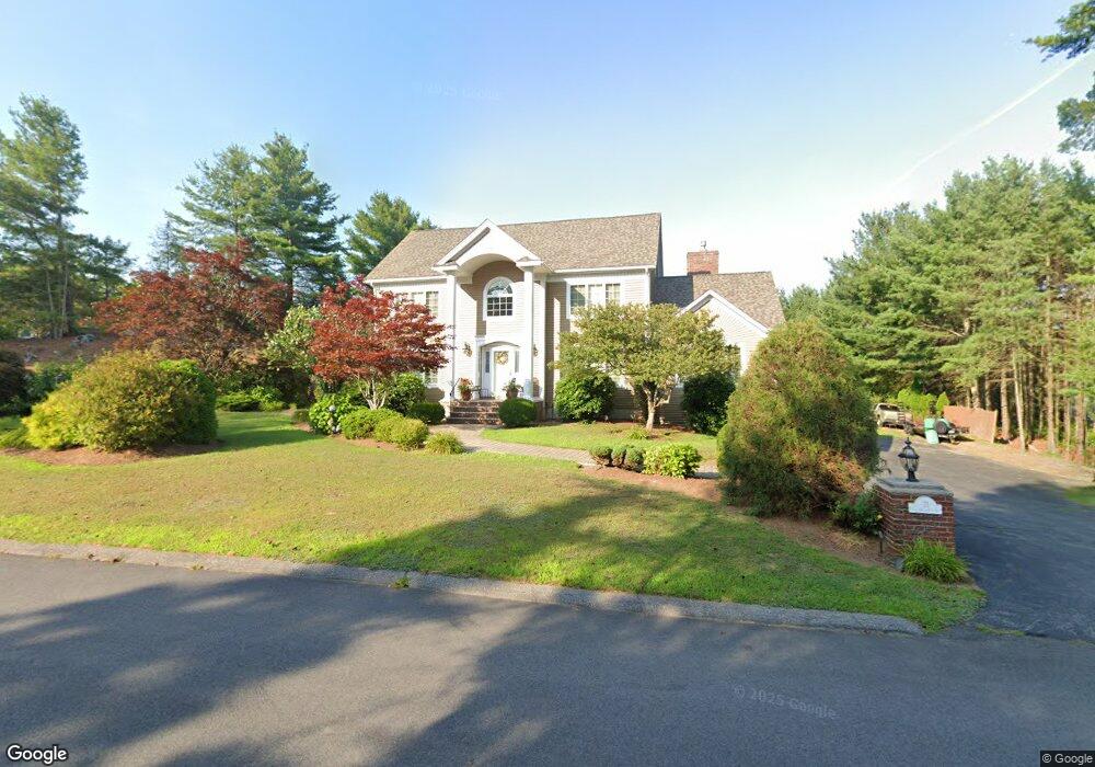
21 Sgt Roode Ln Middleton, MA 01949
Estimated Value: $1,252,123 - $1,310,000
3
Beds
2
Baths
2,846
Sq Ft
$449/Sq Ft
Est. Value
About This Home
This home is located at 21 Sgt Roode Ln, Middleton, MA 01949 and is currently estimated at $1,277,531, approximately $448 per square foot. 21 Sgt Roode Ln is a home located in Essex County with nearby schools including Howe-Manning Elementary School, Fuller Meadow Elementary School, and Masconomet Regional Middle School.
Create a Home Valuation Report for This Property
The Home Valuation Report is an in-depth analysis detailing your home's value as well as a comparison with similar homes in the area
Home Values in the Area
Average Home Value in this Area
Tax History
| Year | Tax Paid | Tax Assessment Tax Assessment Total Assessment is a certain percentage of the fair market value that is determined by local assessors to be the total taxable value of land and additions on the property. | Land | Improvement |
|---|---|---|---|---|
| 2025 | $12,590 | $1,058,900 | $430,100 | $628,800 |
| 2024 | $11,975 | $1,015,700 | $402,100 | $613,600 |
| 2023 | $11,659 | $905,900 | $440,100 | $465,800 |
| 2022 | $10,090 | $761,500 | $348,100 | $413,400 |
| 2021 | $9,992 | $728,300 | $330,100 | $398,200 |
| 2020 | $10,116 | $742,700 | $340,100 | $402,600 |
| 2019 | $9,854 | $719,800 | $324,100 | $395,700 |
| 2018 | $9,766 | $699,600 | $318,100 | $381,500 |
| 2017 | $9,049 | $648,700 | $272,100 | $376,600 |
| 2016 | $8,716 | $627,500 | $256,100 | $371,400 |
| 2015 | $8,596 | $623,800 | $252,100 | $371,700 |
Source: Public Records
Map
Nearby Homes
- 6 White Ln
- 2 Wedge Ct Unit 2
- 6 Cabral Dr
- 67 Fuller Pond Rd
- 15 Rowell Ln Unit 15
- 12 Couture Way
- 1 Couture Way
- 1 Mills Point Unit 1
- 20 Bellingham Ct
- 5 Wennerberg Rd
- 220 Swan Pond Rd
- 40 Glen Dr
- 6 Greystone Dr
- 11 James Coffin Way Unit 11
- 47 Maple St Unit A
- 1466 Main St
- 19 Peachey Cir
- 9 Stableford Ct Unit 9
- 19 Fairway Ln Unit 53
- 5 Stableford Ct Unit 11
Your Personal Tour Guide
Ask me questions while you tour the home.