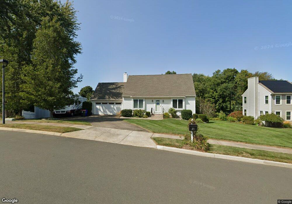
21 Stable Ln Middletown, CT 06457
Westfield NeighborhoodEstimated Value: $415,134 - $476,000
4
Beds
2
Baths
1,485
Sq Ft
$305/Sq Ft
Est. Value
About This Home
This home is located at 21 Stable Ln, Middletown, CT 06457 and is currently estimated at $453,284, approximately $305 per square foot. 21 Stable Ln is a home located in Middlesex County with nearby schools including Spencer School, Middletown High School, and St John Paul II School.
Ownership History
Date
Name
Owned For
Owner Type
Purchase Details
Closed on
Mar 28, 2023
Sold by
Dragan Linda D
Bought by
Dragan Roy A and Dragan Linda D
Current Estimated Value
Purchase Details
Closed on
Aug 3, 2022
Sold by
Dragan Linda D
Bought by
Dragan Roy A
Purchase Details
Closed on
Nov 29, 1994
Sold by
Yvon Beaudoin Bldr Inc
Bought by
Malone Linda D
Create a Home Valuation Report for This Property
The Home Valuation Report is an in-depth analysis detailing your home's value as well as a comparison with similar homes in the area
Home Values in the Area
Average Home Value in this Area
Purchase History
| Date | Buyer | Sale Price | Title Company |
|---|---|---|---|
| Dragan Roy A | -- | None Available | |
| Dragan Roy A | -- | None Available | |
| Dragan Roy A | -- | None Available | |
| Dragan Roy A | -- | None Available | |
| Malone Linda D | $150,900 | -- | |
| Malone Linda D | $150,900 | -- |
Source: Public Records
Mortgage History
| Date | Status | Borrower | Loan Amount |
|---|---|---|---|
| Previous Owner | Malone Linda D | $180,000 | |
| Previous Owner | Malone Linda D | $90,000 | |
| Previous Owner | Malone Linda D | $20,000 |
Source: Public Records
Tax History
| Year | Tax Paid | Tax Assessment Tax Assessment Total Assessment is a certain percentage of the fair market value that is determined by local assessors to be the total taxable value of land and additions on the property. | Land | Improvement |
|---|---|---|---|---|
| 2025 | $9,683 | $248,910 | $77,250 | $171,660 |
| 2024 | $9,160 | $248,910 | $77,250 | $171,660 |
| 2023 | $9,000 | $256,400 | $84,740 | $171,660 |
| 2022 | $7,847 | $178,340 | $50,670 | $127,670 |
| 2021 | $7,875 | $178,970 | $51,300 | $127,670 |
| 2020 | $7,910 | $178,970 | $51,300 | $127,670 |
| 2019 | $7,946 | $178,970 | $51,300 | $127,670 |
| 2018 | $7,821 | $178,970 | $51,300 | $127,670 |
| 2017 | $6,976 | $164,540 | $57,400 | $107,140 |
| 2016 | $6,779 | $164,540 | $57,400 | $107,140 |
| 2015 | $6,516 | $164,540 | $57,400 | $107,140 |
| 2014 | $6,582 | $164,540 | $57,400 | $107,140 |
Source: Public Records
Map
Nearby Homes
- 94 Cynthia Ln Unit A6
- 565 Newfield St Unit 34
- 5 Nathan Hale Rd
- 3 Nathan Hale Rd
- 4 Nathan Hale Rd
- 1 Nathan Hale Rd
- 82 Westfield Terrace
- 8 Nathan Hale Rd
- 194 Camp St
- 27 Barbara Rd
- 137 Webster Ln Unit 2-42
- 145 Webster Ln Unit 2-41
- 60 Sonoma Ln
- 123 Webster Ln
- 128 Webster Ln
- 565 High St
- 132 Grand St
- 10 Talias Trail
- 146 Liberty St
- 207 Pearl St
- 31 Stable Ln
- 9 Stable Ln
- 100 Brookview Ln
- 78 Brookview Ln
- 28 Stable Ln
- 70 Ledgebrook Ln
- 108 Brookview Ln
- 68 Brookview Ln
- 79 Brookview Ln
- 74 Ledgebrook Ln
- 22 Knoll Ridge Ct
- 56 Ledgebrook Ln
- 52 Brookview Ln
- 30 Knoll Ridge Ct
- 10 Knoll Ridge Ct
- 58 Brookview Ln
- 97 Brookview Ln
- 12 Knoll Ridge Ct
- 107 Brookview Ln
- 48 Ledgebrook Ln
Your Personal Tour Guide
Ask me questions while you tour the home.