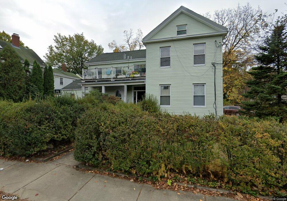
21 Thornton St Newton, MA 02458
Newton Corner NeighborhoodEstimated Value: $1,394,000 - $1,462,000
5
Beds
3
Baths
2,922
Sq Ft
$490/Sq Ft
Est. Value
About This Home
This home is located at 21 Thornton St, Newton, MA 02458 and is currently estimated at $1,433,042, approximately $490 per square foot. 21 Thornton St is a home located in Middlesex County with nearby schools including Lincoln-Eliot Elementary School, Bigelow Middle School, and Newton North High School.
Ownership History
Date
Name
Owned For
Owner Type
Purchase Details
Closed on
Mar 21, 1996
Sold by
Sardi Agnes M and Rosenstrach Paul
Bought by
Sardi Agnes M
Current Estimated Value
Home Financials for this Owner
Home Financials are based on the most recent Mortgage that was taken out on this home.
Original Mortgage
$250,000
Outstanding Balance
$9,769
Interest Rate
6.99%
Mortgage Type
Purchase Money Mortgage
Estimated Equity
$1,423,273
Purchase Details
Closed on
Jan 19, 1990
Sold by
Percelay Bruce A
Bought by
Sardi Agnes M
Home Financials for this Owner
Home Financials are based on the most recent Mortgage that was taken out on this home.
Original Mortgage
$254,250
Interest Rate
9.68%
Mortgage Type
Purchase Money Mortgage
Create a Home Valuation Report for This Property
The Home Valuation Report is an in-depth analysis detailing your home's value as well as a comparison with similar homes in the area
Home Values in the Area
Average Home Value in this Area
Purchase History
| Date | Buyer | Sale Price | Title Company |
|---|---|---|---|
| Sardi Agnes M | $42,500 | -- | |
| Sardi Agnes M | $339,000 | -- |
Source: Public Records
Mortgage History
| Date | Status | Borrower | Loan Amount |
|---|---|---|---|
| Open | Sardi Agnes M | $250,000 | |
| Previous Owner | Sardi Agnes M | $254,250 | |
| Previous Owner | Sardi Agnes M | $96,000 |
Source: Public Records
Tax History Compared to Growth
Tax History
| Year | Tax Paid | Tax Assessment Tax Assessment Total Assessment is a certain percentage of the fair market value that is determined by local assessors to be the total taxable value of land and additions on the property. | Land | Improvement |
|---|---|---|---|---|
| 2025 | $10,145 | $1,035,200 | $752,300 | $282,900 |
| 2024 | $9,809 | $1,005,000 | $730,400 | $274,600 |
| 2023 | $9,170 | $900,800 | $579,400 | $321,400 |
| 2022 | $8,775 | $834,100 | $536,500 | $297,600 |
| 2021 | $8,234 | $765,200 | $492,200 | $273,000 |
| 2020 | $6,323 | $765,200 | $492,200 | $273,000 |
| 2019 | $7,473 | $715,100 | $460,000 | $255,100 |
| 2018 | $5,750 | $673,000 | $427,900 | $245,100 |
| 2017 | $5,374 | $617,400 | $392,600 | $224,800 |
| 2016 | $6,446 | $566,400 | $360,200 | $206,200 |
| 2015 | $6,145 | $529,300 | $336,600 | $192,700 |
Source: Public Records
Map
Nearby Homes
- 1 Channing St
- 34 Channing St Unit 1
- 34 Channing St Unit 2
- 15-17 Jewett Place Unit 2
- 30 Boyd St Unit 30
- 12 Richardson St Unit 14
- 90 Waban Park Unit 2
- 164 Galen St Unit 88
- 164 Galen St Unit 65
- 10 Williams St Unit 39
- 10 Williams St Unit 56
- 77 Pond Ave Unit 1103
- 141 Morse St
- 14 Summit St
- 14 Summit St Unit 14-F
- 66 Aldrich Rd Unit B
- 105 Watertown St
- 324 Adams St Unit 2
- 68 Vernon St
- 12-14 Middle St
- 27 Thornton St
- 12 Waban St Unit 3
- 12 Waban St Unit 2
- 12 Waban St Unit 1
- 1 Waban St
- 1 Waban St Unit 2
- 1 Waban St Unit 1
- 79 Avon Place
- 3 Waban St
- 30 Thornton St
- 30 Thornton St Unit 30
- 30 Thornton St Unit A
- 30 Thornton St Unit B
- 11 Avon Place
- 26 Thornton St
- 11 Waban St
- 11 Waban St Unit 11
- 13 Waban St
- 18 Thornton St
- 11 Thornton St