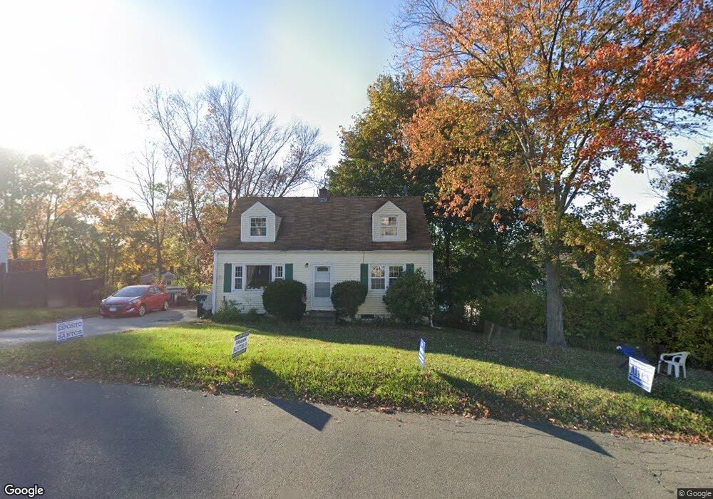
21 Topstone Dr Danbury, CT 06810
Estimated Value: $388,000 - $442,000
2
Beds
2
Baths
1,142
Sq Ft
$367/Sq Ft
Est. Value
About This Home
This home is located at 21 Topstone Dr, Danbury, CT 06810 and is currently estimated at $418,928, approximately $366 per square foot. 21 Topstone Dr is a home located in Fairfield County with nearby schools including Shelter Rock School, Broadview Middle School, and Danbury High School.
Ownership History
Date
Name
Owned For
Owner Type
Purchase Details
Closed on
Jun 29, 2000
Sold by
Wakeman Scott E and Wakeman Carol A
Bought by
Wigder Leslie H and Wigder Ruth D
Current Estimated Value
Home Financials for this Owner
Home Financials are based on the most recent Mortgage that was taken out on this home.
Original Mortgage
$208,000
Interest Rate
8.59%
Purchase Details
Closed on
Sep 23, 1992
Sold by
Albano Alfred and Albano Kathleen
Bought by
Srenaski Lisa and Srenaski Carmel
Home Financials for this Owner
Home Financials are based on the most recent Mortgage that was taken out on this home.
Original Mortgage
$122,800
Interest Rate
5%
Mortgage Type
Unknown
Purchase Details
Closed on
Jul 9, 1990
Sold by
Shepard John
Bought by
Clarke Kathleen
Create a Home Valuation Report for This Property
The Home Valuation Report is an in-depth analysis detailing your home's value as well as a comparison with similar homes in the area
Home Values in the Area
Average Home Value in this Area
Purchase History
| Date | Buyer | Sale Price | Title Company |
|---|---|---|---|
| Wigder Leslie H | $263,000 | -- | |
| Srenaski Lisa | $153,500 | -- | |
| Clarke Kathleen | $162,500 | -- |
Source: Public Records
Mortgage History
| Date | Status | Borrower | Loan Amount |
|---|---|---|---|
| Open | Clarke Kathleen | $221,250 | |
| Closed | Clarke Kathleen | $208,000 | |
| Previous Owner | Clarke Kathleen | $136,800 | |
| Previous Owner | Clarke Kathleen | $122,800 |
Source: Public Records
Tax History
| Year | Tax Paid | Tax Assessment Tax Assessment Total Assessment is a certain percentage of the fair market value that is determined by local assessors to be the total taxable value of land and additions on the property. | Land | Improvement |
|---|---|---|---|---|
| 2025 | $4,909 | $196,420 | $61,880 | $134,540 |
| 2024 | $4,801 | $196,420 | $61,880 | $134,540 |
| 2023 | $4,582 | $196,420 | $61,880 | $134,540 |
| 2022 | $4,210 | $149,200 | $66,300 | $82,900 |
| 2021 | $4,118 | $149,200 | $66,300 | $82,900 |
| 2020 | $4,118 | $149,200 | $66,300 | $82,900 |
| 2019 | $4,118 | $149,200 | $66,300 | $82,900 |
| 2018 | $4,118 | $149,200 | $66,300 | $82,900 |
| 2017 | $3,978 | $137,400 | $63,100 | $74,300 |
| 2016 | $3,941 | $137,400 | $63,100 | $74,300 |
| 2015 | $3,883 | $137,400 | $63,100 | $74,300 |
| 2014 | $3,792 | $137,400 | $63,100 | $74,300 |
Source: Public Records
Map
Nearby Homes
- 14 Newtown Rd Unit B6
- 14 Newtown Rd Unit A5
- 53 Faith Ln
- 37 Faith Ln Unit 37
- 126 Triangle St Unit B43
- 21 Crestview Ln
- 304 Sienna Dr Unit 304
- 35 Taylor St
- 37 Taylor St
- 31 Wildman St Unit 33
- 18 James St
- 3 Balash Ln
- 16 Springside Ave
- 19 Mcdermott St
- 1 Lawrence Ave Unit 1
- 11 Mannions Ln Unit 11
- 121 Great Hill Dr Unit 121
- 8 South St Unit 9
- 175 South St
- 72 Tucker St
- 23 Topstone Dr
- 14 Topstone Dr
- 19 Topstone Dr
- 20 Topstone Dr
- 24 Topstone Dr
- 18 Topstone Dr
- 12 Topstone Dr
- 2 Valley View Dr
- 1 Valley View Dr
- 17 Topstone Dr
- 13 Old Shelter Rock Rd
- 27 Topstone Dr
- 15 Topstone Dr
- 28 Topstone Dr
- 40 Topstone Dr
- 10 Topstone Dr
- 15 Old Shelter Rock Rd
- 13 Topstone Dr
- 4 Valley View Dr
- 5 Valley View Dr
Your Personal Tour Guide
Ask me questions while you tour the home.