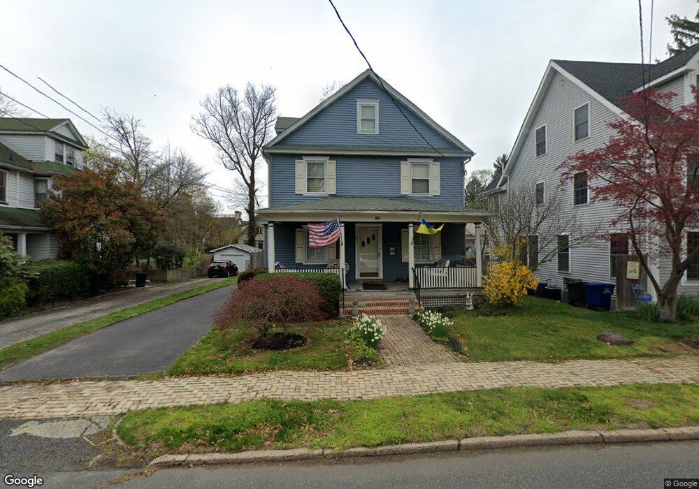
21 W 2nd St Moorestown, NJ 08057
Estimated Value: $517,894 - $871,000
--
Bed
--
Bath
2,282
Sq Ft
$291/Sq Ft
Est. Value
About This Home
This home is located at 21 W 2nd St, Moorestown, NJ 08057 and is currently estimated at $663,724, approximately $290 per square foot. 21 W 2nd St is a home located in Burlington County with nearby schools including George C. Baker Elementary School, Moorestown Upper Elementary School, and William Allen Middle School.
Ownership History
Date
Name
Owned For
Owner Type
Purchase Details
Closed on
Jul 17, 2023
Sold by
Hudson Rene Colson
Bought by
Hudson Gordon G
Current Estimated Value
Purchase Details
Closed on
Nov 10, 1999
Sold by
Richmond Peter E and Richmond Rebecca K
Bought by
Hudson Gordon G and Hudson Rene Colson
Home Financials for this Owner
Home Financials are based on the most recent Mortgage that was taken out on this home.
Original Mortgage
$131,000
Interest Rate
7.76%
Purchase Details
Closed on
Dec 23, 1998
Sold by
Phipps Jennie L
Bought by
Richmond Peter E and Richmond Rebecca K
Home Financials for this Owner
Home Financials are based on the most recent Mortgage that was taken out on this home.
Original Mortgage
$159,630
Interest Rate
6.84%
Mortgage Type
VA
Purchase Details
Closed on
Jan 13, 1995
Sold by
Princeton Bank & Trust Company Na
Bought by
Phipps Jennie L
Create a Home Valuation Report for This Property
The Home Valuation Report is an in-depth analysis detailing your home's value as well as a comparison with similar homes in the area
Home Values in the Area
Average Home Value in this Area
Purchase History
| Date | Buyer | Sale Price | Title Company |
|---|---|---|---|
| Hudson Gordon G | -- | None Listed On Document | |
| Hudson Gordon G | -- | None Listed On Document | |
| Hudson Gordon G | $181,000 | -- | |
| Richmond Peter E | $156,500 | Infinity Title Agency Inc | |
| Phipps Jennie L | $132,000 | -- |
Source: Public Records
Mortgage History
| Date | Status | Borrower | Loan Amount |
|---|---|---|---|
| Previous Owner | Hudson Gordon G | $131,000 | |
| Previous Owner | Richmond Peter E | $159,630 |
Source: Public Records
Tax History Compared to Growth
Tax History
| Year | Tax Paid | Tax Assessment Tax Assessment Total Assessment is a certain percentage of the fair market value that is determined by local assessors to be the total taxable value of land and additions on the property. | Land | Improvement |
|---|---|---|---|---|
| 2025 | $7,476 | $263,500 | $90,500 | $173,000 |
| 2024 | $7,249 | $263,500 | $90,500 | $173,000 |
| 2023 | $7,249 | $263,500 | $90,500 | $173,000 |
| 2022 | $7,175 | $263,500 | $90,500 | $173,000 |
| 2021 | $7,080 | $263,500 | $90,500 | $173,000 |
| 2020 | $7,035 | $263,500 | $90,500 | $173,000 |
| 2019 | $6,912 | $263,500 | $90,500 | $173,000 |
| 2018 | $6,725 | $263,500 | $90,500 | $173,000 |
| 2017 | $6,782 | $263,500 | $90,500 | $173,000 |
| 2016 | $6,759 | $263,500 | $90,500 | $173,000 |
| 2015 | $6,677 | $263,500 | $90,500 | $173,000 |
| 2014 | $6,340 | $263,500 | $90,500 | $173,000 |
Source: Public Records
Map
Nearby Homes
- 15 E 2nd St
- 129 S Church St
- 50 E 3rd St
- 66 E 3rd St
- 82 E 3rd St
- 80 E 3rd St
- 4 W Close
- 133 Plum St Unit 6
- 310 S Washington Ave
- 316 W 3rd St
- 493 N Church St
- 11 E Sutton Ave
- 4 E Sutton Ave
- 313 Fairview Ave
- 543 Bethel Ave
- 308 Kenwood Dr
- 205 E Central Ave
- 308 Elm St
- 316 Farmdale Rd
- 278 Linden St Unit 278