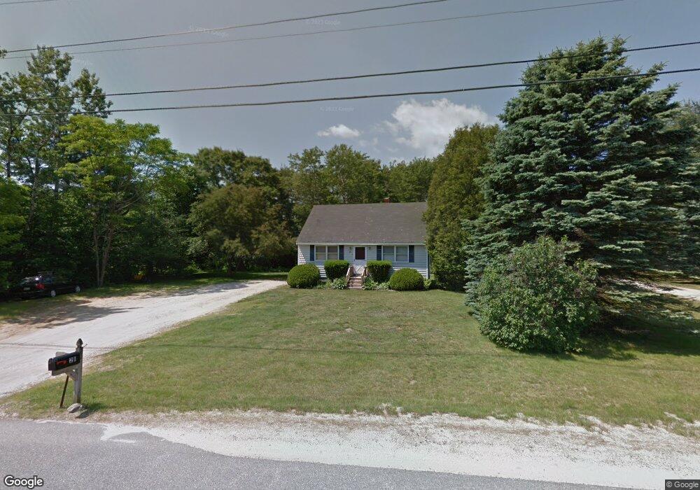
21 Webster Rd Freeport, ME 04032
Estimated Value: $397,502 - $524,000
4
Beds
1
Bath
1,114
Sq Ft
$408/Sq Ft
Est. Value
About This Home
This home is located at 21 Webster Rd, Freeport, ME 04032 and is currently estimated at $454,126, approximately $407 per square foot. 21 Webster Rd is a home with nearby schools including Morse Street School, Mast Landing School, and Freeport Middle School.
Create a Home Valuation Report for This Property
The Home Valuation Report is an in-depth analysis detailing your home's value as well as a comparison with similar homes in the area
Home Values in the Area
Average Home Value in this Area
Tax History
| Year | Tax Paid | Tax Assessment Tax Assessment Total Assessment is a certain percentage of the fair market value that is determined by local assessors to be the total taxable value of land and additions on the property. | Land | Improvement |
|---|---|---|---|---|
| 2025 | $3,594 | $259,500 | $153,900 | $105,600 |
| 2024 | $3,367 | $252,200 | $146,600 | $105,600 |
| 2023 | $3,094 | $225,000 | $133,300 | $91,700 |
| 2022 | $2,882 | $211,100 | $119,400 | $91,700 |
| 2021 | $2,818 | $211,100 | $119,400 | $91,700 |
| 2020 | $2,689 | $192,100 | $110,500 | $81,600 |
| 2019 | $2,578 | $180,300 | $104,300 | $76,000 |
| 2018 | $2,634 | $175,000 | $97,500 | $77,500 |
| 2017 | $2,530 | $169,200 | $95,200 | $74,000 |
| 2016 | $2,479 | $156,900 | $88,200 | $68,700 |
Source: Public Records
Map
Nearby Homes
- 2 Tidal Brook Rd
- 27 Youngs Ln Unit 27
- 17 Youngs Ln Unit 17
- 62 Webster Rd
- 20 Harvest Ridge Rd Unit 23
- 26 Harvest Ridge Rd Unit 24
- 39 Hunter Rd
- 15 Linwood Rd Unit 15
- 177 Bluff Rd Unit 20
- 9 Gables Dr Unit 9
- 34 Sisquisic Trail
- 5 Holbrook St
- 0 Bayview St
- 51 Old Field Rd
- 10 Durham Rd
- 52 Blueberry Cove Rd Unit 52
- 18 Portland St
- 16 Rocky Hill Rd
- 42 Durham Rd
- 1 Railroad Square Unit Townhome C
Your Personal Tour Guide
Ask me questions while you tour the home.