Estimated Value: $846,874 - $927,000
--
Bed
--
Bath
2,083
Sq Ft
$428/Sq Ft
Est. Value
About This Home
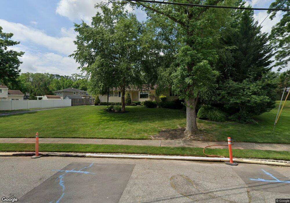
This home is located at 21 Wheatsheaf Rd, Clark, NJ 07066 and is currently estimated at $892,219, approximately $428 per square foot. 21 Wheatsheaf Rd is a home located in Union County with nearby schools including Frank K. Hehnly Elementary School, Carl H. Kumpf Middle School, and Arthur L. Johnson High School.
Ownership History
Date
Name
Owned For
Owner Type
Purchase Details
Closed on
Feb 21, 2024
Sold by
Wheatsheaf Associates Llc
Bought by
Lavecchia Thomas and Hackett Eileen
Current Estimated Value
Purchase Details
Closed on
Jun 11, 2014
Sold by
Hackett Patrick and Hackett Janienne
Bought by
Wheatsheaf Associates Llc
Purchase Details
Closed on
Jul 16, 2007
Sold by
Palumbo Michael S and Palumbo Margaret K
Bought by
Hackett Patrick and Hackett Janienne
Purchase Details
Closed on
Jun 1, 1998
Sold by
Steinhoff Beatrice F
Bought by
Palumbo Michael S and Palumbo Margaret K
Home Financials for this Owner
Home Financials are based on the most recent Mortgage that was taken out on this home.
Original Mortgage
$208,000
Interest Rate
7.11%
Create a Home Valuation Report for This Property
The Home Valuation Report is an in-depth analysis detailing your home's value as well as a comparison with similar homes in the area
Home Values in the Area
Average Home Value in this Area
Purchase History
| Date | Buyer | Sale Price | Title Company |
|---|---|---|---|
| Lavecchia Thomas | -- | None Listed On Document | |
| Lavecchia Thomas | -- | None Listed On Document | |
| Wheatsheaf Associates Llc | -- | None Available | |
| Hackett Patrick | $720,000 | None Available | |
| Palumbo Michael S | $260,000 | -- |
Source: Public Records
Mortgage History
| Date | Status | Borrower | Loan Amount |
|---|---|---|---|
| Previous Owner | Palumbo Michael S | $208,000 |
Source: Public Records
Tax History Compared to Growth
Tax History
| Year | Tax Paid | Tax Assessment Tax Assessment Total Assessment is a certain percentage of the fair market value that is determined by local assessors to be the total taxable value of land and additions on the property. | Land | Improvement |
|---|---|---|---|---|
| 2025 | $15,405 | $695,800 | $350,800 | $345,000 |
| 2024 | $15,175 | $695,800 | $350,800 | $345,000 |
| 2023 | $15,175 | $695,800 | $350,800 | $345,000 |
| 2022 | $14,737 | $695,800 | $350,800 | $345,000 |
| 2021 | $13,726 | $154,400 | $58,400 | $96,000 |
| 2020 | $13,502 | $154,400 | $58,400 | $96,000 |
| 2019 | $13,366 | $154,400 | $58,400 | $96,000 |
| 2018 | $13,206 | $154,400 | $58,400 | $96,000 |
| 2017 | $12,456 | $148,000 | $58,400 | $89,600 |
| 2016 | $11,997 | $148,000 | $58,400 | $89,600 |
| 2015 | $11,876 | $148,000 | $58,400 | $89,600 |
| 2014 | $11,625 | $148,000 | $58,400 | $89,600 |
Source: Public Records
Map
Nearby Homes
- 67 Brookside Terrace
- 24 Woodland Rd
- 37 E Hegel Ave
- 1154 Lake Ave Unit 1154
- 34 E Prescott Ave
- 38 Meadow Rd
- 131 Morningside Rd
- 1033 Cellar Ave Unit 1033
- 107 Meadow Rd
- 868 Inman Ave
- 37 Wareham Ct
- 14 Bonnie Ln
- 99 Cameo Place
- 6 Tulip Ct
- 8 Maddaket
- 2004 Winding Brook Way
- 8 Periwinkle Place
- 27 Stemmer Dr
- 975 Inman Ave
- 990 Inman Ave
- 250 Laurel Ln
- 273 Oak Ridge Rd
- 244 Laurel Ln
- 258 Laurel Ln
- 265 Oak Ridge Rd
- 264 Laurel Ln
- 22 Wheatsheaf Rd
- 28 Wheatsheaf Rd
- 257 Oak Ridge Rd
- 36 Wheatsheaf Rd
- 249 Laurel Ln
- 44 Wheatsheaf Rd
- 299 Oak Ridge Rd
- 270 Laurel Ln
- 243 Laurel Ln
- 247 Oak Ridge Rd
- 257 Laurel Ln
- 52 Wheatsheaf Rd
- 309 Oak Ridge Rd
- 265 Laurel Ln