Estimated Value: $410,000 - $490,000
3
Beds
2
Baths
1,560
Sq Ft
$278/Sq Ft
Est. Value
About This Home
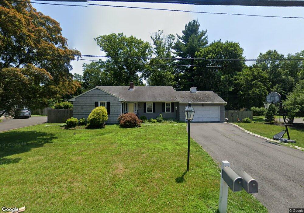
This home is located at 21 Wilburtha Rd, Ewing, NJ 08628 and is currently estimated at $434,220, approximately $278 per square foot. 21 Wilburtha Rd is a home located in Mercer County with nearby schools including Ewing High School, The Village Charter School, and Villa Victoria Academy.
Ownership History
Date
Name
Owned For
Owner Type
Purchase Details
Closed on
Dec 18, 2009
Sold by
Maccaroni Anthony and Maccaroni Yasmyn
Bought by
Warren Barbara
Current Estimated Value
Home Financials for this Owner
Home Financials are based on the most recent Mortgage that was taken out on this home.
Original Mortgage
$212,000
Outstanding Balance
$138,987
Interest Rate
5%
Mortgage Type
New Conventional
Estimated Equity
$295,233
Purchase Details
Closed on
Sep 12, 2003
Sold by
Gardeen Rafi
Bought by
Macarroni Anthony and Macarroni Yasmyn
Home Financials for this Owner
Home Financials are based on the most recent Mortgage that was taken out on this home.
Original Mortgage
$243,200
Interest Rate
5.83%
Purchase Details
Closed on
Oct 12, 2000
Sold by
Mcdevitt Mark
Bought by
Daukshta Eugenia
Home Financials for this Owner
Home Financials are based on the most recent Mortgage that was taken out on this home.
Original Mortgage
$152,800
Interest Rate
7.88%
Create a Home Valuation Report for This Property
The Home Valuation Report is an in-depth analysis detailing your home's value as well as a comparison with similar homes in the area
Home Values in the Area
Average Home Value in this Area
Purchase History
| Date | Buyer | Sale Price | Title Company |
|---|---|---|---|
| Warren Barbara | $265,000 | General Abstract & Title Age | |
| Macarroni Anthony | $304,000 | -- | |
| Daukshta Eugenia | $191,000 | -- |
Source: Public Records
Mortgage History
| Date | Status | Borrower | Loan Amount |
|---|---|---|---|
| Open | Warren Barbara | $212,000 | |
| Previous Owner | Macarroni Anthony | $243,200 | |
| Previous Owner | Daukshta Eugenia | $152,800 |
Source: Public Records
Tax History Compared to Growth
Tax History
| Year | Tax Paid | Tax Assessment Tax Assessment Total Assessment is a certain percentage of the fair market value that is determined by local assessors to be the total taxable value of land and additions on the property. | Land | Improvement |
|---|---|---|---|---|
| 2025 | $9,203 | $234,000 | $59,900 | $174,100 |
| 2024 | $8,651 | $234,000 | $59,900 | $174,100 |
| 2023 | $8,651 | $234,000 | $59,900 | $174,100 |
| 2022 | $8,417 | $234,000 | $59,900 | $174,100 |
| 2021 | $8,211 | $234,000 | $59,900 | $174,100 |
| 2020 | $8,094 | $234,000 | $59,900 | $174,100 |
| 2019 | $7,883 | $234,000 | $59,900 | $174,100 |
| 2018 | $7,416 | $140,400 | $71,800 | $68,600 |
| 2017 | $7,589 | $140,400 | $71,800 | $68,600 |
| 2016 | $7,486 | $140,400 | $71,800 | $68,600 |
| 2015 | $7,386 | $140,400 | $71,800 | $68,600 |
| 2014 | $7,367 | $140,400 | $71,800 | $68,600 |
Source: Public Records
Map
Nearby Homes
- 4 Locke Ct
- 30 Matthew Dr
- 18 Jacob Ct
- 12 Jacob Ct
- 4 Riverview Dr
- 47 E College Ave
- 202 W Upper Ferry Rd
- 42 W College Ave Unit 316
- 42 W College Ave Unit 324
- 42 W College Ave Unit 222
- 0 Dolington Rd
- 29 Cadwallader Ct
- 182 W Upper Ferry Rd
- 1048 River Rd
- 167 Harper Ave
- 1302 Yardley Commons
- 0 Sandy Run Rd Unit PABU2098286
- 0 Sandy Run Rd Unit PABU2099898
- 0 Sandy Run Rd Unit PABU2099912
- 1603 Yardley Commons
- 23 Wilburtha Rd
- 19 Wilburtha Rd
- 27 Wilburtha Rd
- 20 Wilburtha Rd
- 22 Wilburtha Rd
- 32 Riverview Dr
- 17 Wilburtha Rd
- 26 Wilburtha Rd
- 16 Wilburtha Rd
- 1903 Country Ln Unit 2207
- 1903 Country Ln Unit 1302
- 1903 Country Ln Unit 3
- 1903 Country Ln Unit 2
- 1903 Country Ln
- 30 Riverview Dr
- 31 Wilburtha Rd
- 14 Wilburtha Rd
- 15 Wilburtha Rd
- 3 Locke Ct
- 27 Riverview Dr