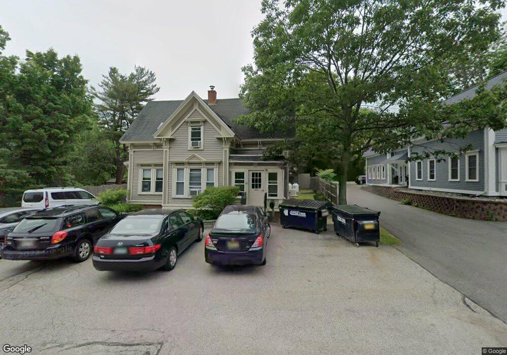
21 Woodbridge Rd York, ME 03909
York Harbor NeighborhoodEstimated Value: $678,378 - $791,000
5
Beds
4
Baths
1,500
Sq Ft
$498/Sq Ft
Est. Value
About This Home
This home is located at 21 Woodbridge Rd, York, ME 03909 and is currently estimated at $746,845, approximately $497 per square foot. 21 Woodbridge Rd is a home located in York County with nearby schools including Village Elementary School, Coastal Ridge Elementary School, and York Middle School.
Ownership History
Date
Name
Owned For
Owner Type
Purchase Details
Closed on
Oct 29, 2012
Sold by
Foster Peter W
Bought by
Stage Neck Inn Inc
Current Estimated Value
Purchase Details
Closed on
Jun 2, 2009
Sold by
Foster Dana and Foster Mark W
Bought by
Foster Peter W
Home Financials for this Owner
Home Financials are based on the most recent Mortgage that was taken out on this home.
Original Mortgage
$198,400
Outstanding Balance
$124,948
Interest Rate
4.87%
Mortgage Type
Purchase Money Mortgage
Estimated Equity
$621,897
Create a Home Valuation Report for This Property
The Home Valuation Report is an in-depth analysis detailing your home's value as well as a comparison with similar homes in the area
Home Values in the Area
Average Home Value in this Area
Purchase History
| Date | Buyer | Sale Price | Title Company |
|---|---|---|---|
| Stage Neck Inn Inc | -- | -- | |
| Stage Neck Inn Inc | -- | -- | |
| Foster Peter W | -- | -- |
Source: Public Records
Mortgage History
| Date | Status | Borrower | Loan Amount |
|---|---|---|---|
| Open | Foster Peter W | $198,400 |
Source: Public Records
Tax History Compared to Growth
Tax History
| Year | Tax Paid | Tax Assessment Tax Assessment Total Assessment is a certain percentage of the fair market value that is determined by local assessors to be the total taxable value of land and additions on the property. | Land | Improvement |
|---|---|---|---|---|
| 2024 | $4,834 | $575,500 | $243,500 | $332,000 |
| 2023 | $4,530 | $536,100 | $204,100 | $332,000 |
| 2022 | $3,848 | $450,000 | $175,400 | $274,600 |
| 2021 | $3,959 | $397,900 | $157,500 | $240,400 |
| 2020 | $3,906 | $351,900 | $154,000 | $197,900 |
| 2019 | $3,884 | $348,300 | $150,400 | $197,900 |
| 2018 | $3,684 | $330,400 | $132,500 | $197,900 |
| 2017 | $3,345 | $305,500 | $118,100 | $187,400 |
| 2016 | $3,406 | $305,500 | $118,100 | $187,400 |
| 2015 | $3,361 | $305,500 | $118,100 | $187,400 |
| 2014 | $3,269 | $305,500 | $118,100 | $187,400 |
| 2013 | $3,000 | $287,600 | $100,200 | $187,400 |
Source: Public Records
Map
Nearby Homes
- 294 York St Unit 1
- 294 York St Unit 2
- 281 York St
- 60 Barrell Ln Unit 3
- 60 Barrell Ln Unit 1
- 425 York St
- 419 & 425 York St
- 23 Harmon Park Rd
- 3 Sentry Hill Rd
- 208 Long Sands Rd
- 50 Seabury Rd
- 21 Starboard Ln
- 589 York St Unit 11
- 2 Roaring Rock Rd
- 12 Norwood Farms Rd Unit 1
- 8 Roaring Rock Rd
- 8 Old Seabury Rd
- 8 Ash Ln
- 8 Wavecrest Dr
- 357 Southside Rd
- 17 Woodbridge Rd Unit 17 Woodbridge 3
- 17 Woodbridge Rd
- 23 Woodbridge Rd
- 12 Ocean Edge Ln
- 18 Ocean Circuit Dr
- 0 Ocean Circuit Dr Unit 1038254
- 0 Ocean Circuit Dr Unit 1059035
- 19 Ocean Circuit Dr
- 2-4 Emerson Ln
- 2 Emerson Ln
- 45 Long Sands Rd
- 282 York St
- 280 York St
- 15 Long Sands Rd
- 15 Long Sands Rd Unit 6
- 13 Elm Dr
- 47 Long Sands Rd
- 294 York St
- 31 Long Sands Rd
- 276 York St