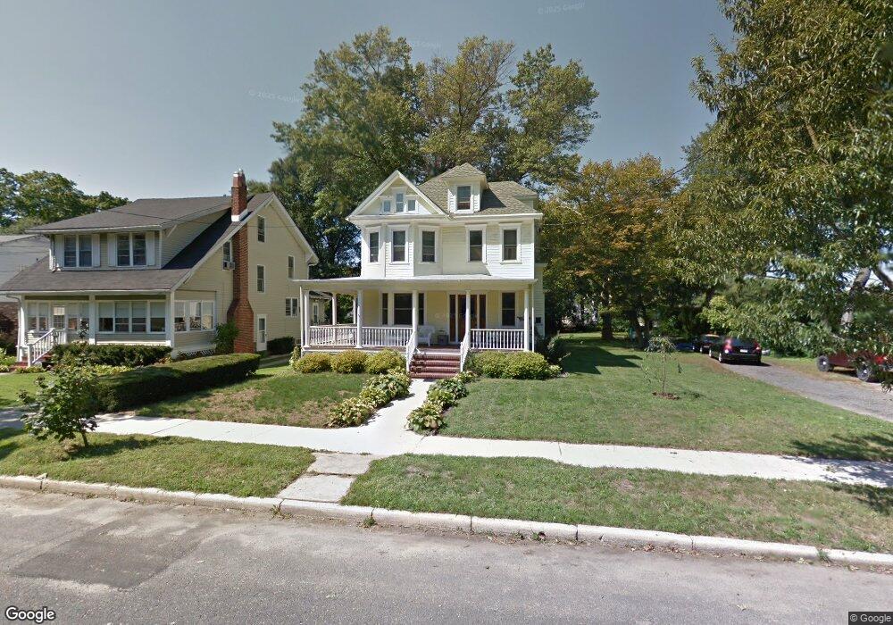
21 Woodland Ave Haddonfield, NJ 08033
Estimated Value: $971,746 - $1,109,000
--
Bed
--
Bath
2,356
Sq Ft
$447/Sq Ft
Est. Value
About This Home
This home is located at 21 Woodland Ave, Haddonfield, NJ 08033 and is currently estimated at $1,052,582, approximately $446 per square foot. 21 Woodland Ave is a home located in Camden County with nearby schools including Haddonfield Memorial High School, Haddonfield Friends School, and Christ the King Regional School.
Ownership History
Date
Name
Owned For
Owner Type
Purchase Details
Closed on
Aug 31, 2000
Sold by
Pine Randall D
Bought by
Brong Charles W and Brong Joan R
Current Estimated Value
Home Financials for this Owner
Home Financials are based on the most recent Mortgage that was taken out on this home.
Original Mortgage
$200,000
Outstanding Balance
$72,893
Interest Rate
8.1%
Estimated Equity
$979,689
Create a Home Valuation Report for This Property
The Home Valuation Report is an in-depth analysis detailing your home's value as well as a comparison with similar homes in the area
Home Values in the Area
Average Home Value in this Area
Purchase History
| Date | Buyer | Sale Price | Title Company |
|---|---|---|---|
| Brong Charles W | $250,000 | -- |
Source: Public Records
Mortgage History
| Date | Status | Borrower | Loan Amount |
|---|---|---|---|
| Open | Brong Charles W | $200,000 |
Source: Public Records
Tax History Compared to Growth
Tax History
| Year | Tax Paid | Tax Assessment Tax Assessment Total Assessment is a certain percentage of the fair market value that is determined by local assessors to be the total taxable value of land and additions on the property. | Land | Improvement |
|---|---|---|---|---|
| 2025 | $16,194 | $501,200 | $315,000 | $186,200 |
| 2024 | $15,978 | $501,200 | $315,000 | $186,200 |
| 2023 | $15,978 | $501,200 | $315,000 | $186,200 |
| 2022 | $15,853 | $501,200 | $315,000 | $186,200 |
| 2021 | $15,773 | $501,200 | $315,000 | $186,200 |
| 2020 | $15,663 | $501,200 | $315,000 | $186,200 |
| 2019 | $155 | $501,200 | $315,000 | $186,200 |
| 2018 | $15,352 | $501,200 | $315,000 | $186,200 |
| 2017 | $14,986 | $501,200 | $315,000 | $186,200 |
| 2016 | $14,650 | $501,200 | $315,000 | $186,200 |
| 2015 | $14,244 | $501,200 | $315,000 | $186,200 |
| 2014 | $13,928 | $501,200 | $315,000 | $186,200 |
Source: Public Records
Map
Nearby Homes
- 209 Haddonfield Commons
- 215 Haddonfield Commons
- 155 Rhoads Ave
- 144 Marne Ave
- 63 Truman Ave
- 315 Peyton Ave
- 252 Rhoads Ave
- 33 Estaugh Ave
- 240 Hopkins Ave
- 107 Colonial Ave
- 209 Westmont Ave
- 120 Kings Hwy W
- 110 Westmont Ave
- 634 W Redman Ave
- 501 Rhoads Ave
- 510 Rhoads Ave
- 310 Briarwood Ave
- 23 Center St
- 107 Centre St
- 341 Station Ave
- 23 Woodland Ave
- 25 Woodland Ave
- 20 Elm Ave
- 405 Westmont Ave
- 30 Elm Ave
- 405 Westmont Ave
- 401 Westmont Ave
- 411 Westmont Ave
- 20 Woodland Ave
- 317 Westmont Ave
- 415 Westmont Ave
- 29 Elm Ave
- 309 Westmont Ave
- 406 Westmont Ave
- 400 Westmont Ave
- 10 N Haddonfield Commons
- 12 S Haddon Ave
- 12 S Haddon Ave Unit FLOOR 2
- 29 Haddonfield Commons
- 35 Haddonfield Commons Unit 35