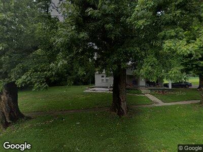
210 2nd St Shoals, IN 47581
Estimated Value: $113,990 - $157,000
3
Beds
1
Bath
1,470
Sq Ft
$89/Sq Ft
Est. Value
About This Home
This home is located at 210 2nd St, Shoals, IN 47581 and is currently estimated at $130,748, approximately $88 per square foot. 210 2nd St is a home located in Martin County with nearby schools including Shoals Community Elementary School, Shoals Middle School, and Shoals Community Junior/Senior High School.
Ownership History
Date
Name
Owned For
Owner Type
Purchase Details
Closed on
May 7, 2023
Sold by
Land Joella Marie
Bought by
Sumner Breeann Marie and Sumner Cassondra Ann
Current Estimated Value
Purchase Details
Closed on
May 13, 2015
Bought by
Land Cory E and Land Joella M
Purchase Details
Closed on
Jun 19, 2014
Bought by
The Secretary Of Veterans Affairs
Purchase Details
Closed on
Jun 17, 2014
Sold by
Robert F Street Sheriff
Bought by
Phillip A Norman Attorney
Create a Home Valuation Report for This Property
The Home Valuation Report is an in-depth analysis detailing your home's value as well as a comparison with similar homes in the area
Home Values in the Area
Average Home Value in this Area
Purchase History
| Date | Buyer | Sale Price | Title Company |
|---|---|---|---|
| Land Cory E | -- | -- | |
| The Secretary Of Veterans Affairs | -- | -- | |
| Phillip A Norman Attorney | $12,800 | -- | |
| Bank Of America Na | -- | -- |
Source: Public Records
Tax History Compared to Growth
Tax History
| Year | Tax Paid | Tax Assessment Tax Assessment Total Assessment is a certain percentage of the fair market value that is determined by local assessors to be the total taxable value of land and additions on the property. | Land | Improvement |
|---|---|---|---|---|
| 2024 | $1,916 | $94,600 | $5,900 | $88,700 |
| 2023 | $1,916 | $71,100 | $5,700 | $65,400 |
| 2022 | $1,358 | $67,900 | $5,500 | $62,400 |
| 2021 | $1,232 | $60,400 | $5,000 | $55,400 |
| 2020 | $1,258 | $61,700 | $4,700 | $57,000 |
| 2019 | $1,220 | $59,800 | $4,600 | $55,200 |
| 2018 | $646 | $31,100 | $4,600 | $26,500 |
| 2017 | $620 | $29,800 | $4,600 | $25,200 |
| 2016 | $620 | $29,800 | $4,600 | $25,200 |
| 2014 | -- | $40,800 | $4,600 | $36,200 |
| 2013 | -- | $40,300 | $4,600 | $35,700 |
Source: Public Records
Map
Nearby Homes
- 619 Stephens St
- 0 Hilltop Dr Unit 25 201822398
- 8284 U S 50
- 00 Sanders Ln
- 7441 Boat Club Ln
- 13691 Chicken Farm Rd
- 9522 Mill Rd
- 15336 County Farm Rd
- 15382 Dover Hill Rd
- 15874 Witt Rd
- 15850 Witt Rd
- 12810 Hart Rd
- TBD Witt Rd
- 220+/- Acres Witt Rd
- 0 25 + - Acres Wildman Rd
- 00 Brooks Bridge Rd
- Off Abel Hill Rd
- 6 Acre Lot Reinhart Rd
- 120 Acres Reinhart Rd
- 40 Acres Reinhart Rd
